
darkskys25
Member
Sref creeping up. 1.5 now for bham.. .75 for tuscaloosa. I'd be happy with an inch of snow. Just enough to sled on ")
Follow along with the video below to see how to install our site as a web app on your home screen.
Note: This feature may not be available in some browsers.
The Euro is fairly the same. Focus is more toward the I-20/59 corridor.Noticeable SE trend on the GFS the last few runs. Going to need to observe that closely.
URGENT - WINTER WEATHER MESSAGE
National Weather Service Birmingham AL
314 PM CST Sun Jan 27 2019
...SNOW EXPECTED LATE MONDAY NIGHT INTO TUESDAY MORNING...
.A strong cold front will move into Central Alabama late Monday
night and Tuesday morning. Rain will change over to snow as early
as midnight Monday night in the northwest with the rain to snow
transition line moving southeastward through the morning on
Tuesday. Snow will come to an end around noon on Tuesday. While
snow will only fall for a couple hours at a given location, it may
be heavy at times resulting in accumulations of 1 to 2 inches with
isolated higher amounts. Temperatures will also fall below
freezing as the snow falls Tuesday morning, which may result in
difficult travel conditions even where accumulations are less than
2 inches. This will impact the morning commute especially along
the Interstate 20 corridor.
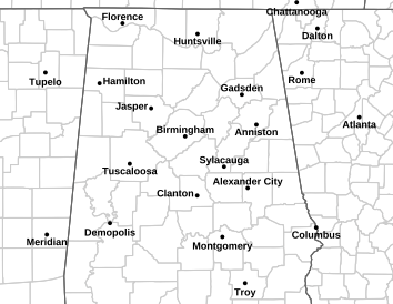
1.25 Tuscaloosa boom of 4.5SREF totals continue creeping upward for most cities from Huntsville, Tuscaloosa, Birmingham, Gadsden, etc.

A key to this event is, IF, the models are underestimating the speed of the dense arctic airmass, then totals will likely be higher. Models often struggle with the speed of cold air advection. Most places this will start as rain (washing away road treatments), but it should quickly transition to snow overnight Monday into Tuesday with temps dropping below freezing.
Usually associated with warm air advection in the low to mid levels with surface low cyclogenesis. This is a bit different.I've seen it go the other way too. Change over takes much longer then expected leaving nothing. I cant recall experiencing a winter weather event go exactly as forecast. Always expect changes right up until the event.
2014 was brutally cold the entire month of January leading up to Snowpocalypse on January 28th (plus, the high that day was only around 20). Obviously, we haven't had brutal cold like that this year. One thing I could see happening that would be similar to January 28, 2014 would be some initial melting on roadways (coupled with the rain that falls before the changeover) leading to somewhat of a flash freeze as the subfreezing temperatures flood in. This would result in a layer of ice coating road surfaces with snow then falling on top of the layer of ice.Other than it being a Tuesday (same as SnowJam 2014), does this have any other similarities to the famous Snowjam 2014 in Bham/ATL?