- Thread starter
- #121
akt1985
Member
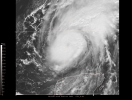
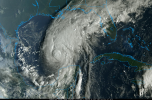
Isaias slowly strengthened overnight, winds up to 80 MPH.
Follow along with the video below to see how to install our site as a web app on your home screen.
Note: This feature may not be available in some browsers.

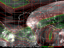
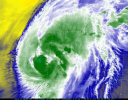
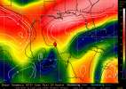
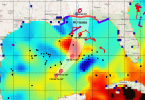

Shear, dry air ingestion at the mid levels, and an increasingly hostile environment. Tough road, Isaias. I think we're likely all really glad it is, though. One MAJOR exception - the TCHP. There's some deep hot water along the way too.
Agreed. The hot TCHP pool has me worried, TBH. That is deep fuel, and a lot of it. Deep ocean heat content is the reason storms are overperforming, IMO, and this will be the deepest it has passed over. Fingers crossed that shear wins. I am really hoping it does, because if the upper level winds just vent it instead of tearing it apart, we may be in real trouble.There's a second exception, and it is in part related to the exception you mentioned - it seems like every storm over the last few years ends up overperforming.
I'm not wishcasting a CAT 5 monster, but if this thing blows up to a strong CAT 3 or even a weak CAT 4 before the shear starts ripping it apart, I wouldn't be shocked.
That is some strong shear though.
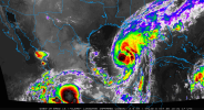


Im not sure how this will rank on inland damage from wind gusts, but how does this look to yall? I remember my dad always talking about opal and the inland effects it had here in birmgiham with trees down. What do yall think of wind damage in birmingham for this system.
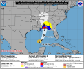
06Z globals are Mobile Bay to the AL/FL line. Pretty good agreement. Hurricane models same area, with HMON the furthest east barely into Florida. I note that all of them are 950s before landfall, even HAFS-A and B. Not liking that agreement at all.
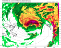
I’m talking about like central Alabama from wind gusts and rainfallI don’t think wind will be particularly severe with this system. Rain and surge will be more impactful at landfall since most of the core may be blown apart by landfall.
Yep, and 3 hours earlier... So a big water dome coming with it. Not one to ride out on a barrier island, IMO. This size and strength will... relocate some things.Pretty much all the TC models are honed in on the AL/FL line, with front-right quadrant centered on Pensacola, FL. 06Z HWRF given as example. Pretty gnarly-looking core, with some right-side supercell activity over the inner Panhandle.
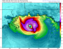
Yeah, we want it to land east of the bay, not west. West pushes the surge up the bay and traps it.None of these solutions are great, but the Euro seems to take Isaias over Dauphin Island and into Mobile Bay. I don't know anything about that area, but all of that water pushing into the Bay can't be good.
I hope you're right. NWS is being more cautious on that. Rain and surge will be big, yes. The forecast surge (5 to 7 feet above ground, including Mobile Bay) is the most life-threatening part. But wind isn't a minor piece. The hurricane center forecasts about 100 mph at landfall. Shear may weaken it some, but they say it should remain a dangerous hurricane through landfall, with its wind field expanding and moving fast enough to push damaging gusts well inland. NWS Mobile's local statement calls for "extensive" wind impacts across southwest and parts of south central Alabama: considerable roof damage to sturdy buildings, many large trees snapped or uprooted, mobile homes destroyed, large areas without power. Here in central Alabama, NWS Birmingham is forecasting gusts of 40 to 50 mph, enough for downed trees and power lines. Less severe than the coast, but not harmless.I don’t think wind will be particularly severe with this system. Rain and surge will be more impactful at landfall since most of the core may be blown apart by landfall.

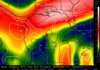
Looking back on model outputs, they've been fairly consistent in showing a small quiet patch in winds ahead of a compact trough that seems to more or less give Isaiah the perfect opening as it approaches the AL/FL area. Guessing that's what's been lending the NHC confidence in intensification despite current shear.Shear is still stout, but it's no longer increasing north of Isaias along the track, and decreasing compared to yesterday along the NW Gulf coast.
View attachment 55193
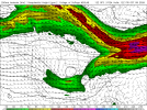

Looking back on model outputs, they've been fairly consistent in showing a small quiet patch in winds ahead of a compact trough that seems to more or less give Isaiah the perfect opening as it approaches the AL/FL area. Guessing that's what's been lending the NHC confidence in intensification despite current shear.