Mann I think that's a eyeIt may end up threading the needle between the departing trough and the incoming jet streak.
Is that a hint of an eye starting to form?
View attachment 55195
Follow along with the video below to see how to install our site as a web app on your home screen.
Note: This feature may not be available in some browsers.
Mann I think that's a eyeIt may end up threading the needle between the departing trough and the incoming jet streak.
Is that a hint of an eye starting to form?
View attachment 55195

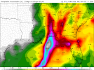
Is that a hint of an eye starting to form?
A bit of a dry slot to the east, but could be trying to stack enough to, yes. Next big convection pulse perhaps it will.Mann I think that's a eye
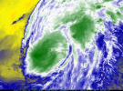
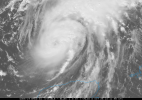

I am worried about the same thing. I am in Dallas County...the counties right below me are in a Tropical Storm Warning. I live in a mobile home, so I am thinking that I should probably stay somewhere else.Im not sure how this will rank on inland damage from wind gusts, but how does this look to yall? I remember my dad always talking about opal and the inland effects it had here in birmgiham with trees down. What do yall think of wind damage in birmingham for this system.
Between the wind and tornado threat, it'd be better to be safe than sorry, if you have some options for where to go.I am worried about the same thing. I am in Dallas County...the counties right below me are in a Tropical Storm Warning. I live in a mobile home, so I am thinking that I should probably stay somewhere else.
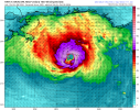
I do have a couple of places I can go, I just can't bring my two cats with me. But I am sure they can take care of themselves if something were to happen.Between the wind and tornado threat, it'd be better to be safe than sorry, if you have some options for where to go.
.LONG TERM...
(Friday night morning through next Wednesday)
Issued at 158 PM EDT Thu Oct 8 2026
Hurricane Isaias Impacts on North and Central GA:
From Friday night through Sunday, Hurricane Isaias will
make landfall over the Gulf Coast and then weaken as it moves
northward across Mississippi and Alabama into the TN Valley. North
and Central Georgia will be on the `dirty` side of the storm, and
potentially see significant impacts with a prolonged period of
strong winds, heavy rainfall with localized flash flooding, and a
few tornadoes.
Strong Winds:
As Isaias moves inland Friday night into Saturday, its wind field
will expand considerably, with strong winds extending well east of
the center of the storm into West-Central GA. A Tropical Storm
Watch is in effect for this area where wind gusts of 40 to 50 mph
will be possible. Further north/east, while Isaias will be
weakening and becoming post-tropical, there will be a very strong
pressure gradient between it and high pressure over the Mid-
Atlantic. This gradient will support a prolonged period of strong
easterly winds with frequent gusts to 40 to 50 mph across most of
North Georgia from early Saturday through early Sunday. A High
Wind Watch has been issued for this area. The prolonged and strong
winds could lead to numerous power outages from downed limbs and
trees, especially when combined with saturated soils from periods
of heavy rain.
Heavy Rainfall:
As Isaias moves northward through Mississippi/Alabama, it will
bring widespread rainfall and multiple bands of heavy rain across
the area Friday night through Sunday. Rainfall totals of 1 to 3
inches are likely across much of the area, with localized amounts
up to 5 inches possible. High rainfall rates (PWAT values of
2-2.3") and repeated rounds of heavy rain could lead to localized
flash flooding, particularly in urban and poor-drainge areas, as
well as flood-prone creeks and streams. A Flood Watch has been
issued for the entire area.
Tornadoes:
As Isaias tracks northward and inland on Saturday, a favorable
environment for tornadoes will develop across North and Central
Georgia, potentially lingering into Sunday morning. Several
tornadoes will be possible during this period, including the
overnight hours Saturday night. Tornadoes from tropical systems
are typically quick to develop and short-lived, but with the
forward speed of the system and the unique setup, we can`t rule
out a stronger (EF2 or EF3), long-track tornado. It is imperative
that everyone has a way to receive tornado warnings.
Warm and Dry In the Wake of Isaias:
On the backside of Isaias` remnants, a mid- level ridge will build
over the Southeast US, bringing a warm and dry airmass into the
area. Rain chances will drop to near zero for Monday- Wednesday,
with low temps in the upper 50s to low 60s, and high temps in the
low to mid 80s.
It will definitely influence the extent of northward movement of moisture, though not quite to to the degree we tend to see in non-tropical events, there should be plenty of 60+ dews in place in the western half of Georgia into Alabama. It'll also help exacerbate gradient winds in the wake of the storm, however.Forgive me @Clancy but does the wedge factor in here? I never fully quite understand.

Thanks!It will definitely influence the extent of northward movement of moisture, though not quite to to the degree we tend to see in non-tropical events, there should be plenty of 60+ dews in place in the western half of Georgia into Alabama. It'll also help exacerbate gradient winds in the wake of the storm, however.
Dry as a bone, as they say. Some of that mid-level dry air getting pushed into Isaias is impacting it pretty good at the moment - it's pretty dry all the way to the upper levels over the western Gulf currently.On the back side of Isaias there is a Red Flag Warning for inland southwestern Louisiana while southeastern Louisiana is under a Tropical Storm Warning.
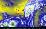
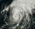
Dont want to see that :|Looks like wind gusts in birmingham will be similar to about how strong opals was in birmingham back in 1995. Looking at opals and what it did
Before you panic, while the predicted gust speed is the same, the circumstances are a bit different. Before Opal, the ground became extremely saturated immediately before the hurricane made landfall due to a massive, separate weather system.Looks like wind gusts in birmingham will be similar to about how strong opals was in birmingham back in 1995. Looking at opals and what it did