

Seeing talk of a major hurriance landfall not being out of the question now.
Follow along with the video below to see how to install our site as a web app on your home screen.
Note: This feature may not be available in some browsers.

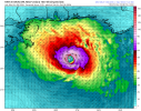
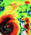
I did noticed on satellite vapor, that some of the bands color goes from red/yellow to green and blue (some light yellow).Oh, there's been quite a bit of wind shear its entire life and it's ever-increasing the further north it moves. It's done pretty well for itself and defied some odds I suppose. The shear will increase more today, though, but it's becoming a super thin line between "weakening before landfall" and "oops, the shear didn't stop it fast enough, it made landfall already", the National Hurricane Center even alludes to this in the 5 AM EDT advisory. So it may well be a photo finish to see if this storm weakens substantially or not. I still think 1995 Opal is a great comparison to this one, and Opal cause tremendous damage in the Florida Panhandle.

We lose power with a 20 mph wind...I already know that I will probably not have power for a couple of days. I work at Old Cahawba Archaeological Park and when Hurricane Zeta came through, it looked like a war zone...trees down EVERYWHERE...but those winds were 80 mph when it came through here.I have a feeling a corridor from central alabama to south alabama is going to get wacked with some serious power outages and trees down
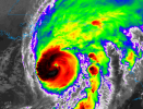
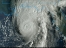
It's going through some major RILooks like the latest Recon pass reported top winds of 120 knots at Flight Level, which is 140 mph. If you do the standard 10% reduction, that's still 125 mph, so if a dropsonde confirms it, Isaias may be even higher than 120 currently.
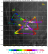
Not leaving it off the table maybe a weak cat 4, This storm is going crazy. It's been ahead of schedule and stronger than advertised already.A run to Cat 4 status? maybe? I truly hope not.

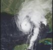
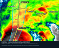
This... I worry this is just ugly inland and produces minimal rain we need in Jefferson / Shelby county but gives us WAY more wind than we ever wanted.I have a feeling a corridor from central alabama to south alabama is going to get wacked with some serious power outages and trees down