
- Thread starter
- #401
These waits before expected activity are hard (expensive, too, because of warning measures).
Here is IMO's update today (don't know why Google says "Norwegian" -- if anything, one would expect "Danish"):
Here is IMO's update today (don't know why Google says "Norwegian" -- if anything, one would expect "Danish"):
Magma accumulation under Svartsengi remains stable
The total volume of magma in the magma chamber under Svartsengi has never been higher since before November 10. Additional scenarios need to be considered if magma accumulation continues without a magma flow or eruption
17.5.2024
Updated May 17, 2024, at 17:10
About 50 earthquakes were recorded in the area around the magma tunnel yesterday, May 16, most of them below 1.0 in magnitude. This is similar to the seismic activity that has been recorded in recent days, but around 50 to 80 earthquakes have been recorded in a 24-hour period, most of them in the areas between Stóra-Skógfell and Hagafell on the one hand and south of Þorbjarna on the other.
- Magma accumulation under Svartsengi remains stable
- About 16 million cubic meters of magma have been added to the magma chamber since March 16
- Increased probability of a new magma flow and another eruption in the coming days
- Most likely to erupt on the Sundhnúks crater series
- Eruption warning may be very short
Magma accumulation continues under Svartsengi and land is rising there at the same rate as before. At the moment, there is no reason to estimate other than that there is still a considerable probability of a new magma run and another eruption in the Sundhnúks crater series in the coming days.
The last eruption of the Sundhnúks crater series began on March 16. In the 62 days that have passed since then, about 16 million cubic meters of magma have been added to the magma chamber beneath Svartsengi. This is the longest cycle of magma accumulation since this scenario began in late October 2023.
Updated risk assessment and scenarios
The Norwegian Meteorological Agency has issued an updated risk assessment that is valid until May 21 with everything unchanged. The risk due to gas pollution in area 7 has been increased in connection with the increased probability of a new eruption in area 3. Due to the change, the overall risk in the area is now assessed to be considerable (orange) but was previously some (yellow). The risk due to gas pollution in all other areas is unchanged from last week and assessed as considerable. Due to increased microseismic activity within zone 4, the risk of seismic activity has been increased there.
The Norwegian Meteorological Agency has also updated the most likely scenarios:
Scenario 1 - Eruption between Sýlingarfell and Stóra-Scógfell (Middle of zone 3 on hazard assessment map) Similar location to eruptions that started on December 18, 2023, February 8, 2024 and March 16, 2024.
Scenario 2 - Eruption south or southwest of Hagafell (Southern part of zone 3 on hazard assessment map) Similar location to eruption that started on January 14, 2024
- A probable cause is a local series of small earthquakes between Stóra-Scógfell and Sýlingarfell, acceleration in deformation and pressure changes in boreholes in the area
- Very short notice (less than 30 minutes), even no notice
- Lava could reach Grindavíkurvegu in 2 to 4 hours
- A likely precursor is a series of small earthquakes that start near Stóra-Skógfell or Sýlingarfell and move south, acceleration in deformation and pressure changes in boreholes in the area.
- It is likely that the eruption warning in this area would be longer than in scenario 1, but by how much is uncertain.
- Lava could reach the defenses at Grindavík in about 1 hour.
- A magma intrusion extending south of Hagafell will probably cause significant fissure movements in Grindavík.
The total volume of magma in the magma chamber under Svartsengi has never been higher since before November 10. Additional scenarios need to be considered if magma accumulation continues without a magma flow or eruption
Until now, the amount of magma that is added to the magma chamber between magma flows or eruptions has been considered. When it is said that magma pressure is increasing in the magma chamber under Svartsengi, it is good to look at the total amount of magma that is estimated to be present.
From October 25 to November 10, 2023, more than 10 million m 3 of magma accumulated under Svartsengi. When a 15 km long magma tunnel formed on November 10, it is estimated that around 80 million m 3 of magma left the magma chamber . Therefore, it can be assumed that about 70 million m 3 of magma was present in the magma chamber under Svartsengi at that point in time. Magma accumulation has continued uninterrupted since then, and magma has flowed at least five times from Svartsengi to the Sundhnúks crater series. Four of these five times have ended in eruption.
Each magma flow or eruption has not exhausted the magma accumulation area, and therefore the initial position of magma accumulation under Svartsengi is different in each cycle after November 2023, as shown in the figure below.
A graph showing the evolution of magma accumulation and the estimated total amount of magma in the magma chamber under Svartsengi from October 25. Each magma flow has not exhausted the magma accumulation area, and therefore the initial position of magma accumulation under Svartsengi is different in each cycle after November 2023. Here it can be seen that the total amount of magma has never been greater since the magma tunnel formed on November 10.
There are some similarities between the sequence of events in the Sundhnúks crater series and the one that happened in the Kraflufires that started in 1975. In a 10-year period there were 20 magma flows and 9 of them ended with an eruption. In Kräflueld, the magma flows all entered the same magma passage, but were of different magnitudes. The experience from Kraflueld shows that as the number of magma flows increases, more pressure is needed to start them. Therefore, it must be considered probable that magma flows again from the magma chamber under Svartsengi to the Sundhnúks crater series, but there is some uncertainty as to when sufficient pressure will be reached to start a new magma flow and for magma to reach the surface.
The picture shows the interaction between the formation of magma tunnels and the land elevation in the middle of the Kraflu crater. The lower picture shows the elevation of a measuring point within the Kraflu crater, while the upper one shows where the metamorphic zones were in each ridge. In the upper picture, the red color represents an eruption. (Páll Einarsson and Bryndís Brandsdóttir, 2021)
It has now come to a point that the total volume in the magma chamber under Svartsengi has never been higher since the magma tunnel was formed on November 10. As time goes by without a new magma flow moving into the Sundhnúks crater sequence, the probability of magma moving to other areas where there is a weakness in the earth's crust increases.
Small-scale seismic activity has persisted in recent weeks in the area south of Þorbjarna in the large sigdal at Grindavík. In this area, there are weaknesses in the Earth's crust that magma could exploit to reach the surface. A magma flow from the magma chamber to the area south of Þorbjarna is at this point a less likely scenario than the ones mentioned above. Therefore, this scenario is not taken into account in the updated risk assessment. The Norwegian Meteorological Agency will collect and process data in the coming days to shed more light on this possibility.


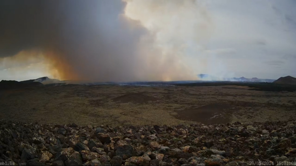


") I think it's magma and groundwater making contact. This will widen the eruption's effects considerably, might even bring
I think it's magma and groundwater making contact. This will widen the eruption's effects considerably, might even bring 
