• Welcome to TalkWeather!
    We see you lurking around TalkWeather! Take the extra step and join us today to view attachments, see less ads and maybe even join the discussion.
    CLICK TO JOIN TALKWEATHER

Iceland's Fagradalsfjall Fires


In such a complex tectonic environment, this layperson is not about to try to interpret the fracture style, but it is amazing -- textbook case!
 
Current IMO text with graphic showing relationship of erupting vents to Grindavik and other landmarks:

Updated on December 19, at 02:50

Rather, the power of the eruption that started about four hours ago seems to be reducing. It can be seen on both seismometers and GPS meters. The fact that the activity is already reducing is not an indication of how long the eruption will last, but rather that the eruption is stabilizing. This trend has been seen at the beginning of all the eruptions on the Reykjanes Peninsula in recent years.

Eruption continues throughout the entire fissure, with the greatest intensity around the center of the fissure in the area marked "Zone 3" and shown in orange on the hazard assessment map released a week ago. a>

The crack is about 4 km long and the northern end of the crack is just east of Stóra-Skógfell and the southern end is just east of Sundhnúk. The distance from the southern end to the edge of Grindavík is almost 3 km.

The Norwegian Meteorological Agency will continue to monitor the development of the activity and is in direct contact with civil defense and emergency responders in the area. The Watch will post information on the development of the scenario under "Expert Comments" as deemed necessary. A consultation meeting of scientists will be held this morning.

This news will be updated at 9, 19 December.
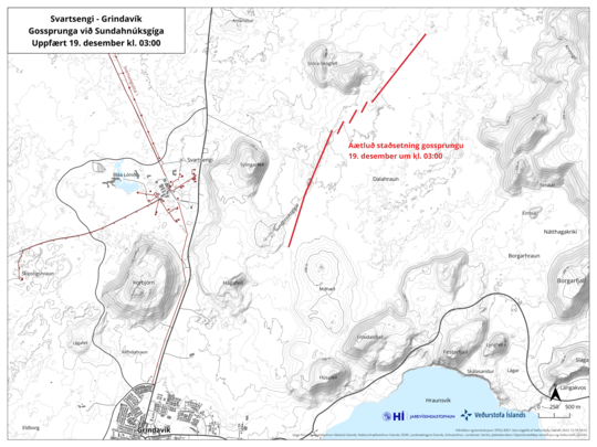
Eldgos_19dec_stadsetsetn_0300_IS
 
This is what it looks like on the other side of the peninsula:

 
Atmospheric perspective (see whole thread, also neat thermal signature picked up by satellite):

 
Cam update with links, very handy:


"A perspective view of the area, the crater marked in, along with webcams."
 
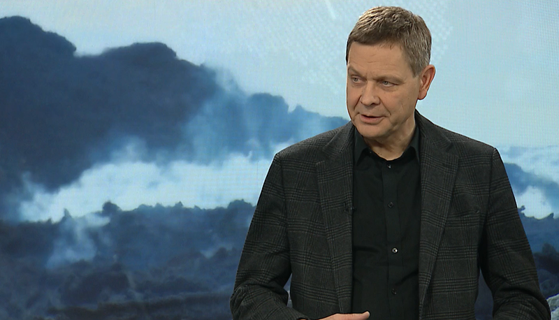
Magnus Tumi points out some good news, even though it's almost 3 a.m. for the interview:

Magnús Tumi Guðmundsson is a professor of geophysics.
Magnús Tumi Guðmundsson is a professor of geophysics.INDEX/EINAR
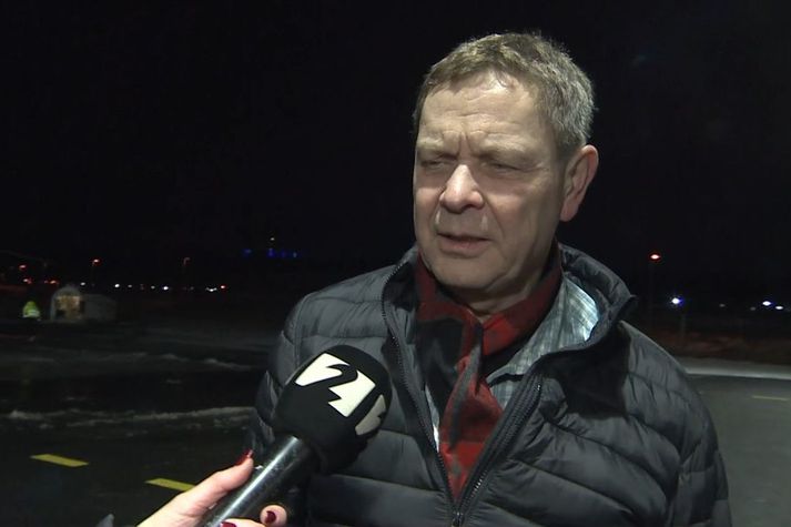
It can be expected that the flow of lava from the eruption on the Reykjanes Peninsula will decrease rapidly. A geophysicist says the eruption is in the best place given the conditions. Lava does not flow towards Grindavík, and it has to flow a long way to reach the defenses at Svartsengi.

-- Source (autotranslated)
 
Mbl.is reports (autotranslated) that bore hole monitoring, etc., at the power plant hasn't detected any changes.

They note that the boffins will be meeting in about an hour and a half.


This doesn't necessarily mean it is stopping; in interviews earlier this evening, volcanologists said it was stabilizing.

Maybe it will stop, which would be great, but only time can tell.

Per news reports, the science meeting broke up about an hour and a half ago, and there is talk in articles of lava flow models (here's a paper with more information about that important but very complicated work). IMO will probably post an update on their web page when they get a moment.

Reportedly no infrastructure is threatened yet, but HS Veitnur -- the local region's electricity/geothermal heat supplier -- is watching its above-ground hot-water lines closely.

Map of the area:

 
Last edited:
The main concerns right now, per mbl.is (autotranslated).

The low-lying plume looks nasty on cams, but wind is blowing it off island, more or less, at the moment:
 
Just out (via Google Translate, with some uncertain terms -- I think "gosop" is vent and "soda" is another word for eruption):

Updated December 19, at 12:30 p.m


The power of the volcanic eruption at Sundhnúks crater continues to decrease. Lava flow is roughly estimated at ¼ of what it was at the start and a third of the original fissure is active. The magma plumes are also lower than at the beginning of the eruption, about 30 meters at their highest. These numbers are a visual assessment from a survey flight, another measurement flight is scheduled at 13 today, where a clearer picture is obtained of the development of the activity.

The development of the eruption is similar to the volcanic eruption at Fagradalsfjall, where the fissures have started to contract and form single vents. At this point there are about five gosops scattered along the original crack.

According to the information of scientists who went on the second helicopter flight of the Coast Guard around As of 4:00 a.m., the total length of the eruption zone had not changed much since the beginning. There was little activity at the southern end of the fissure at Hagafell, and the largest lava flow is looking east towards Fagradalsfjall. Two reins extend to the west, both north of Stóra-Skógfell.

Today, the plume of soda is coming from the west and north-west direction. Gas pollution may be noticed in Vestmannaeyjar today, but not elsewhere in the settlement. According to the weather forecast, gas pollution could be noticed in the capital area late tonight or in the morning.

A new hazard assessment map is being developed and will be published later today.

-- IMO
 
I'm learning all the Icelandic I can! Thanks for sharing this. So, in an earlier post, you said that they were working on lava barriers. What type of material is used for that? I've seen lava do all kinds of things to different materials.
 
I'm learning all the Icelandic I can! Thanks for sharing this. So, in an earlier post, you said that they were working on lava barriers. What type of material is used for that? I've seen lava do all kinds of things to different materials.

Thanks and you're welcome, WesL. My technical knowledge is close to nothing, but I believe they basically went out and scraped off the top of the Svartsengi plain -- "Svartsengi" = "black bed," i.e., hardened basalt from old flows -- and piled it up (using some humungous Cats and other equipment they've got).

BTW, the source of basalt material, per that linked article, was a nearby mountain -- still "surface," I guess, since everything here formed in eruptions.

Of course, there is more to this than that, but time was limited (the eruption could have happened any time from November 10th on) and a geothermal power plant covers a huge area, plus they had to factor in natural barriers.

The Blue Lagoon was included because it's so close to the power plant; incidentally, no one was at the resort when the eruption began, per news stories, and of course, the place is closed now -- they have been running the plant remotely, so no one was there, either. The 24-hour-shift workers on the barrier evacuated, though.

Icelanders tried a barrier during one of the earlier eruptions, too, on a much smaller scale.

They built a wall in a narrow valley, hoping to pool lava. That worked but too much lava was coming in and the barrier was overtopped.

Fortunately, the lava didn't reach the road they were trying to protect -- not sure if that was from an eruption slowdown or other diversion efforts.

Out on the Svartsengi Plain, there's plenty of room for lava to spread out. The tricky part, I understand, has been taking subsidence into account (the reservoir feeding the eruption is centered right there and of course the land above it goes down as the lava comes out).

There are a few gaps still, but it is mostly completely. Good news, too, is that this eruption site is fairly distant, so lava has a way to go. There is time.

There's also uncertainty, but Páll Einarsson is taking the positive view.
 
Last edited:
Yep. Per IMO's update today:

No visible eruption activity​

However, it is possible that the lava flow is in closed channels​

21.12.2023

Updated December 21 at 9:45 a.m

Scientists flying over the craters confirm that no eruptive activity is visible and that the craters appear to be extinguished, but embers are still visible in the lava bed. This was also confirmed by an Efla employee who is in Sýlingarfell. The activity seems to have gone down late last night or very early this morning. However, it is still possible that the lava flow is in closed channels and therefore it is premature to declare the eruptions closed.

But this is not an ordinary volcano; it's the Mid-Atlantic Ridge, and even if this particular fire has finished, there will be others on the peninsula.

Two things to keep in mind just now:

  1. The magma sill under Svartsengi plain did not deflate much, although the initial eruption output was bigger than in earlier fires. There is still plenty of magma available for more fires from this November 10th dike or elsewhere -- and maybe they will only give 90 minutes' warning like this one did.
  2. Scientists are starting to talk about the possible presence of a big magma chamber under the peninsula rather than separate volcanic systems as previously though. (Details, autotranslated.) This is not at all to say there is risk of a huge eruption -- that isn't seen in the record here, AFAIK; instead, it makes prediction fiendishly complicated -- not good with the most densely inhabited part of Iceland waking up from a long volcanic sleep.
Still, I hope this one really is out and that there is a long delay before the next of these fires. And I'm glad Grindavik and/or its harbor weren't hit with lava.

But I really wish the sill had deflated more...and that the December 18th pre-eruption pattern hadn't followed the MO of previous Fagradalsfjall eruptions (almost total decline in activity suddenly followed by eruption). If that had been the case, this layperson would feel better about this sudden drop-off in activity.
 
Heartbreaking news for the residents of Grindavik:

RÚV's logo

6 hours ago

The eruption is probably over, but it's not time to spend the night in Grindavík​

fri_20231221_205526667

Magnús Tumi Guðmundsson, professor of geophysics, says that magma accumulation under Svartsengi, which seems to have started again, is similar to before the eruption at Sundhnúksgíga began.
"It built up before the eruption, these weeks, enough pressure and then it broke, what to say, the lid or something like that - and this broke out. It did not manage to flow up continuously and the eruption is probably over. Then the magma starts to accumulate again below because the flow deeper has continued as it was before the eruption."
He says it is just as likely that it will erupt again if it continues like this. "If magma continues to flow from below into this chamber beneath Svartsengi, then we are expected to have a similar scenario again."
He says weeks to months can pass before that happens, and that the chain of events can also stall.
Magnús Tumi says that reassessing the danger in Grindavík will be considered, but it is clear that it is not time for people to spend the night in the town.

6 hours ago

Most likely, magma will continue to accumulate under Svartsengi for weeks or months​

Halldór Geirsson, a geophysicist at the Earth Sciences Institute, says that the most likely scenario after magma accumulation begins again under Svartsengi is that it continues to accumulate there for a few weeks or months and then escapes from the magma chamber.

That's from today's RUV live feed (autotranslated).

Jón Frimann's update today is notable, too.
 
Latest article from mbl.is notes (sorry about the header, can't delete it):

mbl.is
  • User
  • Search
  • Menu
Freysteinn Sigmundsson, a geophysicist at the University of Iceland, says ...

... there are various factors that need to be considered.

"The most important thing at this stage is to pay close attention to the sequence of events, assess what this magma flow is and make a small assessment of what might be needed to trigger a new eruption," says Freysteinn.

"The Earth's crust doesn't behave like that regularly, we don't really know where the limits are to trigger a new event. Now you have to pay close attention."

Freysteinn Sigmundsson.
Freysteinn Sigmundsson. mbl.is/Sigurður Bogi

It is so seldom that we get to see some of the best minds on the planet struggling to understand a new phenomenon, especially with such high stakes (not to mention the global audience, which must not be fun to get up and face every day, although acceptable and a potentially vast public outreach opportunity re: volcanism).

I don't know what a meteorological comparison might be -- just guessing here, but say, working at the NHC on what you expect to be a typical season coming on and suddenly learning that, no, Earth is more in the mood for another Carnian-style pluvial event.

That's a bad comparison because the CPE was so much more extreme. At least it hints at the dramatic psychological and perhaps socioeconomic impact that these comparatively small, repetitive fires likely will have on the nation over the next 30-40 years because of their location.
 
Starting tomorrow, Grindavik is open to residents 24 hours a day, per RUV (autotranslated) BUT check out the list of caveats.

They're not overstating the risk, but it's Christmas and the most likely spot for an eruption (Svartsengi inflation now is more rapid) probably would be at the December 18th fissures.
 
Last edited:
Here's RUV's eruption site cam page.

A lot of people will be watching. Even though the fissures are not active, there is still strong degassing, according to Jón Frimann, and lava might just be a little ways down, lacking the oomph to erupt.

With the sill reinflating, the oomph could come at any moment, though some geologists reportedly estimate a 3 to 4-week break.

 
Last edited:
Of note, I was reading about Iceland's biggest known eruption, which happened in the 900s shortly after the Vikings moved in, and they quoted from the original "Book of Settlement" how someone, even back then, moved to "Grindwik."

That's how far back people's ties go.
 
Back
Top