• Welcome to TalkWeather!
    We see you lurking around TalkWeather! Take the extra step and join us today to view attachments, see less ads and maybe even join the discussion.
    CLICK TO JOIN TALKWEATHER

Iceland's Fagradalsfjall Fires

Volcanophiles are every bit as enthusiastic as weather fans -- here is how this man in London follows Iceland's volcanic events at home:

 
Okay, a complex package of updates here, one that will probably make the most sense if you keep in mind that these are Viking descendants, after all -- and this is their centuries-long home.

Also, that earning a living at Grindavik sometimes means enduring things like this (Dramamine alert, as well as a note on the video's page that the sea was "a bit rough" and that there are reefs on either side of the ship):


All to help supply us with fish to eat!

Updates:

First, InSAR, referencing those November 12-14 interferograms above. Someone shared this incredible close-up of the Grindavik area over the same time span:


Next, the IMO take as of 1540 UTC (autotranslated) on the current situation, including last night's swarm:

Around midnight today, an earthquake began near Sýlingarfell and activity temporarily increased for over an hour. About 170 earthquakes were recorded in the area, and most of them were small earthquakes, but one earthquake measured 3.0 in magnitude. The seismic activity was greatest at a depth of about 3 – 5 km.


From the deformation data from GPS monitors and satellites, it can be seen that expansion continues at Svartsengi and deformation is still measured close to the magma tunnel. However, no changes were detected in the GPS measurements in connection with the earthquake last night. Both seismic and deformation data indicate that magma inflow continues both beneath Svartsengi and in the center of the magma tunnel. The tremors tonight could be an indication of increased pressure in the corridor.


In light of this and the interpretation of the latest data, an eruption over the magma tunnel is still considered likely while the inflow of magma continues. The greatest risk of magma outbreak remains in the area between Hagafell and Sýlingarfell. The risk assessment map issued by the Norwegian Meteorological Agency on November 22 is still valid.

Graphically, that assessment is this:


22-nov-ragnar-haettumatskort.png


They do note that parts of the magma tunnel are wider than expected but they provide no details.

(BTW, I noticed that Google translation of the word for lava barriers is "dike" and so will continue using "magma tunnel," as Google does, for the linear magmatic feature that formed November 10, to keep things consistent.)

Finally, there is this (bad news for Atlantic cod):


There are some online commenters out there who snark about how it's stupid to stay in a dangerous area. I admire the Icelander approach to this complex and difficult situation though personally would not ever be able to return, if I were a Grindviking -- if H. sapiens were "smart" in the sense the snarky commenters mean, we would have gone extinct a long time ago.

What's that verse about saving one's life by being willing to risk it?
 
Things are unchanged, but this tweet about today's civil defense meeting is so sad:

 
I put this update in the wrong thread, sorry!

Still waiting on the magma, but there have been some other developments.
 
They've been try to get businesses going in Grindavik and to repair damage, including that huge crack through the town's big intersection.

Today this happened:


"'A large hole opened shortly before noon under an excavator that was working around the great crack in Grindavík."

Icelanders are amazing. Per mbl.is (autotranslated), the driver filled the hole in himself!

They can't do that with the big hole noted earlier: it goes down over 25 meters to ground water, but ? how deep it really is under that.

The update IMO released a little while ago confirms a "new chapter" and not one in which Grindvikings are going to be able to move back home any time soon:

Updated December 1 at 16.45


Seismic activity continues to decrease on the Reykjanes Peninsula, and there are now much fewer and smaller earthquakes than in recent weeks. Most earthquakes are measuring below one in magnitude. The activity is greatest between Sýlingarfell and Hagafell, where the magma tunnel runs. In all likelihood, the magma that is accumulating under Svartsengi is feeding that magma passage. The deformations are still being measured at stations near the magma tunnel, but it is believed to be due to the landslide that is taking place at Svartsengi.

Despite less activity at the magma tunnel and the immediate vicinity, landris remain stable at Svartsengi.

The event that began on October 25 with intense seismic activity that peaked on the evening of November 10 when the 15 km magma tunnel formed is not over. But it can be said with some certainty that a new chapter has begun where the same sequence of events can repeat itself.

At this stage, it is difficult to say when the next magma injection will occur and whether it will occur in similar directions. The National Weather Service continues to monitor the area carefully.


Interestingly, quite a few national weather services do include volcano monitoring -- mainly in countries that have a lot of volcanoes.

Per Jón Frimann, the sill will have reached its previous size around December 9th.
 
Last edited:
Possibly good news for Grindvikings, although magma still flows into the Svartsengi sill:

Magma seems to have stopped flowing into the magma tunnel​

Sunna Sæmundsdóttir writes December 4, 2023 12:18 p.m
Magnús Tumi Guðmundsson, professor of geophysics, says that the probability of an eruption has decreased.
Magnús Tumi Guðmundsson, professor of geophysics, says that the probability of an eruption has decreased.INDEX/VILHELM
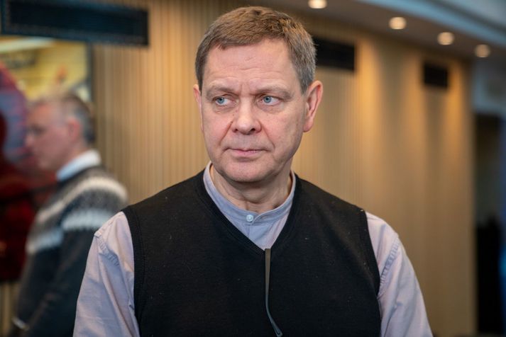
Magma seems to have stopped flowing into the magma tunnel at Reykjanes. It now gathers under Svartsengi at a speed similar to the flow of the Elliða River. A professor of geophysics says that the probability of a volcanic eruption has decreased even though it cannot be written off...

-- Source (Autotranslated)

I have never seen magma rate of speed compared to a river's flow rate before.

All the images of Icelandic geoscientists accompanying news articles like this show very tired-looking people. Quite understandably.

In terms of geology, I wonder if stress is building again on the peninsula. There were a couple of moderately strong (M2-ish) quakes at Kleifarvatn this morning; the lake is east of the area of concern but this region has been a site of multiple triggered (regional stress releasing) earthquakes since October.
 
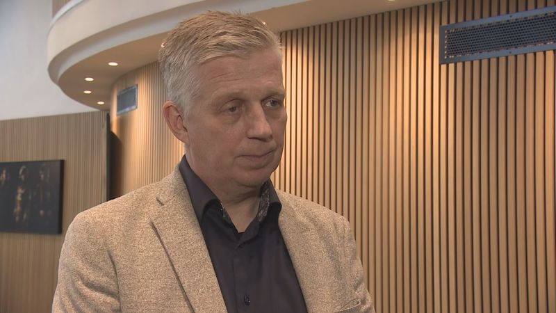
The look of a man telling a whole town that 'no, you probably can't go home for Christmas':

All down to two hours notice on the surface​

Víðir Reynisson, Chief Inspector of Civil Defense, says this new risk assessment does not change much in the larger context.

"The activity in the magma tunnel has stopped for now. It also tells us that there is still magma flow under Svartsengi as it was before the November 10 scenario. The risk assessment also says that such a scenario can happen at very short notice. The National Weather Service has said that the warning time after a magma flow starts and before something happens on the surface could be as little as two hours."
fri_20231120_120134247

Civil defense and evacuation alert levels are and will remain in effect. The situation in Grindavík is under constant review, but it is not considered safe to stay in the town longer than is currently allowed.

"But we are constantly trying to reassess this because we know that Grindvíking want to get home. We know that people at least want to be able to choose whether they can stay at home or somewhere else."

No chance of getting home before Christmas​

Now there has been some demand to spend Christmas in Grindavík. Is there any chance of that?

"They're not big, see. But...

-- RUV (autotranslated)

Here is the new hazard map from IMO (note the inset of Grindavik with the new fractures):

haettusvaedi_vi_8des.png


Other news from online local media, autotranslated:

  • "The warning of a possible eruption near Grindavík could be extremely short, even just two hours. Next week it will become clearer when it will be possible to ensure acceptable security in Grindavík." mbl.is
  • Thorvaldur Thordarson "...believes that it is a mixed effect, some magma has come in, that's obvious, but also tectonic movements, that is to say the movement of plates in the earth's crust, which could even be a bigger factor than the magma...' mbl.is
  • No, this crisis isn't a 'get out of school' pass: The Yule Cat mbl.is


:)

"Life is a risk."
 
Well, good (though IMO cautions that this statement is premature):

Southland's Volcanic and Natural Hazards Group stated in a status post on Facebook today that it seemed that landris in Svartsengi "has practically stopped this week".

Horizontal movements can still be seen on several gauges, but they have also been significantly reduced...

-- Source (autotranslated)

Grindvikings still cannot stay overnight at home, though they are allowed to go in between 7 a.m. and 9 p.m.

Let's hope that this intrusion has failed, though there will be future ones and Iceland, per earlier IMO reports (December 12), is gearing up for a major change in its roughly 800-year relationship with volcanoes on the peninsula.

In other news, a submarine segment of the Ridge a little south of Iceland has been having some M5-ish swarming, and on land there are still news reports of a geothermal area moving/expanding in a separate volcanic segment of the peninsula east of Fagradalsfjall, but the boffins are silent on it and [layperson opinion] this very well could be normal activity [/layperson opinion].

In totally unrelated news, I finished a big writing project last night and, if the volcanoes behave, look forward to catching up on weather news, particularly that recent round of deadly severe weather -- glad Alabama wasn't even harder.
 
Of course, there is controversy.

It isn't a layperson's role to weigh in on scientist disagreement, but (doing so anyway ;) ), I think this geoscientist might have a point.

That's because:
  • There wasn't really much SO2 emission reported in Grindavik, which probably would be the case with a big basalt intrusion just a few thousand feet below the surface.
  • He called this lack of an eruption many weeks ago in an interview while in the States, saying (as again in that linked article above) that it was mostly tectonic. It's always impressive when scientists make predictions that turn out to be accurate, especially when they go against the official line (at the time, I thought he was wrong to "break ranks," but now see that he has courage as well as standing).
  • Páll Einarsson (see post earlier in thread) quietly said, reportedly, that some Fagradalsfjall intrusions don't make it to the surface; of the five known (before this one), only three led to eruptions. That was the last I've heard of him in the news and I assume he might feel that he has made his contribution and is just letting the furor run its course.
 
This (autotranslated) is probably Iceland's equivalent of a riot. The story has legs because today they actually reopened the Blue Lagoon! That is controversial, just judging by the very little I can follow online.

IMO and other experts will be releasing a new risk assessment on the 20th.
 
Yep:

"Of course this is civil disobedience, but if you don't get arrested, I don't think it's a big crime," says Ólafur Benedikt Arnberg Þórðarson, who runs Hotel Grindavík and the restaurant Brúna in the town, but he was threatened with arrest last night if he (did not leave)...

-- Source

From RUV, the "PBS" of Iceland:

In the morning news, a restaurateur in Grindavík was interviewed who said that he was not allowed to open his restaurant, but he and his wife have stayed in their home for the night. According to news agency sources, more residents have done so as well. Úlfar Lúðvíksson, police chief in Suðurnes, says one rule applies to everyone without exception. Everyone is open for presence and activities in the town from seven in the morning to nine in the evening.

If there is a slight change from the current situation, lifting the evacuation will be considered
"It may well be that someone has been hiding in town, but this has not been a problem so far." This case that happened yesterday, I just show full understanding. Many of the residents of Grindavík are very tired of this situation, which has been going on for a very long time. But it's not like the police, or the chief of police, gives orders to arrest people and deport them," says Úlfar.

"The weather office will issue an updated risk assessment on Wednesday due to (seismicity) at Grindavík. If there is a slight change from the current situation, lifting the evacuation will be considered," according to Úlfars.

"If the danger assessment map doesn't change from what it looks like today, if I don't see big changes in the National Weather Service's danger assessment map, then it could very well be that the evacuation will be lifted." Then things go back to normal."


This layperson suspects that none of that would have occurred if they hadn't opened the Blue Lagoon (which I don't understand them doing at all, considering its location pretty much directly over the trouble point -- the power station is a necessity, but not this commercial operation).

If it's too dangerous for the one, it is too dangerous for the other, and if it's safe enough to risk reopening for one, it is safe enough for the other.

It seems tone-deaf to open the business on the one hand and to tell a town it can't have Christmas at home on the other hand, especially after confirming multiple times that an eruption within Grindavik isn't likely now and after opening up the town to business (fishing).

I'll bet volcano emergency managers all over the world are taking notes on this Iceland crisis. Which, of course, only worsens the pressure on local volcanologists and officials. :(
 
Yep. Here's the geology professor in Idaho, doing a stream on it (ended a while ago, but the insights are good):


Well, it's not embeddable but worth watching on YT.

I just got online; will check more info.
 
Some live cams:

RUV:


I hate seeing Grindavik lights in the background on this one:


The mbl.is mosaic (for all these, you can go to the YT channel and find more live cams: Iceland's eruption coverage is unsurpassed!):


Looks like either bad weather or (and/or?) vog is taking over. Anyway, here is RUV's mosaic:

 
Last edited:
Dr. W. did a drone flight, too:

 
IMO news (autotranslated).

Latest comment (0540):

Eruption started around 22:17 on 18 Dec. north of Sundhnúk on the Sundhnúka crater series. The prelude was a powerful earthquake that started just before 21. At 23:25 there was a magnitude 4.1 earthquake just SE of Hagafell. Since 20:30, almost 500 earthquakes have been recorded at the magma corridor. See also the news: Eruption started on the Reykjanes Peninsula.
Written by geoscientist on duty 19 Dec 05:40
 
Check Jón Frimann's blog for future updates; this is current now --

This article is written on 19. December 2023 at 02:35 UTC. Information in this article can go outdated quickly and without warning.

  • The fissure is at last measurement around 4000 meters long (4 km) according to the news.
  • The volcano that is erupting is Svartsengi volcano. On some maps this is shown as Reykjanes volcano.
  • This is the largest eruption on the Reykjanes peninsula so far.
  • The lava flow is mostly to the east, a way from infrastructure and roads. This is mostly, but can change without warning.
  • There’s a lot of gas pollution from this eruption. This gas is dangerous to people and animals.
  • The lava flow from the fissure is around 100m3/sec to 200m3/sec.
  • The fissure has started to form crates. This is going to continue to create craters as the eruption goes on.
  • There’s a ongoing risk that the eruption fissure might extend to the south towards Grindavík. If that actually happens is impossible to know.
I am going to write next update sometimes later today (19. December 2023) when I have new information and more is known about this eruption.
 
IMO staff interviewed (autotranslated):

Volcanologist Ármann Höskuldsson said in an interview during a news shift on Rás 2 that the fissure seemed to be stretching to the north, which means that the lava is not going down into Grindavík.

Ármann says this classic Icelandic eruption; strong at the beginning but by mid-day it will be two to three craters that are active. "It could rain for seven to ten days, that's my prediction."

Kristín says this was short notice. The earthquake started at nine o'clock and the eruption about ten minutes past ten. The beginning of the eruption surprised scientists. "It happened really fast, really."

Read the whole thing; there is a chance it will go north this time, sparing Grindavik. BUT, as they say, this is going to happen again and again, because that's how the ridge and its fires operate.

Edit: No word yet on what a northward flow field might mean for the lower plant and its barrier walls: at least they have walls (? completed or nearly complete). Those for Grindavik, I understand, are still on the drawing board and under planning.
 
Last edited:
Fast indeed! This is the most amazing and yet terrifying eruption video I've seen yet:

 
Back
Top