
Navigation
Install the app
How to install the app on iOS
Follow along with the video below to see how to install our site as a web app on your home screen.
Note: This feature may not be available in some browsers.
More options
-
Welcome to TalkWeather! We see you lurking around TalkWeather! Take the extra step and join us today to view attachments, see less ads and maybe even join the discussion. CLICK TO JOIN TALKWEATHER
You are using an out of date browser. It may not display this or other websites correctly.
You should upgrade or use an alternative browser.
You should upgrade or use an alternative browser.
Archive Former Hurricane Nate
- Thread starter Brent
- Start date
Kory
Member
Yeah, forward speed and land interaction is going to determine if it follows the left or right side of guidance. Euro/Ukmet is slower, thus more east toward Panama City Beach. Faster solution with the GFS is more toward SELA. I'd take a blend of the two for now until we get a center fix (later today) and this consolidates into a tighter storm versus a monsoonal gyre. But don't be surprised if we have a minimal hurricane in the Gulf this weekend...
This is will a very lopsided storm with most of the action to the east. A Ukmet/Euro track would mean minimal effects to AL and points west, outside the very SE portion of the state. An approaching trough will increase shear across the storm in the Gulf and allow for dry air entrainment.
We've been quite dry in AL for the past few weeks. Could use some rain.
Yeah, forward speed and land interaction is going to determine if it follows the left or right side of guidance. Euro/Ukmet is slower, thus more east toward Panama City Beach. Faster solution with the GFS is more toward SELA. I'd take a blend of the two for now until we get a center fix (later today) and this consolidates into a tighter storm versus a monsoonal gyre. But don't be surprised if we have a minimal hurricane in the Gulf this weekend...
This is will a very lopsided storm with most of the action to the east. A Ukmet/Euro track would mean minimal effects to AL and points west, outside the very SE portion of the state. An approaching trough will increase shear across the storm in the Gulf and allow for dry air entrainment.
We've been quite dry in AL for the past few weeks. Could use some rain.
Not trying to be nitpicky, but the GFS and Euro are almost the same timing wise. Landfall within 6 hours or so of each other. The real difference seems to come from how much different the two are handling the trough digging into the plains. Euro digs the initial trough into the plains/midwest much more at 72-84 hours, which beats back the ridge to the east of the system a bit and allows the more easterly path.
- Thread starter
- #4
Kory
Member
I was looking at 00z data for both models and the GFS looked a bit faster to me. Allowed it to get further NW before the curve. No need to worry about being nitpicky. Always good to have another interpretation.Not trying to be nitpicky, but the GFS and Euro are almost the same timing wise. Landfall within 6 hours or so of each other. The real difference seems to come from how much different the two are handling the trough digging into the plains. Euro digs the initial trough into the plains/midwest much more at 72-84 hours, which beats back the ridge to the east of the system a bit and allows the more easterly path.
Another key factor seems to be the handling of the Bahamas disturbance. So far, it seem the Euro is really on its own with regards to leaving a weakness versus other models keeping the ridging stronger over FL/GA for the weekend time frame. Hard to bet against the Euro...
Kory
Member
NHC first track gives huge weight to the Euro. Completely discounts the GFS.
- Admin
- #7
- Messages
- 3,616
- Reaction score
- 3,429
- Location
- Fayetteville, AR
- Special Affiliations
- SKYWARN® Volunteer

TuckerTerry
Member
Boooooooooooooooooooooooooooooooooo .... I'm over this hurricane season already! Living in Atlanta, I never thought I'd have to do any storm prep ....and this will be twice in one year.
Go away, Nate!
Go away, Nate!
TuckerTerry
Member
Next intermediate in just about 20 minutes. Wonder if we'll have Nate by then. Looking at their cone graphic, it sure does look that way.
- Admin
- #10
- Messages
- 3,616
- Reaction score
- 3,429
- Location
- Fayetteville, AR
- Special Affiliations
- SKYWARN® Volunteer
Still TD16
2:00 PM EDT Wed Oct 4
Location: 12.3°N 82.3°W
Moving: NW at 7 mph
Min pressure: 1005 mb
Max sustained: 35 mph
2:00 PM EDT Wed Oct 4
Location: 12.3°N 82.3°W
Moving: NW at 7 mph
Min pressure: 1005 mb
Max sustained: 35 mph
Destin Native
Member
- Messages
- 16
- Reaction score
- 39
- Location
- Carrabelle, FL and Keaton Beach, FL
- Special Affiliations
- SKYWARN® Volunteer
Boooooooooooooooooooooooooooooooooo .... I'm over this hurricane season already! Living in Atlanta, I never thought I'd have to do any storm prep ....and this will be twice in one year.
Go away, Nate!
I'm with you! We are near Valdosta and own a place in Keaton Beach, FL (near Steinhatchee), I'm sick of cleaning up tree debris. Plus, my husband works for Georgia Power Co he's sick of it too....
TuckerTerry
Member
I'm with you! We are near Valdosta and own a place in Keaton Beach, FL (near Steinhatchee), I'm sick of cleaning up tree debris. Plus, my husband works for Georgia Power Co he's sick of it too....
I feel certain both of you are ...and thankful for him for all he does.
Hopefully this one just doesn't develop as they're currently saying.
- Admin
- #14
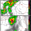
Interesting Development. Looks like Rain and wind this weekend.
TuckerTerry
Member
Latest Euro brings it in as a strong Cat 2-ish near Panama City Sunday night/Monday morning.
That's my concern, without so much land mass to kill it, like Irma. Ugh
akt1985
Member
That's my concern, without so much land mass to kill it, like Irma. Ugh
Latest Euro brings it in as a strong Cat 2-ish near Panama City Sunday night/Monday morning.
Are there any models that bring Nate to Category 3 status before landfall?
- Admin
- #17
- Messages
- 3,616
- Reaction score
- 3,429
- Location
- Fayetteville, AR
- Special Affiliations
- SKYWARN® Volunteer
Are there any models that bring Nate to Category 3 status before landfall?
Not at the moment.

TuckerTerry
Member

TuckerTerry
Member
5 pm looks a bit different than the 11 am. <sigh>

TuckerTerry
Member
Quite a substantial shift overnight. Looks like Euro agrees with GFS now.
