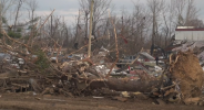
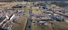
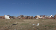
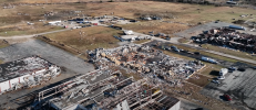
• Welcome to TalkWeather!
    We see you lurking around TalkWeather! Take the extra step and join us today to view attachments, see less ads and maybe even join the discussion.
    CLICK TO JOIN TALKWEATHER

Enhanced Fujita Ratings Debate Thread

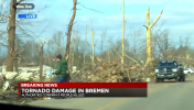
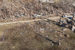
There is no shortage of "that look" from Bremen. I fully believe a EF5 rating is justified at this point, the contextual damage is nothing short of exceptional. The 190 mph house also may justify the rating too
One of the things I find most impressive about the 190 MPH house and the surrounding area is how little debris was recovered. The house was absolutely decimated.
 
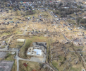
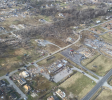
That bottom image might be one of the most impressive images of tornado damage ive ever seen, regardless of home construction.

One of the things I find most impressive about the 190 MPH house and the surrounding area is how little debris was recovered. The house was absolutely decimated.
Yeah that home, while it had some unorthodox construction methods, is in my eyes fully deserving of am EF-5 rating.

From what I understand it was a odd mix of poured concrete and CMU, with the foundation sitting on gravel (said foundation was then tossed 1000+ yards downstream). Considering there was essentially 0 trace of the home and given it being stated by NWS Paducah as "an amazingly strong home", there really doesn't seem like there is much reason it shouldn't have been rated EF-5, even if low end (I personally think 205-210 for the home is just fine.).
 
That bottom image might be one of the most impressive images of tornado damage ive ever seen, regardless of home construction.


Yeah that home, while it had some unorthodox construction methods, is in my eyes fully deserving of am EF-5 rating.

From what I understand it was a odd mix of poured concrete and CMU, with the foundation sitting on gravel (said foundation was then tossed 1000+ yards downstream). Considering there was essentially 0 trace of the home and given it being stated by NWS Paducah as "an amazingly strong home", there really doesn't seem like there is much reason it shouldn't have been rated EF-5, even if low end (I personally think 205-210 for the home is just fine.).
To add on to this, in some areas of the path, there were some brief areas of widespread partial debarking. While this could be due to disease, there was atleast minor debarking to trees throughout the path, especially in the land between the lakes. Vehicle damage, especially in southwest Mayfield and near the university, was some of the worst in recent memory. It lofted heavy objects (such as the 1000 gallon propane tank and the tractor trailer.) aswell.

The debris granulation though is in a league of its own. Personally I find it as one of its strongest contextual damage points. The images @AJS posted does show windrowed streaks of what appears to be granulated debris on extensive, heavy scouring with homes being completely wiped from their foundations. Obvious indicators of a violent tornado.

In terms of actual EF-5 structual damage, I think the 190 MPH home is our safest bet and likely should have been rated EF-5, with the church in Mayfield being a plausible candidate for EF-5 aswell. I will concede that no other structures to my knowledge were worthy of anything higher than EF-4.
 
  • Like
Reactions: AJS
To add on to this, in some areas of the path, there were some brief areas of widespread partial debarking. While this could be due to disease, there was atleast minor debarking to trees throughout the path, especially in the land between the lakes. Vehicle damage, especially in southwest Mayfield and near the university, was some of the worst in recent memory. It lofted heavy objects (such as the 1000 gallon propane tank and the tractor trailer.) aswell.

The debris granulation though is in a league of its own. Personally I find it as one of its strongest contextual damage points. The images @AJS posted does show windrowed streaks of what appears to be granulated debris on extensive, heavy scouring with homes being completely wiped from their foundations. Obvious indicators of a violent tornado.

In terms of actual EF-5 structual damage, I think the 190 MPH home is our safest bet and likely should have been rated EF-5, with the church in Mayfield being a plausible candidate for EF-5 aswell. I will concede that no other structures to my knowledge were worthy of anything higher than EF-4.
The trees in the area with all of the heavy scouring/granulation/wind rowing do seem to have suffered minor to partial debarking.

We’ve also seen a tornado such as Rochelle, which produced very intense scouring/rowing/granulation not produce many instances of debarking.
 
The bottom image is what has always convinced me. Even with the stricter standards of more recent times, only EF5 intensity tornadoes do that. Bremen and Vilonia are probably what I find personally most impressive since 2013.
It's pretty much these two that I think deserve it. Initially, it was just Vilonia but this new standard really changes what is a EF5 indicator, and so going by that, Bremen is the only area where things meet the rules. It was just absolutely violent around that point, and that house was VERY well constructed too so despite the rather unorthodox methods used, it still meets criteria pretty nicely
 
  • Like
Reactions: AJS
To add on to this, in some areas of the path, there were some brief areas of widespread partial debarking. While this could be due to disease, there was atleast minor debarking to trees throughout the path, especially in the land between the lakes. Vehicle damage, especially in southwest Mayfield and near the university, was some of the worst in recent memory. It lofted heavy objects (such as the 1000 gallon propane tank and the tractor trailer.) aswell.

The debris granulation though is in a league of its own. Personally I find it as one of its strongest contextual damage points. The images @AJS posted does show windrowed streaks of what appears to be granulated debris on extensive, heavy scouring with homes being completely wiped from their foundations. Obvious indicators of a violent tornado.

In terms of actual EF-5 structual damage, I think the 190 MPH home is our safest bet and likely should have been rated EF-5, with the church in Mayfield being a plausible candidate for EF-5 aswell. I will concede that no other structures to my knowledge were worthy of anything higher than EF-4.
All this is correct, except the university you speak of I assume is actually the UofK research facility instead of a campus building, which it is kinda weird how It was just in the middle of nowhere, and I really do think the First Presbyterian Church is a good enough indicator for EF5 damage to be confident in saying so, most everything points to it being of that caliber.
 
Also in Dawson Springs the tornado quite suddenly intensified as it crossed the eastern side of town producing relatively extreme damage,

1760290686208.png1760290709463.png

Higher end of vegetation damage, with some debarking and rootballing. This is probably a bit easier in a densely populated area though.

1760290937982.png

There was a small industrial district right on the edge of town. Multiple larger buildings were destroyed here.

1760291046796.png
1760291067257.png1760291129686.png

Debris was once again granulated and wind rowed, and trees were mangled - as was common with this tornado throughout the track.

1760291347595.png

The NWS used 2 EF4 DIs in the town, the highest being 180mph, however you can see on DAT they missed numerous structures.

1760291476638.png

If you watch the aerial damage videos there are so many slabs where homes are almost completely covered in debris from other structures to the point they aren't visible. I don't find it impossible to think there may have been one home perhaps well built enough for an EF5 rating that was not surveyed, but there was also plenty of very subpar construction used. It's just one of those things where I think we will never know.

Also in my personal opinion, when tornadoes move through densely populated areas, especially quickly - the pure abundance of debris makes it harder to achieve the granulated, wind rowed, slab swept clean look so the tornado looks less intense (similar occurred in Rolling Fork and Greenfield). That's partly what makes tornadoes like Moore and Smithville (you could even argue Washington, IL) so extremely impressive when they completely swept clean almost all debris in the areas they impacted.
 
Also in Dawson Springs the tornado quite suddenly intensified as it crossed the eastern side of town producing relatively extreme damage,

View attachment 47224View attachment 47225

Higher end of vegetation damage, with some debarking and rootballing. This is probably a bit easier in a densely populated area though.

View attachment 47226

There was a small industrial district right on the edge of town. Multiple larger buildings were destroyed here.

View attachment 47227
View attachment 47228View attachment 47229

Debris was once again granulated and wind rowed, and trees were mangled - as was common with this tornado throughout the track.

View attachment 47230

The NWS used 2 EF4 DIs in the town, the highest being 180mph, however you can see on DAT they missed numerous structures.

View attachment 47231

If you watch the aerial damage videos there are so many slabs where homes are almost completely covered in debris from other structures to the point they aren't visible. I don't find it impossible to think there may have been one home perhaps well built enough for an EF5 rating that was not surveyed, but there was also plenty of very subpar construction used. It's just one of those things where I think we will never know.

Also in my personal opinion, when tornadoes move through densely populated areas, especially quickly - the pure abundance of debris makes it harder to achieve the granulated, wind rowed, slab swept clean look so the tornado looks less intense (similar occurred in Rolling Fork and Greenfield). That's partly what makes tornadoes like Moore and Smithville (you could even argue Washington, IL) so extremely impressive when they completely swept clean almost all debris in the areas they impacted.
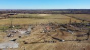
Yeah, the damage in Dawson Springs doesn’t get brought up a lot due to the pretty poor construction, but the complete destruction along with some intense contextual damage is truly astounding to see. I still can’t believe this tornado for the majority of its track was producing high end damage.
 
there really doesn't seem like there is much reason it shouldn't have been rated EF-5, even if low end (I personally think 205-210 for the home is just fine.).
IIRC the main reason this wasn't EF5 was because...wait for it...there were still trees standing near it. You know, like at East Wicker Street back in Vilonia 2014? Yeah.
 
  • Like
Reactions: AJS
Also in Dawson Springs the tornado quite suddenly intensified as it crossed the eastern side of town producing relatively extreme damage,

View attachment 47224View attachment 47225

Higher end of vegetation damage, with some debarking and rootballing. This is probably a bit easier in a densely populated area though.

View attachment 47226

There was a small industrial district right on the edge of town. Multiple larger buildings were destroyed here.

View attachment 47227
View attachment 47228View attachment 47229

Debris was once again granulated and wind rowed, and trees were mangled - as was common with this tornado throughout the track.

View attachment 47230

The NWS used 2 EF4 DIs in the town, the highest being 180mph, however you can see on DAT they missed numerous structures.

View attachment 47231

If you watch the aerial damage videos there are so many slabs where homes are almost completely covered in debris from other structures to the point they aren't visible. I don't find it impossible to think there may have been one home perhaps well built enough for an EF5 rating that was not surveyed, but there was also plenty of very subpar construction used. It's just one of those things where I think we will never know.

Also in my personal opinion, when tornadoes move through densely populated areas, especially quickly - the pure abundance of debris makes it harder to achieve the granulated, wind rowed, slab swept clean look so the tornado looks less intense (similar occurred in Rolling Fork and Greenfield). That's partly what makes tornadoes like Moore and Smithville (you could even argue Washington, IL) so extremely impressive when they completely swept clean almost all debris in the areas they impacted.
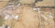
Downtown Mayfield, Cayce (where the trenching happened), Cambridge Shores, Dawson Springs, Bremen, Princeton, etc. So many places with maximum damage, but no maximum rating. When you look at the full picture it becomes very clear it's the scale and surveying that was wrong rather than the buildings themselves.

Since there's currently so much interest, here's detailed 4K aerial surveys of the entire tornado path, in chronological order. This Youtube channel did an incredible job covering everything.

Entire Path


Cayce (Ground Trenching)


Downtown Mayfield


Cambridge Shores


Princeton (including the UK building)


Dawson Springs

Bremen
 
  • Like
Reactions: AJS
It's pretty much these two that I think deserve it. Initially, it was just Vilonia but this new standard really changes what is a EF5 indicator, and so going by that, Bremen is the only area where things meet the rules. It was just absolutely violent around that point, and that house was VERY well constructed too so despite the rather unorthodox methods used, it still meets criteria pretty nicely
It's not just Vilonia and Mayfield. There's a ton more. So much more. Listing just from structural damage alone:

Louisville the day after Vilonia
Pilger family later that year (at least 3 EF5 candidates)
Rochelle 2015
Holly Springs 2015 (New Wren reborn)
Chapman 2016 (rock solid EF5 DI)
Canton 2017 (maybe?)
Camp Crook 2018
Bassfield 2020 (Evidence seems to be piling up for an EF5 at the cabin)
Rolling Fork 2023 (Likely EF5 at Family Dollar)

Not even including likely contextual EF5s like Cisco, Monette or Matador.

So, yea
 

Downtown Mayfield, Cayce (where the trenching happened), Cambridge Shores, Dawson Springs, Bremen, Princeton, etc. So many places with maximum damage, but no maximum rating. When you look at the full picture it becomes very clear it's the scale and surveying that was wrong rather than the buildings themselves.

Since there's currently so much interest, here's detailed 4K aerial surveys of the entire tornado path, in chronological order. This Youtube channel did an incredible job covering everything.

Entire Path


Cayce (Ground Trenching)


Downtown Mayfield


Cambridge Shores


Princeton (including the UK building)


Dawson Springs

Bremen

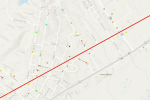
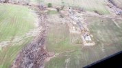
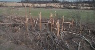
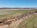
Pretty wild stuff while it was traversing the distance between Cayce and Mayfield20241114_191524_1-3.jpghowell3 (1) (1).jpgScreenshot_20251009-014451.png


Here’s a more formal thread on the calculation of wind speeds near the surface in tornadoes from cycloidal markings/scattering in fields. Seems to certainly have some promise.

 
Last edited:
Back
Top