Navigation
Install the app
How to install the app on iOS
Follow along with the video below to see how to install our site as a web app on your home screen.
Note: This feature may not be available in some browsers.
More options
-
Welcome to TalkWeather! We see you lurking around TalkWeather! Take the extra step and join us today to view attachments, see less ads and maybe even join the discussion. CLICK TO JOIN TALKWEATHER
You are using an out of date browser. It may not display this or other websites correctly.
You should upgrade or use an alternative browser.
You should upgrade or use an alternative browser.
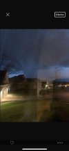
Severe WX April 11-14th, 2022 Severe Weather Threat
- Thread starter KevinH
- Start date
bwalk
Member
That tornadic cell in Noxubee Co, Ms is about to cross into Alabama.
So is the cell in lauderdale, Ms
So is the cell in lauderdale, Ms
bwalk
Member
BMX so far choosing to go with SVR over TOR warnings for previous tornadic cells crossing into Alabama from Miss.
Hopefully that’s a good sign.
Hopefully that’s a good sign.
Equus
Member
I really don't like the looks of the leading edge of this QLCS even north of the intense bow that should prob be tornado warned, damaging wind and a spinup tornado could drop at any time from this; grandmother has a broken wrist and really doesn't need to be have to scramble to the basement

Equus
Member
The gust front has not outrun the deepest convection, so inflow is still surface based and tornadoes could spin up along the line at any time; the most unpleasant of the QLCS events. Will be carefully watching it
Equus
Member
Confirmed tornado east of Moundville
Wouldnt be surprised to see a tornado south of Berry in northern Tuscaloosa county. That storm has ramped up in the last few frames
This needs a TOR immediatly
Edit: there it is
Justin Hindman
Member
- Messages
- 378
- Reaction score
- 1,165
- Location
- Gardendale Alabama
- Special Affiliations
- SKYWARN® Volunteer
- ARRL Member
Man it’s tightened a lot to
Equus
Member
That will probably put down a significant spinup well south of Berry, very strong QLCS spinup signature
Fortunately no TDS so far with this storm, despite the pretty good velocity returns. I think they should probably extend this TOR into west Jefferson and extremely southern Walker counties. Circulation is a little broader than it was a few minutes ago, but it is still pretty strong and could put a solid tornado down at any time.
Justin Hindman
Member
- Messages
- 378
- Reaction score
- 1,165
- Location
- Gardendale Alabama
- Special Affiliations
- SKYWARN® Volunteer
- ARRL Member
I would warn as well, I’m pretty conservative, but it could spin up one really quicklyFortunately no TDS so far with this storm, despite the pretty good velocity returns. I think they should probably extend this TOR into west Jefferson and extremely southern Walker counties. Circulation is a little broader than it was a few minutes ago, but it is still pretty strong and could put a solid tornado down at any time.
Equus
Member
Would still definitely assume it's capable of spitting out a significant tornado, still a very strong QLCS spinup signature; that big outflow surge on a QLCS tends to precede very bad things
Justin Hindman
Member
- Messages
- 378
- Reaction score
- 1,165
- Location
- Gardendale Alabama
- Special Affiliations
- SKYWARN® Volunteer
- ARRL Member
They said severe storm with tornado possible,BMX going with a SVR instead of a TOR. That's an awfully strong circulation to drop the TOR. Guess they'll go with a SVR unless we get a TDS.
That's making me nervous...could all change in a matter of seconds. In an area we have seen terrible things happen.I would warn as well, I’m pretty conservative, but it could spin up one really quickly
Justin Hindman
Member
- Messages
- 378
- Reaction score
- 1,165
- Location
- Gardendale Alabama
- Special Affiliations
- SKYWARN® Volunteer
- ARRL Member
It’s coming directly at me or a mile or 2 south. Hope it pulses downThat's making me nervous...could all change in a matter of seconds. In an area we have seen terrible things happen.