OHWX97
Member
18z HRRR is rather alarming for southern Minnesota/northern Iowa on Tuesday. Dry line is a nonevent.

Follow along with the video below to see how to install our site as a web app on your home screen.
Note: This feature may not be available in some browsers.

If the surface low occluding wasn't pushing the northern end of the front so quickly so that it would be tucked back westward a little over central Missouri into Arkansas in a more north-to-south orientation, that would still be a trough orientation favorable for a fully discrete storm mode. However, the northern end of that front races eastward on the synoptic level, and that causes the front to be parallel to the deep-layer shear, despite the broad-base nature of the upper trough. You don't get more angled deep-layer shear vectors until you get farther out into the warm sector where the deep-layer shear magnitudes are a good bit too weak to support supercell structures. Yeah, this one definitely looks a lot more scary at first glance than it actually does when you start digging into the details.18z HRRR joining the more progressive bunch of models, leaving just ECM and UKMO back with a slightly slower system, with the strongest LLJ exiting Arkansas and surrounding areas by 18z. Environment still looks favourable further North, but large scale synoptic pattern favours a more linear mode. We *may* have dodged a higher-end potential, but we will see. View attachment 13358
Woooohooooo10% hatched tornado probabilities and 30% hatched hail probabilities to compliment the upgrade to ENH over parts of OK and AR today... heads up.
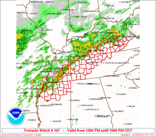
Looks like Fayetteville lucked out of being included in the Tornado Watch though as everyone knows that doesn't mean zero threat. Stay safe!Woooohooooo

Well... that was fast. It's already trying to rotate too.Severe thunderstorm headed towards Fort Smith, AR.
Well... that was fast. It's already trying to rotate too.

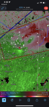
I kinda like that radar... wish it wouldn't.Speaking of a tornado warned cell moving directly towards a radar site...
View attachment 13361