• Welcome to TalkWeather!
    We see you lurking around TalkWeather! Take the extra step and join us today to view attachments, see less ads and maybe even join the discussion.
    CLICK TO JOIN TALKWEATHER

2025 Global Tropical Cyclone Season Discussion

The disturbance in the Eastern Pacific is up to 0/50 now. The GFS is wanting a tropical cyclone outbreak in the basin, which wouldn’t be surprising considering what this basin has done this year so far.
This became Tropical Depression Ten-E yesterday evening, and it was upgraded to Tropical Storm Juliette just over an hour ago.

On top of Juliette, we now have a 0/20 AoI to watch in the Eastern Pacific as well.

Invest 99L in the Atlantic is unlikely to form, and chances are now at 10/10.

Typhoon Kajiki is making landfall in northern Vietnam as I type this as a 90 kt (105 mph) typhoon, and it is expected to move inland and quickly dissipate within the next 48 hours or so.
 
Typhoon Kajiki has made landfall in near Vinh, Vietnam with maximum sustained winds of 105 mph and a pressure of 967 mbs.
IMG_5725.png
 
how cool is this but yes you can use spaghetti models from a different tropical weather websites but i just thought this was too neat to share
 
Hi, Julie! Be a good girl, okay?
Nearly became a hurricane. Peaked at 60 kts (70 mph) it is post-tropical now and its moisture could surge up into California, what’s left of it that is.
 
Invest 93W became Tropical Depression 20W overnight last night. PAGASA (Philippines) gave it the next name on their list: Jacinto
 
That moment when the NHC highlights the whole basin for development (it was a glitch)
 
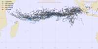
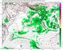
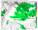
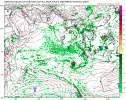
How about a round three of an off-season SHEM storm? We have had a system every month of this pre-season so far with 01S in July and Awo in August, both of which we in the Southern Indian Ocean.


Once again the Southern Indian Ocean is up for the possibility of another development.
IMG_6388.png
IMG_6389.png
IMG_6390.png
IMG_6391.png
 
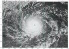
In the Eastern Pacific Hurricane Kiko is getting itself into gear as a 95 kt (110 mph) Category 2 hurricane. It is expected to peak at 115 kts (130 mph), a Category 4 hurricane.

Also in the Eastern Pacific we have concurrent Hurricane Lorena threatening the Baja California peninsula as a 70 kt (80 mph) Category 1 hurricane currently. It is expected to intensify a bit more to 85 kts (100 mph), which is a Category 2 hurricane. It is then expected to weaken before crossing over Baja California and briefly move across the Gulf of California before moving inland over mainland Mexico. Its remnants could bring decent rains to Arizona and Texas when all is said and done.

Recently we had Tropical Storm Nongfa in the South China Sea in the Western Pacific, which was a weak tropical storm that struck Vietnam and affected the same region that Typhoon Kajiki recently struck. It degenerated into a remnant low over Laos but its remnants survived into the Bay of Bengal in the North Indian Ocean. The remnants then moved into the east coast of India yesterday and dissipated. It had the Philippine name Jacinto.

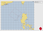
About an hour ago Invest 95W became Tropical Depression 21W. 21W is expected to briefly become a tropical storm before getting picked up by the jet stream over the northern Western Pacific and whipped eastwards out to sea as an extratropical cyclone.

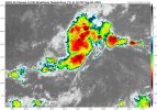
In the Atlantic we are watching a disturbance very closely that has a 30%/70% chance right now.
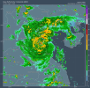
Thanks hurricane man @Atlantic.
 
How about a tale of two Kikos?

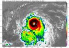
We have Hurricane Kiko in the Eastern Pacific as a slightly weakened Category 4 hurricane with 115 kt (130 mph) winds. Kiko previously peaked at 125 kts (145 mph) before weakening due to a EWRC.

In the Western Pacific we have Tropical Storm Peipah (21W became Peipah) which is known as Kiko in the Philippines.
 
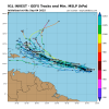
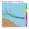
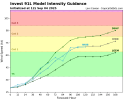
The Atlantic disturbance is now Invest 91L. It seems possible that this could be more of a U.S. threat than Erin ever was.
IMG_6457.jpeg
IMG_6453.png

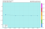
First guidance on 91L

IMG_6454.png
IMG_6455.png
IMG_6456.png
 
How about a tale of two Kikos?

We have Hurricane Kiko in the Eastern Pacific as a slightly weakened Category 4 hurricane with 115 kt (130 mph) winds. Kiko previously peaked at 125 kts (145 mph) before weakening due to a EWRC.

In the Western Pacific we have Tropical Storm Peipah (21W became Peipah) which is known as Kiko in the Philippines.
Dang what, wow @Atlantic
 
Back
Top