KakashiHatake2000
Member
oh okay i see gotchaMario will find the Power Up and thrive or he will not find it and he will hit a brick wall, literally.
Follow along with the video below to see how to install our site as a web app on your home screen.
Note: This feature may not be available in some browsers.
oh okay i see gotchaMario will find the Power Up and thrive or he will not find it and he will hit a brick wall, literally.
oh okay i see gotcha

Anyway back on topic. My bad..
Another Mario meme from the NHC:“Mini Mario”
View attachment 46526
“Powered up to Tropical Storm Mario”
View attachment 46527
Hereee we goo!

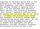
LOL nice @Atlantic.Another Mario meme from the NHC:
View attachment 46529
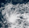
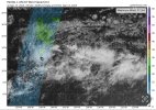
We also have Invest 90W just west of Guam, which all of the models want to become the first truly intense major (Cat 4+) typhoon of the season. If it happens, better late than never I guess if it doesn’t hit land.An invest in the Western Pacific has become Tropical Depression 23W. It is also known as Tropical Depression Mirasol in the Philippines.
23W (Mirasol) rapidly intensified to 45 kts before striking the northern Philippines. It has weakened back to a TD as it tracks overland moving NW. It will be slow to reorganize its low-level structure due to the mountainous terrain of the northern Philippines. Its forecast track bends back towards the west as it approaches the Chinese mainland and if it stay over the South China Sea waters longer, it will intensify more.An invest in the Western Pacific has become Tropical Depression 23W. It is also known as Tropical Depression Mirasol in the Philippines.
| 23W (Mirasol) rapidly intensified to 45 kts before striking the northern Philippines. It has weakened back to a TD as it tracks overland moving NW. It will be slow to reorganize its low-level structure due to the mountainous terrain of the northern Philippines. Its forecast track bends back towards the west as it approaches the Chinese mainland and if it stay over the South China Sea waters longer, it will intensify more. |
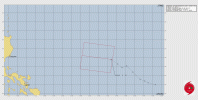
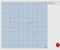
These two have been declared TD 24W and TD 25W by the JTWC. They have also been upgraded to named storms by JMA with 90W becoming 24W Ragasa and 91W becoming 25W NeoguriWe also have two High Chance invests in the WPAC behind Mitag. Both Invest 90W (which is now known in the Philippines as Tropical Depression Nando) and Invest 91W.
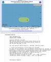
Invest 90W (Philippine name Nando) TCFA
View attachment 46574
WTPN22 PGTW 180600
MSGID/GENADMIN/JOINT TYPHOON WRNCEN PEARL HARBOR HI//
SUBJ/TROPICAL CYCLONE FORMATION ALERT (INVEST 90W)//
REF/A/JOINT TYPHOON WRNCEN PEARL HARBOR HI/180152Z SEP 25//
AMPN/REF A IS A TROPICAL CYCLONE FORMATION ALERT (WTPN21 PGTW 180200)//
RMKS/
1. FORMATION OF A SIGNIFICANT TROPICAL CYCLONE IS POSSIBLE WITHIN
090 NM EITHER SIDE OF A LINE FROM 15.8N 133.5E TO 16.2N 130.1E
WITHIN THE NEXT 12 TO 24 HOURS. AVAILABLE DATA DOES NOT JUSTIFY
ISSUANCE OF NUMBERED TROPICAL CYCLONE WARNINGS AT THIS TIME.
WINDS IN THE AREA ARE ESTIMATED TO BE 18 TO 23 KNOTS. METSAT
IMAGERY AT 180600Z INDICATES THAT A CIRCULATION CENTER IS LOCATED
NEAR 15.8N 133.4E. THE SYSTEM IS MOVING NORTHWESTWARD AT 08
KNOTS.
2. REMARKS: THE AREA OF CONVECTION (INVEST 90W) PREVIOUSLY LOCATED 15.3N
134.1E IS NOW LOCATED 15.8N 133.4E APPROXIMATELY 581 NM EAST NORTHEAST
OF LEGAZPI, PHILIPPINES. ANIMATED ENHANCED MULTISPECTRAL SATELLITE
IMAGERY (MSI) DEPICTS A WELL-DEFINED, EXPOSED LOW LEVEL CIRCULATION
CENTER (LLCC) WITH PERSISTENT DEEP CONVECTION TO THE SOUTH OF THE
CENTER. A 180113Z METOP-C ASCAT IMAGE REVEALS 20-25 KNOT WINDS WRAPPING
INTO THE CIRCULATION FROM THE SOUTHERN PERIPHERY. ENVIRONMENTAL ANALYSIS
FOR THE AREA INDICATES FAVORABLE CONDITIONS FOR DEVELOPMENT WITH LOW
VERTICAL WIND SHEAR (10-15 KTS), WARM SEA SURFACE TEMPERATURES (29-30 C)
AND GOOD EQUATORWARD OUTFLOW ALOFT. MODEL GUIDANCE IS IN GOOD AGREEMENT
THAT 90W WILL CONTINUE IN A WEST-NORTHWESTWARD TRACK WITH GFS SHOWING
THE STRONGEST DEVELOPMENT IN THE NEXT 48 HOURS. MAXIMUM SUSTAINED
SURFACE WINDS ARE ESTIMATED AT 18 TO 23 KNOTS. MINIMUM SEA LEVEL
PRESSURE IS ESTIMATED TO BE NEAR 1005 MB. THE POTENTIAL FOR THE
DEVELOPMENT OF A SIGNIFICANT TROPICAL CYCLONE WITHIN THE NEXT 24 HOURS
IS HIGH.
3. THIS ALERT WILL BE REISSUED, UPGRADED TO WARNING OR CANCELLED BY
190600Z.
4. SEE REF A FOR DETAILS ON A TROPICAL CYCLONE FORMATION ALERT
LOCATED NEAR 23.5N 164.3E.//
NNNN
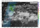
Invest 91W TCFA from the JTWC
View attachment 46575
WTPN21 PGTW 180200
MSGID/GENADMIN/JOINT TYPHOON WRNCEN PEARL HARBOR HI//
SUBJ/TROPICAL CYCLONE FORMATION ALERT//
RMKS/
1. FORMATION OF A SIGNIFICANT TROPICAL CYCLONE IS POSSIBLE WITHIN
160 NM EITHER SIDE OF A LINE FROM 23.5N 164.3E TO 24.7N 156.0E
WITHIN THE NEXT 12 TO 24 HOURS. AVAILABLE DATA DOES NOT JUSTIFY
ISSUANCE OF NUMBERED TROPICAL CYCLONE WARNINGS AT THIS TIME.
WINDS IN THE AREA ARE ESTIMATED TO BE 23 TO 28 KNOTS. METSAT
IMAGERY AT 180000Z INDICATES THAT A CIRCULATION CENTER IS LOCATED
NEAR 23.5N 164.3E. THE SYSTEM IS MOVING WESTWARD AT 12 KNOTS.
2. REMARKS:THE AREA OF CONVECTION (INVEST 91W) PREVIOUSLY LOCATED 22.9N
167.1E IS NOW LOCATED 23.5N 164.3E APPROXIMATELY 282 NM NORTH NORTHWEST
OF WAKE.ANIMATED ENHANCED MULTISPECTRAL SATELLITE IMAGERY (MSI) DEPICTS
A CONSOLIDATING LOW LEVEL CIRCULATION CENTER (LLCC), WITH PERSISTENT
DEEP CONVECTION FROM THE SOUTH SOUTHEAST. A 172240Z ASCAT IMAGE REVEALS
20-25 KNOT WINDS TO THE EAST AND NORTHEAST OF 91W. ENVIRONMENTAL
ANALYSIS FOR THE AREA INDICATES FAVORABLE CONDITIONS FOR DEVELOPMENT
WITH LOW VERTICAL WIND SHEAR (10-15 KTS), WITH WARM SEA SURFACE
TEMPERATURES (30-31C) AND GOOD EQUATORWARD OUTFLOW ALOFT. GLOBAL
DETERMINISTIC MODELS ARE NOT IN AGREEMENT WITH ECMWF SHOWING SUPPORT FOR
A HIGHER INTENSITY OVER THE NEXT 48 HOURS WHILE NO OTHER DETERMINISTIC
MODELS SHOW SUPPORT. GLOBAL ENSEMBLE GUIDANCE HAS 91W ONLY PICKING UP ON
ECENS WITH A HIGHER INTENSITY OVER GEFS. MAXIMUM SUSTAINED SURFACE WINDS
ARE ESTIMATED AT 23 TO 28 KNOTS.MINIMUM SEA LEVEL PRESSURE IS ESTIMATED
TO BE NEAR 1001 MB. THE POTENTIAL FOR THE DEVELOPMENT OF A SIGNIFICANT
TROPICAL CYCLONE WITHIN THE NEXT 24 HOURS IS HIGH.
3. THIS ALERT WILL BE REISSUED, UPGRADED TO WARNING OR CANCELLED BY
190200Z.
//
NNNN
25W Tropical Depression Neoguri warning 124W Tropical Depression Ragasa Warning Forecast number 1:
View attachment 46576
