• Welcome to TalkWeather!
    We see you lurking around TalkWeather! Take the extra step and join us today to view attachments, see less ads and maybe even join the discussion.
    CLICK TO JOIN TALKWEATHER
  • Current Tropical Systems
    Erin

2025 Atlantic Hurricane Season

I’m going to test a very bold theory here. I predict Erin will come to a very slow crawl or stall at some point in its life. The trough will initially start to pull it northwest, but I think western flank of the Bermuda high will build back in farther west than what models currently think. That will allow Erin to continue on a more north northwest track and increase a North Carolina to New England landfall.
 
Here's the HAFS-A and HAFS-B 24-hour error plots -- pretty darn good! These hurricane models are nailing this storm so far.


View attachment 45926


View attachment 45927

And their 48-hour lag is great too, barring the first one when the circulation wasn't well-defined yet.

View attachment 45929


View attachment 45931


But the Official forecast is still King (only has 12-hour lag currently because the official forecast hasn't existed 24 hours yet):

View attachment 45928


Will try to keep posting these model verifications as we go, so we can see which models are grasping with this storm the best. I'll also start doing intensity verifications too, once the storm resumes strengthening.
I love these plots! Minor suggestion though, would it be possible to draw lines connecting the points?
 
98L wasn't expecting that one. Could snatch Fernand I suppose.
Pretty much another Barry in terms of track and possible intensity.
 
Pretty much another Barry in terms of track and possible intensity.
Actually, if 98L becomes Fernand that would be such a continued coincidence as the 2013 and 2019 interations both formed in the same area (Fernand also replaced Felix in the spring of 2008, and it was used for the first time in 2013.)

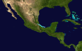
Fernand 2013
IMG_4931.png

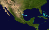
Fernand 2019
IMG_4932.png

And we have 98L, which would be the third time in a row of Fernand forming in this general area if 98L does so.
 
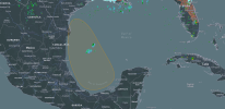
98L now has 40% odds of development for 2-and-7-day terms. Set to move northwest. Main threat would be flooding.
ZCZC MIATWOAT ALL
TTAA00 KNHC DDHHMM

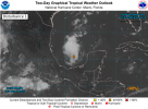
Tropical Weather Outlook
NWS National Hurricane Center Miami FL
200 PM EDT Thu Aug 14 2025

For the North Atlantic...Caribbean Sea and the Gulf of America:

Active Systems:
The National Hurricane Center is issuing advisories on Tropical
Storm Erin, located east of the Leeward Islands.

1. Southwestern Gulf (AL98):
Shower and thunderstorm activity has increased in association with
an area of low pressure located over the Bay of Campeche. The low is
forecast to move west-northwestward across the southwestern Gulf
during the next day or so, where environmental conditions are
marginally conducive for further development. A tropical depression
could form before this system moves inland over northeastern Mexico
or southern Texas by late Friday ending its chances for tropical
development. Regardless of development, locally heavy rainfall is
possible along portions of northeastern Mexico and southern Texas
over the next few days. An Air Force Reserve Hurricane Hunter is en
route to investigate this system.
* Formation chance through 48 hours...medium...40 percent.
* Formation chance through 7 days...medium...40 percent.


Forecaster Bucci
1755193664785.png
 
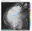
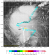
Where I circled in blue, is that a possible LLC? This is the recon mission for 98L
IMG_4949.jpeg
 
Recon for 98L progresses.

IMG_4963.png
 

another possible signal

Well we are approaching peak season after all, so…
Clubbing Summer Vacation GIF by Pepsi India
 
Back
Top