Shouldn’t we wait until we have an actual system before hinting at a hurricane in the deep tropics in late June? Given the fickleness of models...
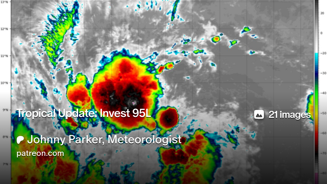
The TC models—especially the HWRF and HAFS—are notoriously too aggressive with systems that lack a well-defined centre. Furthermore, the GFS in particular is too aggressive with any system, most of the time. SHIPS guidance is GFS-based, if I recall correctly. Right now 95L is close to meeting the criteria for classification as a depression, but beyond that dry air looks to be an issue over the next three days, low shear and high SSTs notwithstanding. Afterward shear increases dramatically over the Caribbean, so I would tend to expect rapid weakening by then, especially given the small size of the circulation.
Currently I would like to see deeper and more persistent convection rather than a bursting-type evolution, along with a well-defined centre, to be more certain of those solutions that call for a hurricane near the Lesser Antilles. As of now I think that a weak to moderate tropical storm is most likely. (We had Bret and Cindy last June in the same general area, and neither of these ended up presaging a hyperactive season ACE-wise.) The dry air on visible imagery is just too close and will only get worse with any slight gain in latitude that 95L makes over the upcoming days. Such a small system as this will be prone to dramatic fluctuations.