There's also this:


Follow along with the video below to see how to install our site as a web app on your home screen.
Note: This feature may not be available in some browsers.
There's also this:


Highly doubt it will amount of anything but...
Tweet from someone who said there was a very, very small chance of a subtropical storm forming.What is this?
I remember seeing something about this and I was talking about on Discord.Tweet from someone who said there was a very, very small chance of a subtropical storm forming.

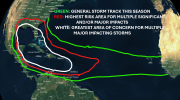
.jpg")
All the high-ACE forecasts are, in my view, going to bust very badly. (In particular, all of CSU’s previous calls for ACE of > 160 units ended up verifying much lower than expected.) The most recent dynamical modelling shows a stronger Newfoundland warm pool, and a warmer subtropical North Atlantic, along with a weaker +AMO compared to that on previous runs. This implies that stability and shear will be an issue once more, as the warmest +SST anomalies will be north of the deep tropics during the peak of the season. Merely having well-above-average MDR temperatures will not be enough to ensure hyperactivity, even with La Niña, if the preponderance of the warmth is up near the Canadian Maritimes. I think that actual ACE units will end up somewhere in the 140s, but not much higher, if at all. That would still be above average, however, but in no way hyperactive. The “hurricane season from Hell,” to paraphrase AccuWeather, most likely won’t be, at least ACE-wise (landfalls could always be another story, but historically, most U.S. major landfalls originated between Africa and the Lesser Antilles, if I recall correctly).


None of the models have a 2013-esque warm-pool develop. Subtropics remain, on all guidance, substantially less warm that the deep tropics, and as we approach the start of the season these anomalies will force a feedback loop that ensures these anomalies don't degrade unless something exceptionally dramatic happens with the atmospheric pattern.
^ This is the kind of SSTA configuration that would need to persist through the peak of the season, in order to favour the upper-tier ACE forecasts. However, the preponderance of the dynamical guidance currently seems to favour considerable warming of the subtropical Atlantic over the coming months, which, in my view, would likely lead to the “bust” that was mentioned previously.
At this stage I will only believe the “hyperactive” forecasts if SST anomalies look like this in late July or early August. Given climate change I will be rather shocked if a big Newfoundland warm pool somehow does not reemerge just in time for the peak of the season. At this point I still would expect this to prevent seasonal ACE north of the 140s, let alone the 190+ units (with CV long-trackers à la 2004/‘17) that a lot of sources seem to anticipate.
This and the upcoming seasons will have a lot of ground to cover in order to make up for high-end U.S.-landfall deficits vs. previous +AMO cycles. Even the last -AMO seemingly produced more-frequent Cat-4+ hits that were verified by ground-based observations. 2024 alone will probably need multiple Carla- or 1926-style hits on eastern peninsular FL and/or TX, in order to allow subsequent years to catch up. But will climate allow this?


Much of the Gulf is 3-5 degrees F above average for this time of year. I wonder if that's having an effect on the damaging severe weather over the country lately? Of course, I know it IS May so severe weather is expected, but just curious is all.
View attachment 27224
In theory, yes, but in actuality we have been mostly underperforming in terms of major tornado outbreaks this spring, given the emergent Niña and the -PDO. Under similar circumstances a few decades ago, in the pre-warming era, we might well have seen multiple HIGH-Risk events that verified tornado-wise, especially in terms of long-tracked EF2+ events. So far only 26–7 April really merited a HIGH Risk tornado-wise to date. If you look at posts from a few months ago you will see that some people were bringing up high-end years such as 1974 and 2011 as analogs or parallels. To date verification has not gone so well. We are seeing above-average numbers of (lower-end, shorter-tracked) tornadoes, but possibly fewer strong, long-tracked events than one might have anticipated.Much of the Gulf is 3-5 degrees F above average for this time of year. I wonder if that's having an effect on the damaging severe weather over the country lately? Of course, I know it IS May so severe weather is expected, but just curious is all.