
This was from yesterday -- just saw it.
Navigation
Install the app
How to install the app on iOS
Follow along with the video below to see how to install our site as a web app on your home screen.
Note: This feature may not be available in some browsers.
More options
-
Welcome to TalkWeather! We see you lurking around TalkWeather! Take the extra step and join us today to view attachments, see less ads and maybe even join the discussion. CLICK TO JOIN TALKWEATHER
You are using an out of date browser. It may not display this or other websites correctly.
You should upgrade or use an alternative browser.
You should upgrade or use an alternative browser.
2022 Tropical Weather
- Thread starter Taylor Campbell
- Start date
- Thread starter
- Moderator
- #122
Very cool. I read this is one of the worst storms to hit Alaska since 2011 and lowest pressure in the month of September.
TornadoFan
Member
We now have Hurricane Fiona, with 80 mph sustained winds and pressure down to 987mb.
Meanwhile, in Japan, this guy is chasing Nanmadol (Kagoshima is home to restless Sakurajima volcano, which -- thankfully -- is maintaining its somewhat enhanced Level 3 status and showing no signs of impending increased activity, per the JMA):
He might post more footage that hasn't been shown in general media yet, depending on how things go for him on the ground.
He might post more footage that hasn't been shown in general media yet, depending on how things go for him on the ground.
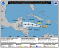
Could this by any chance be related to the possible system entering the eastern Caribbean this weekend shown on the current five-day graphic?Way out in voodoo land but pretty strong hurricane in the gulf 300+ hrs out. probably gone tomorrow.
- Thread starter
- Moderator
- #126
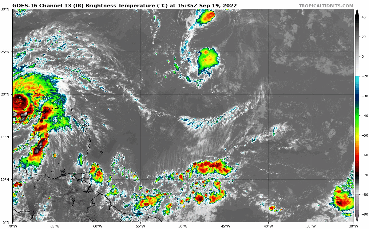
This disturbed area between 50W/45W at 10N has seen an uptick in model support for further development and a look that threatens the US.
Timhsv
Member
GFS has a 935 in the Central GOM at just beyond 240 Hrs
warneagle
Member
I know it's the happy hour GFS but it probably shouldn't be hitting the sauce that hard on a Monday. Gotta pace yourself dude, there's a whole week ahead of you.
- Thread starter
- Moderator
- #129
I know it's the happy hour GFS but it probably shouldn't be hitting the sauce that hard on a Monday. Gotta pace yourself dude, there's a whole week ahead of you.
NAVGEM agrees that the operational GFS is hitting it way too hard. It takes a weak COC over PR. GFS ensembles support this scenario. Fiona is playing a large role in the environment.
INVEST 98L is now up with 60/80 probs. Really got its self together last night. 

- Thread starter
- Moderator
- #131
We may be doing it all again.
There’s been a noticeable uptick in global operational models that support tropical development.
Source: https://www.cpc.ncep.noaa.gov/products/precip/CWlink/MJO/mjoupdate.pdf• The RMM index and upper-level velocity potential anomaly analyses indicate a weak MJO.
• Widespread agreement among forecast models of an increase in MJO activity in the coming weeks.
• TC activity in the Atlantic basin has increased, and some activity in the Main Development Region remains a possibility as we move into early October.
There’s been a noticeable uptick in global operational models that support tropical development.
- Thread starter
- Moderator
- #132
Models say watch the tropical wave at 40W/10N as it moves into the Caribbean. It may take off in the western side.
MattW
Member
- Messages
- 387
- Reaction score
- 379
- Location
- Decatur, GA
- HAM Callsign
- KG4GUF
- Special Affiliations
- SKYWARN® Volunteer
GFS has for several runs now spun something up in the Caribbean by this weekend into Monday. Where it ends up is still very much voodoo land.
- Thread starter
- Moderator
- #135
An unusual tropical threat to the Southeast coast looks imminent over the next 7 days with a pattern that looks like late September.
Last edited:
- Thread starter
- Moderator
- #136

For anyone who's interested in this rare but real threat, but not used to checking the NHC website (suppose it's possible, this late in the year and not all that long before Thanksgiving break at the colleges):
That's from their current five-day tropical outlook.
Southwestern Atlantic:
A trough of low pressure located over the eastern Caribbean Sea is
producing a large area of disorganized showers and thunderstorms.
The trough is forecast to move northward over the southwestern
Atlantic by Sunday, where a broad area of low pressure is expected
to form north of Hispaniola. Environmental conditions are forecast
to be conducive for gradual development, and a subtropical or
tropical depression could form during the early part of next week
while the system moves generally westward to west-northwestward over
the southwestern Atlantic. Regardless of development, there is an
increasing risk of coastal flooding, gale-force winds, heavy
rainfall, rough surf, and beach erosion along much of the
southeastern United States coast, the Florida east coast, and
portions of the central and northwestern Bahamas during the early
to middle part of next week. The disturbance is also expected to
bring locally heavy rainfall to Puerto Rico and the Virgin Islands
this weekend. Interests in those areas should monitor the progress
of this system.
* Formation chance through 48 hours...medium...40 percent.
* Formation chance through 5 days...high...70 percent.
That's from their current five-day tropical outlook.
Also, outlooks and advisories will be an hour early starting in the morning due to the time change.
98L is officially up.80/90 probs.
1. Southwestern Atlantic:
An area of low pressure located more than 300 miles north of Puerto
Rico is producing a large area of disorganized showers and
thunderstorms. This system is forecast to move generally
northwestward over the southwestern Atlantic where environmental
conditions appear conducive for additional development, and a
subtropical or tropical storm is likely to form in the next day or
so. The system is then forecast to turn westward or
west-southwestward over the southwestern Atlantic by the middle
part of this week where additional development is possible.
Regardless of development, there is an increasing risk of coastal
flooding, tropical-storm-force winds, heavy rainfall, rough surf,
and beach erosion along much of the southeastern United States
coast, the Florida east coast, and portions of the central and
northwestern Bahamas beginning in the early to middle part of this
week. Interests in those areas should continue to monitor the
progress of this system as tropical storm, hurricane, and storm
surge watches could be required for a portion of these areas by
early Monday. Additional information on this system, including
gale warnings, can be found in High Seas Forecasts issued by the
National Weather Service and in products from your local weather
office.

Meanwhile in the Atlantic....
.png")
.png")
