• Welcome to TalkWeather!
    We see you lurking around TalkWeather! Take the extra step and join us today to view attachments, see less ads and maybe even join the discussion.
    CLICK TO JOIN TALKWEATHER

Severe WX March 30th- April 1st 2023 (South, Southeast, Ohio Valley, Upper Midwest)

Those would be right as it was about to get munched and the tornado was about to rope out northwest of Kalona. Thanks, though! Hoping someone has some from near/during the cycle southwest of Keota. I agree Iowa radar coverage leaves something to be desired, with only KDMX and KDVN in the state.
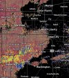
I got it as it was about to move into KeotaF8B49C79-8E2D-4662-B9F1-46BC805A5E0E.jpeg
 
Those would be right as it was about to get munched and the tornado was about to rope out northwest of Kalona. Thanks, though! Hoping someone has some from near/during the cycle southwest of Keota. I agree Iowa radar coverage leaves something to be desired, with only KDMX and KDVN in the state.
And here’s the velocity scan/CC
EA5E8E4B-1E6F-46C9-9822-5A513EBD8CE5.jpeg
 

Attachments

  • 505945A7-0ED8-421F-8A85-22DD9850A016.jpeg
    505945A7-0ED8-421F-8A85-22DD9850A016.jpeg
    1.3 MB · Views: 0
I'm surprised this hasn't gotten more discussion. Sounds horrible, but they got lucky it wasn't a stronger tornado.

EF1SE of Stillman Valley to Belvidere to S of CapronOgle, Winnebago, BooneIL
17px-WMA_button2b.png
42.0723°N 89.1497°W
00:24–00:4927.7 mi (44.6 km)900 yd (820 m)1 death – A tornado struck Belvidere, causing extensive damage. The Apollo Theatre, hosting a sold-out concert with hundreds of people for Morbid Angel, Revocation, and Skeletal Remains, suffered a roof collapse in the middle of the show. At least 40 people were injured and one person was killed, prompting a mass casualty incident.[30][31][32]
 
I saved a bunch of loops but they'd be on my laptop which I won't be able to access for a little while, will post when I can

Very interested in that nighttime Tennessee tornado - seemed to kind of be overshadowed by everything else going on but could've been one of the most violent of the day
 
I saved a bunch of loops but they'd be on my laptop which I won't be able to access for a little while, will post when I can

Very interested in that nighttime Tennessee tornado - seemed to kind of be overshadowed by everything else going on but could've been one of the most violent of the day
Is GR3 analyst worth getting?

It would be a dream of mine to follow one of those historical, high end outbreaks in real time using something like that.
 
Is GR3 analyst worth getting?

It would be a dream of mine to follow one of those historical, high end outbreaks in real time using something like that.
I have yet to personally make the investment (generally use Radarscope thus far) but given the feature suite I'd say it would be a solid investment for anyone with dedication to tracking events, I will definitely eventually get around to that
 
THAT LOOKS LIKE WHAT THE LOYAL VALLEY, TX 1999 TORNADO DID TO TREES AND THE GROUND.
Also should be considered that it did this type of damage under 60 to 65mph moving speed. The fact that it completely mangled and tossed many types of vehicles was also impressive but it's not really surprised given the andover esque motion showed in video.
 
Also should be considered that it did this type of damage under 60 to 65mph moving speed. The fact that it completely mangled and tossed many types of vehicles was also impressive which also not really surprised given the andover esque motion showed in video.
I wouldn't be surprised if it was as violent as the Andover 1991 or the Bridge Creek-Moore 1999 tornadoes to name a couple.The Andover 1991 tornado average speed was 40 mph and it was at around 700 yards at it widest and the Bridge Creek-Moore 1999 tornado average speed was 28 mph and it was a mile-wide. This Keota tornado was 600 yards wide and moved at least 60 mph.
 
Good footage of the Ellendale tornado; anyone would have guessed it was weak based on how it looks, but the damage it left behind tells a different story. Just another example that a tornado should NEVER be judged solely based on its appearance.

If that ends up ranked as an EF3, which I've read may happen, it would be the first (E)F3 in Delaware in a long time, maybe since 1961 (according to my quick googling). (Delaware is my home state. )
 
curious as to how many tors will be confirmed for friday when this is all said & done. doubt it'll touch 100 but could definitely come close.
 
Back
Top