ashtonlemleywx
Member
I've had that Van Halen song from Twister playing in my head while reading this thread.
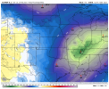
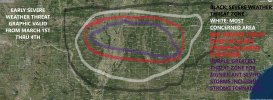
March is coming in like a lion guys. The Deep South in March/April is a mystical place.
March is coming in like a lion guys. The Deep South in March/April is a mystical place.

")