
The fact that the Greensburg tornado likely wasn't even at peak strength and still managed to level almost the entire town stands out to me.
Navigation
Install the app
How to install the app on iOS
Follow along with the video below to see how to install our site as a web app on your home screen.
Note: This feature may not be available in some browsers.
More options
-
Welcome to TalkWeather! We see you lurking around TalkWeather! Take the extra step and join us today to view attachments, see less ads and maybe even join the discussion. CLICK TO JOIN TALKWEATHER
You are using an out of date browser. It may not display this or other websites correctly.
You should upgrade or use an alternative browser.
You should upgrade or use an alternative browser.
Significant Tornado Events
- Thread starter locomusic01
- Start date
AJS
Member
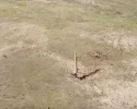
One thing to this day that i’m dying to see is the ground scar and damage photos from the 2.2 mile wide Trousdale wedge that occurred right after the Greensburg monster that’s rumored to have been even more intense.
WeathermanLeprechaun
Member
Holy crap man, unbelievable work altogether. Greensburg was a very large tornado, yet consolidated its core which is rather rare for extremely large wedges like itself. It explains why it was so violent...Appreciate it!
As for a specific point of damage, that’s a good question. Some things I’m most impressed by contextually to start are definitely the multi-ton steel tanks almost certainly being blown 7 miles and landing in various locations throughout the town. Then there’s the vehicles being blown hundreds of yards, some being stripped to the chassis or ripped in half. There was a pickup truck that landed in someone’s living room that was crushed into a ball no more than a few feet across, and another one that was lodged into the elementary school’s cafeteria. Most impressively, co-op workers told stories that reportedly there were 2 car bumpers 120 feet up on the grain elevator, and that another one left blue paint skid marks 40 feet up from that. Manhole and storm drain covers were removed, and I identified 2 seperate areas where the railroad tracks were bent. The tree and vegetation damage near the lake was also extraordinary to say the least, and is up there with some of the most extreme documented IMO.
Structurally, the damage to the high school obviously sticks out, particularly to the south wing of the school which was totally leveled to the ground in some spots. That section of the school was very well built, and featured “well-built walls that included two layers of brick and mortar, one layer of concrete masonry blocks and mortar, as well as more than 19 mm of plaster on the inside wall,” which lead the initial QRT to rate it EF5.
View attachment 48762
View attachment 48763
Elsewhere, the destruction of entire neighborhoods on the north side of town which featured several homes swept cleanly away, including a large, brick Mennonite church.
View attachment 48764
View attachment 48765
View attachment 48766
There was also a large, anchored RV business a few stories tall that was largely swept away.
View attachment 48769
View attachment 48770
Then there’s the damage to this church that had been converted to a home that was quite impressive.
View attachment 48767View attachment 48768
I also go into detail with several aerials and additional photos of extreme damage in this post and further in the same thread. https://talkweather.com/threads/significant-tornado-events.1276/post-162878
To answer your last question, yes I do believe it’s firmly in the list of strongest tornadoes ever documented.
Western_KS_Wx
Member
Greensburg was pretty much steady-state EF5 intensity from Highway 183 to just past the lake north of town. There are 3 likely peaks however where damage appeared most intense, with that being just past 183, as it first entered town, and the northern part of town.
I’ve got several photos I can DM to you if you’d like. Apparently the scouring was severe enough that Tim Marshall believed it to be an EF5-strength tornado. He said it was visible for miles and it pretty much ‘mowed the grass,’ however he didn’t take any photos unfortunately.One thing to this day that i’m dying to see is the ground scar and damage photos from the 2.2 mile wide Trousdale wedge that occurred right after the Greensburg monster that’s rumored to have been even more intense.
Saltical Wx
Member
Hi everyone,
I saw a lot of discussion on this forum regarding my Cycloidal Coefficient Method a couple weeks ago, and I intended to clarify some aspects of my formula and methodology. I meant to find the time to share some more about my equations sooner, but unfortunately my schedule was very heavy as I am currently taking multiple math classes simultaneously.
If anyone has questions they would like answered, I'd be glad to help to the best of my abilities and current situation. I'll try to answer some questions about my research that have already been asked on this thread, as well as some other questions you all may have.
For those of you who do not know who I am. My name is Aidan, and I am an engineering student who has researched cycloidal marks for nearly a year and a half. I have developed a set of equations to calculate the wind speeds inside tornadoes based on cycloidal marks in what I call the "Cycloidal Coefficient Method." I won't go into full detail here, but if you like to read more about my work I suggest reading my twitter thread here.
As a short summary, my formula involves using the geometry of the cycloidal marks and the forward speed of the tornado to determine different velocities inside the tornado. I call it the Cycloidal Coefficient Method because my formulas introduce something I call the cycloidal coefficient. This constant represents the unique shape of a cycloid and can be used to reconstruct any circular cycloidal mark. I have derived multiple equations, but the two major ones I've derived are a tangential velocity equation which calculates the maximum velocity of the cycloid producing region of the tornado. This number is concrete and as exact as a direct measurement assuming the inputs are correct (correct forward speed, correct cycloid shape). This formula applies to both tornado models introduced by Fujita (suction vortices) or Lewellen & Zimmerman (Corner flow region), as there is debate as to what exactly produces cycloidal marks. The second major formula I have derived is an equation to determine a 3 second horizontal wind gust. This number relies on parameters such as the core diameter, swirl ratio, forward speed, and cycloidal coefficient. While this number is much more of an estimate compared to the tangential velocity equation, it has shown to correlate extremely well with the EF scale. While I understand the curiosity to know what the equations are, I have elected to keep them private until I have my paper published under my name. I have taken my research very seriously and I am taking every step towards publishing it. Over the past few months, I have been writing a paper on my equations as I have began to share my work to larger audiences. I understand the skepticism of trusting an anonymous online user who claims to have numbers pulled out of seemingly nowhere. However, I am serious in my work and the academic integrity of publishing it. I have presented my work to knowledgeable individuals and I am in the process of getting it presented to those highly educated in the field.
I also noted many people were curious as to why people are so trusting of my work. I do completely agree with not trusting someone so heavily that you use their words without understanding everything it means or verifying what they said. Recently, I have started to share less of everything I think or work on as I noticed many people used my words in online discussions without understanding my primary argument. A few times, people shared messages I sent a while back that were simply notes rather than a full analysis. These were presented in the light as an official statement by me, but these were rather brief observations by me not intended to be spread around as a concrete fact. However, the reason people trust me is due to my insightful analysis and understanding of damage analysis and cycloidal marks that I have discussed with people over the past two years in niche chatrooms.
To briefly answer some questions people have asked on this thread, I am publishing my work to AMS and I hope to present in person at an AMS conference. I have indeed seen Roegner's work on cycloidal marks at the University of Illinois Urbana-Champaign, and I may contact them in the future about my analysis. No, I do not believe Robinson is a stronger tornado than Smithville. My intent is to look at things as objectively as I can, and cycloid analysis introduces that as a possibility. While my tangential velocity formula shows Robison had higher tangential velocities than Smithville, it does not mean Robinson is a stronger tornado. I analyzed over a dozen cycloidal marks in the path of Robinson and Sullivan. Yes, Robinson and Sullivan are two different tornadoes. While Robinson's highest cycloidal calculation in its path clocked in at 241 mph for the tangential velocity, this is a case of sampling bias. Smithville only produced one partial cycloid while it was not at maximum intensity. I reconstructed this partial cycloid to get a large range for the tangential velocity that was a bit lower than Robinson. This is a drastic difference as Robison and Sullivan both produced rather consistent cycloidal marks for a large portion of their paths. Vilonia is obviously an EF5. However, from a structural standpoint first stated in Tim Marshall's 2013 analysis of slab-on-grade residences, the home on Wicker Street does not meet the EF5 criteria. This is not a problem with my analysis, as my analysis is using a definition set my Marshall himself, not my own. While the residence may or may not have required EF5 winds to sweep, this residence was not exactly along the right edge of the RMW. This means higher velocities occurred to the northwest of this residence. Yes, Smithville seems to be two tornadoes when comparing the observed split in the track with radar data. The tornado appeared to cycle rapidly over the state line. This is evident when comparing the track with radar data including other tilts. In-depth analysis reveals the rapidly dissipating Smithville circulation would have had to accelerated to 140 mph to cross the 0.41mi gap in tree damage before the couplet matched the new track. I can explain this more in-depth later if you all would like, but my methodology to prove this was verified by other well educated people; I do understand and agree with the skepticism though.
Overall, I understand the skepticism about my work especially when many of you had not heard of me before. I hope my answer was able to clear up some questions and I do intend to reply to any questions you all have. Though it may take me a bit to reply since I will have a busy next few days. For anyone wondering when my paper is likely to be published, it will be a while. I am a full-time college student who will be working a job over the summer and I unfortunately do not have the time to dedicate towards publishing my research at this instant. However, a long term plan is already in place and I have already begun to work towards building connections and presenting my work to qualified individuals.
Thank you all,
-Saltical
joshoctober16
Member
gonna release it when your finish?Yeah Alex Giles was killed on his farm to the south-southwest of Hopewell. Here’s a fatality map I’ve got from the event. I haven’t been able to locate Sarah Tackett, it states she died in an assisted living center but the only facility I know of in Greensburg was on the far western side of the circulation. The rest of the locations are all accurate.
View attachment 48755View attachment 48756
On the topic of maps, I’ve been working on a EF-rating map on every structure impacted by the Greensburg tornado based on extensive aerial and ground images I’ve received. It’s not 100% complete, but it’s pretty close. Here’s a few screenshots of some locations in town.
View attachment 48757View attachment 48758View attachment 48759View attachment 48760View attachment 48761
Overall, there are 1,219 points plotted so far, not including contextual non-DI’s. Several revisions still need to be made and I found myself going back and reviewing/making changes to DI’s frequently.
Western_KS_Wx
Member
Yep and a contour map as well!gonna release it when your finish?
Ivanthetornadoenthusiast
Member
I feel like Trousdale might be the most underrated tornadoes of 2007, i think most would be focused on the Greensburg EF5I’ve got several photos I can DM to you if you’d like. Apparently the scouring was severe enough that Tim Marshall believed it to be an EF5-strength tornado. He said it was visible for miles and it pretty much ‘mowed the grass,’ however he didn’t take any photos unfortunately.
I appreciate you coming on here, and welcome to the forum!Hi everyone,
I saw a lot of discussion on this forum regarding my Cycloidal Coefficient Method a couple weeks ago, and I intended to clarify some aspects of my formula and methodology. I meant to find the time to share some more about my equations sooner, but unfortunately my schedule was very heavy as I am currently taking multiple math classes simultaneously.
If anyone has questions they would like answered, I'd be glad to help to the best of my abilities and current situation. I'll try to answer some questions about my research that have already been asked on this thread, as well as some other questions you all may have.
I definitely owe you an apology. I took some comments from people that weren’t you that took some of your findings out of context and used that to paint with a broad brush. I was wrong to do that and am always willing to learn more. I’m really impressed with the research you’ve put into this.
Really excited to see more, and hope you stick around and contribute here.
WeathermanLeprechaun
Member
Regarding Smithville, i am actually on board with the cycle and admit that my skepticism was wrong. Someone posted a image showing a clear cut between two paths from some imagery in 2011 in TornadoTRX's Discord server, I'll try dig it up soon.
I am glad to see you on here, Saltical and am very excited for any further theories/conclusions you have, your work is brilliant and apologies for those who twisted your words too. You have a bright future!
I am glad to see you on here, Saltical and am very excited for any further theories/conclusions you have, your work is brilliant and apologies for those who twisted your words too. You have a bright future!
WeathermanLeprechaun
Member
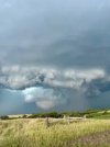
The Bonesteel, South Dakota tornado from this year on July 29th was potentially EF3+. It appeared as a large, rain-wrapped but tall stovepipe tornado.
I actually stumbled across a tweet of Nick Krasz's while looking for media on this and the drone shows intense-potentially violent contextuals here.
This was a very interesting day to watch unfold additionally
I actually stumbled across a tweet of Nick Krasz's while looking for media on this and the drone shows intense-potentially violent contextuals here.
This was a very interesting day to watch unfold additionally
Attachments
Central Ohio Wx
Member
Honestly, I haven't seen a single piece of visual evidence that indicates that tornado should have been rated above 170, let alone 165. I am very skeptical that it was stronger than Greensburg, and I haven't seen any photos that prove it was.I feel like Trousdale might be the most underrated tornadoes of 2007, i think most would be focused on the Greensburg EF5
WeathermanLeprechaun
Member
I actually agree here, i used to believe this sentiment but there is a lack of proper evidence to confirm if it was stronger then Greensburg and i actually doubt it was honestly. I could eat my words here howeverHonestly, I haven't seen a single piece of visual evidence that indicates that tornado should have been rated above 170, let alone 165. I am very skeptical that it was stronger than Greensburg, and I haven't seen any photos that prove it was.
WeathermanLeprechaun
Member
@andyhb, just curious, is the 2025 data staying up on Tornado Archive?
Central Ohio Wx
Member
I actually agree here, i used to believe this sentiment but there is a lack of proper evidence to confirm if it was stronger then Greensburg and i actually doubt it was honestly. I could eat my words here however
The biggest supporting point for an extreme intensity outside of what Marshall has said in relation to it is radar, which had iirc one of the highest gate-to-gate velocity couplet signatures ever observed on radar. However, radar is never a good measurement of intensity, as just in the last few years we have seen tornadoes like Essex, Hollister and Plevna.
Interestingly, the Trousdale tornado also had satellites that were never documented officially, the only existing video of which appears to have been lost as I can't find it anywhere. From Lemon & Umschied 2008, "Their video documentation will continue to be researched by the authors as it is believed this is the only video captured of the TT (Trousdale Tornado) and its satellite tornadoes". If you're into learning more about the Greensburg cell and it's associated tornadoes I would highly suggest reading Lemon & Umschied's 2008 publication "THE GREENSBURG, KANSAS TORNADIC STORM: A STORM OF EXTREMES", it's very interesting.
AJS
Member

The Trousdale, KS tornado’s radar signature was even more impressive than Greensburg. Absolutely monstrous appearance on radar.
WeathermanLeprechaun
Member
Oh, I've read about the supercell many times, it's was no doubt one of the most impressive tornado producers in Plains history (given every tornado being able to maintain such large width) and i wouldn't doubt Trousdale being violent but not to a incredible extent. The VROT is pretty absurd, and I'm glad that the environment has limits, the mid level intensity of some supercells are extremely high and had those winds translated to the winds in cases like Hollister and Plevna, it would've been no doubt historic. Tornadoes likely have some sort of restriction to their intensity at some point and they just can't breach a certain barrier. If every incredible 70+ kt VROT breaker in the mid levels translated to the ground, we would have many violent tornadoes each year and it's for the better that supercells just aren't amazingly consistent at it most of the time (this is why 4/27/11 is such a incredible day)The biggest supporting point for an extreme intensity outside of what Marshall has said in relation to it is radar, which had iirc one of the highest gate-to-gate velocity couplet signatures ever observed on radar. However, radar is never a good measurement of intensity, as just in the last few years we have seen tornadoes like Essex, Hollister and Plevna.
Interestingly, the Trousdale tornado also had satellites that were never documented officially, the only existing video of which appears to have been lost as I can't find it anywhere. From Lemon & Umschied 2008, "Their video documentation will continue to be researched by the authors as it is believed this is the only video captured of the TT (Trousdale Tornado) and its satellite tornadoes". If you're into learning more about the Greensburg cell and it's associated tornadoes I would highly suggest reading Lemon & Umschied's 2008 publication "THE GREENSBURG, KANSAS TORNADIC STORM: A STORM OF EXTREMES", it's very interesting.
The High School is definitely a probable EF5 candidate, three wythes thick masonry, I also note a strong collar joint in the masonry with alternating header and stretcher courses as backing wythes. The second church is very curious to me, definitely reminds me of Mayfield's church which I recently looked at and it 100% deserves EF5, do you happen to have any details on that one. The first church does appear to be a frame structure however.Appreciate it!
As for a specific point of damage, that’s a good question. Some things I’m most impressed by contextually to start are definitely the multi-ton steel tanks almost certainly being blown 7 miles and landing in various locations throughout the town. Then there’s the vehicles being blown hundreds of yards, some being stripped to the chassis or ripped in half. There was a pickup truck that landed in someone’s living room that was crushed into a ball no more than a few feet across, and another one that was lodged into the elementary school’s cafeteria. Most impressively, co-op workers told stories that reportedly there were 2 car bumpers 120 feet up on the grain elevator, and that another one left blue paint skid marks 40 feet up from that. Manhole and storm drain covers were removed, and I identified 2 seperate areas where the railroad tracks were bent. The tree and vegetation damage near the lake was also extraordinary to say the least, and is up there with some of the most extreme documented IMO.
Structurally, the damage to the high school obviously sticks out, particularly to the south wing of the school which was totally leveled to the ground in some spots. That section of the school was very well built, and featured “well-built walls that included two layers of brick and mortar, one layer of concrete masonry blocks and mortar, as well as more than 19 mm of plaster on the inside wall,” which lead the initial QRT to rate it EF5.
View attachment 48762
View attachment 48763
Elsewhere, the destruction of entire neighborhoods on the north side of town which featured several homes swept cleanly away, including a large, brick Mennonite church.
View attachment 48764
View attachment 48765
View attachment 48766
There was also a large, anchored RV business a few stories tall that was largely swept away.
View attachment 48769
View attachment 48770
Then there’s the damage to this church that had been converted to a home that was quite impressive.
View attachment 48767View attachment 48768
I also go into detail with several aerials and additional photos of extreme damage in this post and further in the same thread. https://talkweather.com/threads/significant-tornado-events.1276/post-162878
To answer your last question, yes I do believe it’s firmly in the lAttach filesist of strongest tornadoes ever documented.
Western_KS_Wx
Member
That church was a bit of an older structure and was I believe constructed around the same time as the high school was, so it had older construction techniques. Here’s some additional images to gauge off of.The High School is definitely a probable EF5 candidate, three wythes thick masonry, I also note a strong collar joint in the masonry with alternating header and stretcher courses as backing wythes. The second church is very curious to me, definitely reminds me of Mayfield's church which I recently looked at and it 100% deserves EF5, do you happen to have any details on that one. The first church does appear to be a frame structure however.


As for the Mennonite church, it did appear to have been anchored and was of newer construction. That combined with some extreme, high-end contextual damage to me could justify an EF5 rating.
Edit: Yeah the high school also is worthy of an EF5 rating. There is some disagreement between Marshall and the initial QRT that included Dan McCarthy. That was actually the first point of damage they used to rate it an EF5 less than 2 days afterwards, but Marshall applied an EF4 rating. He did however call it some of the most extreme damage to a school he’s ever seen, and had it very borderline.
WeathermanLeprechaun
Member
One thing i found extremely interesting about 5/25/24 was the unusually consistent production of 1.5 mile wide+ tornadoes from a few supercells that night.
Valley View, Claremore and a few tornadoes from that exceptionally long lived Arkansas supercell breached the 1.5 mile wide+ limit. I would love to hear some sort of explanation to why tornadoes this night established such incredible width that easily. A truly fascinating case altogether and probably one that deserves its respect in the 2020s. That Arkansas supercell is actually a candidate for one of the most craziest tornadic supercells so far this decade, had a LONG while of intense tornado production, with record breaking tornadoes in Arkansas standards. Plus highly deviant paths too, which isn't that common in the Ozarks.
Valley View, Claremore and a few tornadoes from that exceptionally long lived Arkansas supercell breached the 1.5 mile wide+ limit. I would love to hear some sort of explanation to why tornadoes this night established such incredible width that easily. A truly fascinating case altogether and probably one that deserves its respect in the 2020s. That Arkansas supercell is actually a candidate for one of the most craziest tornadic supercells so far this decade, had a LONG while of intense tornado production, with record breaking tornadoes in Arkansas standards. Plus highly deviant paths too, which isn't that common in the Ozarks.