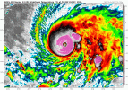
Working theory - there have been EWRCs, it's just so moist at all levels that they are basically mergers that weren't as obvious because they are less disruptive.
Nerdy AI assisted theorizing:
Rainband downdrafts & θe dilution: Outer rainband convection often seeds the secondary ring but also drives evaporatively cooled downdrafts that inject low-θe (drier, cooler) air into the moat/inner core. In a moist envelope (high 700–500 hPa RH), those downdrafts are weaker (less evaporative cooling), so there’s less dry air intrusion to erode the inner eyewall. The inner ring stays healthier, so “replacement” becomes “merger.”
PV mixing vs. collapse: With less θe dilution, vortex-Rossby-wave activity and axisymmetric inflow can radially mix PV between the two rings. The result is a reconstitution into a single, still-strong ring rather than the inner ring starving to death.
Energy supply not pinched: In very high OHC/SST setups, surface enthalpy flux can feed both rings for longer. That reduces the classic energy-competition phase that forces the inner ring to decay, again favoring a gentle merge.
Less moat subsidence drying: The diabatic heating in the budding outer ring normally induces subsidence/drying in the moat. If the environment starts moist, the moat never gets as stable/dry, keeping convective “bridges” alive that physically knit the rings together.
What moisture probably doesn’t do:
It likely doesn’t prevent SEF/EWRC outright - those are largely internal dynamical processes tied to angular-momentum fluxes and the radial wind profile. But moisture can modulate the character of the cycle: shallow or near-zero intensity dip, shorter duration, and a higher chance of the “merge” phenotype.
Straight up though - to test this theory will require a lot more data than just Melissa.

