Wasn’t there a home in Hackleburg that had concrete stem walls sheared off at something like 2-4 inches AGL? I feel like that may have been the only legitimate home in Hackleburg rated EF5.I’d honestly say a lot of the survey was highballed. Structures that shouldn’t have been rated higher than low-end EF4 were given EF5 ratings. I’m yet to see a single structure in Hackleburg that actually warrants the EF5 rating, although later down it’s path I think it did hit a few EF5-worthy structures.
Navigation
Install the app
How to install the app on iOS
Follow along with the video below to see how to install our site as a web app on your home screen.
Note: This feature may not be available in some browsers.
More options
-
Welcome to TalkWeather! We see you lurking around TalkWeather! Take the extra step and join us today to view attachments, see less ads and maybe even join the discussion. CLICK TO JOIN TALKWEATHER
You are using an out of date browser. It may not display this or other websites correctly.
You should upgrade or use an alternative browser.
You should upgrade or use an alternative browser.
Significant Tornado Events
- Thread starter locomusic01
- Start date
Shelby
Member
Here is Smithville kinematics. I am not sure that I have seen its equal?Here is the RAP reanalysis proximity sounding of the Robinson tornado. I’ve noticed these reanalysis skew Ts can really undercount thermodynamics and instability, so take those measurements with a grain of salt. However, this tornado took place well after dark so instability was decreasing with time.
Definitely high end kinematics, but not even in the ballpark of that thermal boundary area on 4/27/11 where 0-1 KM SRH was reaching up into the 800s,
0-3 SRH a little over 1000, and almost 2000 ML CAPE.
View attachment 46602
Attachments
Western_KS_Wx
Member
Here’s some examples of homes swept away in EF5-fashion. Not sure how convincing the construction quality is on these ones however.I’d honestly say a lot of the survey was highballed. Structures that shouldn’t have been rated higher than low-end EF4 were given EF5 ratings. I’m yet to see a single structure in Hackleburg that actually warrants the EF5 rating, although later down it’s path I think it did hit a few EF5-worthy structures.
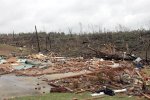
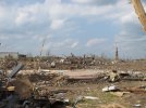
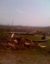
(I’m pretty positive this photo is from the Hackleburg tornado, but I’m not 100% on that)
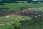
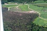
Aerials of probable EF5 damage.
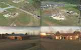
These were homes rated EF5 by the survey team. The first one is highly questionable and was rated EF4 by Tim Marshall (rightfully so), while the latter 2 are from the home in Oak Grove often cited as having higher-quality construction. That can also come into question, as it appears the foundation is a CMU foundation.
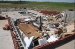
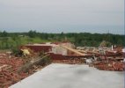
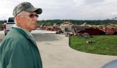
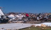
It is also worth noting just how extreme the damage was to the Wrangler plant. In my opinion this is a level of destruction that could warrant an EF5 rating.
sripey
Member
The vegetation damage in that second photo is incredibly impressive. Also of note is the the near "wood chip" level of granulation surrounding that foundation.Here’s some examples of homes swept away in EF5-fashion. Not sure how convincing the construction quality is on these ones however.
View attachment 47946View attachment 47947
(I’m pretty positive this photo is from the Hackleburg tornado, but I’m not 100% on that)
View attachment 47948
Aerials of probable EF5 damage.
View attachment 47949View attachment 47950View attachment 47951
These were homes rated EF5 by the survey team. The first one is highly questionable and was rated EF4 by Tim Marshall (rightfully so), while the latter 2 are from the home in Oak Grove often cited as having higher-quality construction. That can also come into question, as it appears the foundation is a CMU foundation.
View attachment 47952View attachment 47953View attachment 47954
It is also worth noting just how extreme the damage was to the Wrangler plant. In my opinion this is a level of destruction that could warrant an EF5 rating.
View attachment 47955
If that's the large brick home/mansion that was swept away in Oak Grove, it also had "extensive" anchoring per the survey team. It's hard to tell what the CMU blocks are used for there.These were homes rated EF5 by the survey team. The first one is highly questionable and was rated EF4 by Tim Marshall (rightfully so), while the latter 2 are from the home in Oak Grove often cited as having higher-quality construction. That can also come into question, as it appears the foundation is a CMU foundation.
View attachment 47952View attachment 47953View attachment 47954
- Messages
- 4,577
- Reaction score
- 9,358
- Location
- California, United States
- Special Affiliations
- SKYWARN® Volunteer
re: The Hackleburg survey was indeed weird, and on the DAT it's a freakin' mess. Some DI's were highballed, others were lowballed.
The home @slenker mentioned that had its concrete stemwalls pulled off is on the DAT as an EF3 DI with an estimated wind speed of 200MPH, for some reason.
Some EF5 DI's say "threshold of visible damage". Others say "debris not blown from slabs". And yet, not a single swept slab home in Tanner was rated EF5, just to give a few examples.
Spots with genuine (in my opinion) EF5 damage...
Phil Campbell:
Mount Hope: CMU framed restaurant. Slab not entirely swept clean, but a portion of the slab itself was sucked up.
Tanner: multiple slab homes swept clean, some well-built and anchored per NWS Huntsville
Other areas where plausible EF5 damage occurred:
US 43 SW of Hackleburg: Many poorly constructed homes, but at least a few that seemed like stronger EF5 candidates. Details unknown due to the fact that NWS Huntsville used blanket DIs here.
Wrangler duplexes in Hackleburg: buildings on poured slabs, but level of anchoring unknown.
Cornelius Dr, Phil Campbell: entire cul-de-sac obliterated with three fatalities. Homes swept from slabs, but construction details unknown.
Woodard Rd, Phil Campbell: At least one slab home swept, but details unknown. To say the DAT is a mess here would be an understatement.
The home @slenker mentioned that had its concrete stemwalls pulled off is on the DAT as an EF3 DI with an estimated wind speed of 200MPH, for some reason.
Some EF5 DI's say "threshold of visible damage". Others say "debris not blown from slabs". And yet, not a single swept slab home in Tanner was rated EF5, just to give a few examples.
Spots with genuine (in my opinion) EF5 damage...
Phil Campbell:
- home at intersection of Hwy 237 and Pinion Dr: Block foundation brick home. Grass on and near property scoured to bare soil. Carport slab twisted out of place.
- Phil Campbell Housing Authority on Stalcup Circle: four unit apartment building leveled and at least 50% slabbed. Well built and anchored.
- Exact location unknown, but possibly near Woodard Rd: the infamous swept home where a storm shelter on the property had its concrete roof torn off
Mount Hope: CMU framed restaurant. Slab not entirely swept clean, but a portion of the slab itself was sucked up.
Tanner: multiple slab homes swept clean, some well-built and anchored per NWS Huntsville
Other areas where plausible EF5 damage occurred:
US 43 SW of Hackleburg: Many poorly constructed homes, but at least a few that seemed like stronger EF5 candidates. Details unknown due to the fact that NWS Huntsville used blanket DIs here.
Wrangler duplexes in Hackleburg: buildings on poured slabs, but level of anchoring unknown.
Cornelius Dr, Phil Campbell: entire cul-de-sac obliterated with three fatalities. Homes swept from slabs, but construction details unknown.
Woodard Rd, Phil Campbell: At least one slab home swept, but details unknown. To say the DAT is a mess here would be an understatement.
The portion around the basement was CMU, the rest was poured slab. The home had a partial basement, meaning it didn't underlie the entirety of the home. Makes sense considering how large the Oak Grove mansion was.If that's the large brick home/mansion that was swept away in Oak Grove, it also had "extensive" anchoring per the survey team. It's hard to tell what the CMU blocks are used for there.
In some ways I actually kind of like the way the "general scene" or "collective magnitude" seems to have been used to rate the Hackleburg and Phil Campbell damage EF5. The individual DIs are annoyingly inconsistent though.
- Messages
- 4,577
- Reaction score
- 9,358
- Location
- California, United States
- Special Affiliations
- SKYWARN® Volunteer
This. That is essentially why the tornado got rated EF5.In some ways I actually kind of like the way the "general scene" or "collective magnitude" seems to have been used to rate the Hackleburg and Phil Campbell damage EF5. The individual DIs are annoyingly inconsistent though.
Honestly... during the 2013-2025 drought where EF5 ratings were dependent on an impossibly high construction standard, I don't think a single structure along the Hackleburg-Phil Campbell path would have passed EF5 muster. Pretty much all of the EF5-rated damage along the path may have (and probably would have) been nitpicked down to EF4. "CMU foundation", "not swept clean enough" or "not a valid DI" covers pretty much everything unfortunately - and that's exactly what went wrong with damage surveying for so long.
But during the EF scale's earlier years, it was indeed eligible for (and got rated) EF5. And post-Enderlin it would probably get that rating too.
Hopefully we're back on track.
SpotlightForRareTornadoes
Member
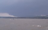
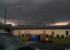
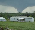
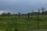
Which tornadoes are in those photos? I know one of them is the Sherwood-Antler, ND F4 from 1911!Speaking of which, there are some insane tornado photos in that book:
View attachment 47603
View attachment 47604
View attachment 47605
View attachment 47606
Central Ohio Wx
Member
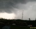
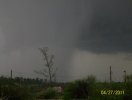
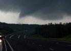
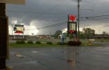
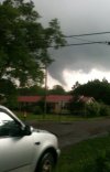
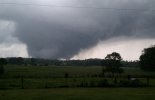
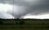
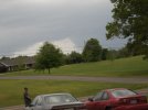
Before i joined this forum, some of my 4/27/11 "resurfacing" got onto this forum. Perhaps my holy grail is these photos of the Hackleburg tornado, remnants. These didn't get onto the forum, a video of Bridgeport taken by Vicky West Westmoreland (which i FALSELY attributed to Hackleburg in its early days) got on. Very intense video no doubt! The DAT cut up two paths and these photos gave credible evidence to what Tornado Talk suggested about two tornadoes. I'm not sure if these photos were recognised by the office, or they used the AMS meeting that showed a lack of a TDS during this time.
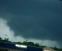
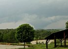
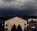
Wall cloud prior to producing
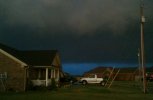
Hackleburg storm near Harvest, AL
WeathermanLeprechaun
Member
How'd you find the first one? That's a third photo now of the wall cloud!View attachment 47999
Wall cloud prior to producing
View attachment 48000
Hackleburg storm near Harvest, AL
Central Ohio Wx
Member
Flickr; the image title doesn't include the words "Hackleburg" or "tornado" so it doesn't appear in results when you look up "Hackleburg tornado" (only way to find it is by looking up "April 27, 2011 Moulton"). There's several other images of the wall cloud and tornado on there, I'll pull them up in a bit.How'd you find the first one? That's a third photo now of the wall cloud!
WeathermanLeprechaun
Member
Oh yeah, I've checked Flickr but their new restrictions are stupid so you barely view any images for 5 minutes without popups. I've found some stuff on there, but it is admittedly frustrating to skim through.Flickr; the image title doesn't include the words "Hackleburg" or "tornado" so it doesn't appear in results when you look up "Hackleburg tornado" (only way to find it is by looking up "April 27, 2011 Moulton"). There's several other images of the wall cloud and tornado on there, I'll pull them up in a bit.
Central Ohio Wx
Member
I'll note that there is a ton of 4/27 content on Flickr (including images of the Cullman tornado near Lake Guntersville and the Tuscaloosa tornado from the windows of the DCH medical center). I'll image dump here if y'all want, is that allowed?
Central Ohio Wx
Member
I’ll take that as a yes. Coming in a bit, need to compile them lol
Central Ohio Wx
Member
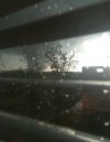
Tuscaloosa tornado seen from a window at the DCH; the tornado barely avoided hitting the building
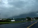
Hackleburg storm near Moulton
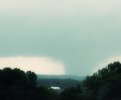
Cullman tornado from Lake Guntersville
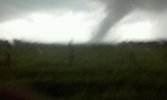
Rainsville tornado near Fyffe
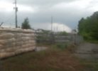
Hackleburg tornado wall cloud near Hamilton
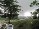
Hackleburg tornado’s initial stage from the 292 Quenton Road property in Hamilton
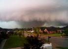
Hackleburg tornado near Harvest
More to come.
Central Ohio Wx
Member
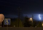
Either the Lumpkin County EF2 or Lake Burton EF3
Unknown tornado
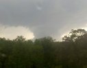
Tornado that moved through the Mulberry River and through I-65, if anyone could identify this tornado that’d be great
“Tornado-007”, no other information is attached
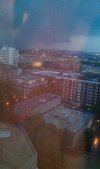
Birmingham tornado from the 17th floor of the Regions Herbert Plaza
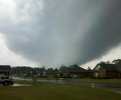
Unknown tornado


