• Welcome to TalkWeather!
    We see you lurking around TalkWeather! Take the extra step and join us today to view attachments, see less ads and maybe even join the discussion.
    CLICK TO JOIN TALKWEATHER
  • Current Tropical Systems
    Melissa

Severe Weather 2025

.FRIDAY/DAY 7 AND SATURDAY/DAY 8

THE LARGE-SCALE MID-LEVEL TROUGH IS FORECAST TO MOVE OVER THE
ROCKIES ON FRIDAY, AS A RIDGE MOVES EASTWARD INTO THE OHIO AND
TENNESSEE VALLEYS. THUNDERSTORMS WILL BE POSSIBLE FRIDAY INTO FRIDAY
NIGHT BETWEEN THESE TWO FEATURES, ALONG AND AHEAD OF A COLD FRONT
FROM THE UPPER MISSISSIPPI VALLEY SOUTHWESTWARD INTO THE CENTRAL
PLAINS. CONVECTIVE COVERAGE IS EXPECTED TO EXPAND ON SATURDAY ACROSS
THE MISSISSIPPI VALLEY, AS THE EXIT REGION OF A LARGE-SCALE
MID-LEVEL JET MOVES ACROSS THE REGION. A SEVERE THREAT WILL BE
POSSIBLE ALONG A CORRIDOR OF MAXIMIZED LOW-LEVEL MOISTURE AND
INSTABILITY FROM THE OZARKS NORTHWARD INTO THE MID TO UPPER
MISSISSIPPI VALLEY. CONCERNING THE POTENTIAL FOR A SEVERE WEATHER
EVENT ON SATURDAY, UNCERTAINTY IS SUBSTANTIAL MAINLY DUE TO THE
EXTENDED RANGE AND WIDE VARIANCE AMONG THE MODEL SOLUTIONS.
oh shoot, it tis on, time to start prep for sec season stuffs
 
.FRIDAY/DAY 7 AND SATURDAY/DAY 8

THE LARGE-SCALE MID-LEVEL TROUGH IS FORECAST TO MOVE OVER THE
ROCKIES ON FRIDAY, AS A RIDGE MOVES EASTWARD INTO THE OHIO AND
TENNESSEE VALLEYS. THUNDERSTORMS WILL BE POSSIBLE FRIDAY INTO FRIDAY
NIGHT BETWEEN THESE TWO FEATURES, ALONG AND AHEAD OF A COLD FRONT
FROM THE UPPER MISSISSIPPI VALLEY SOUTHWESTWARD INTO THE CENTRAL
PLAINS. CONVECTIVE COVERAGE IS EXPECTED TO EXPAND ON SATURDAY ACROSS
THE MISSISSIPPI VALLEY, AS THE EXIT REGION OF A LARGE-SCALE
MID-LEVEL JET MOVES ACROSS THE REGION. A SEVERE THREAT WILL BE
POSSIBLE ALONG A CORRIDOR OF MAXIMIZED LOW-LEVEL MOISTURE AND
INSTABILITY FROM THE OZARKS NORTHWARD INTO THE MID TO UPPER
MISSISSIPPI VALLEY. CONCERNING THE POTENTIAL FOR A SEVERE WEATHER
EVENT ON SATURDAY, UNCERTAINTY IS SUBSTANTIAL MAINLY DUE TO THE
EXTENDED RANGE AND WIDE VARIANCE AMONG THE MODEL SOLUTIONS.
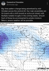
It's THAT time of year...
Season 5 No GIF by The Office
 
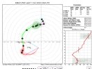
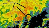
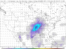
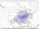
The 12z Euro today, though not as aggressive as yesterday's 12z run, still had good shear/CAPE/Dewpoints for around the 20th timeframe with system. 00z Euro signal the same thing.
 
Still want to see a lot more consistency before latching onto any one system, but GFS/GEFS is definitely showing some interest in the mid-to-late month period. What comes through and when is still all over the place, so I wouldn't get too excited about any juicy-looking troughs in the long-range. But it is that time of year for us, so no surprise we're seeing a gradual return to a severe-favorable pattern.
1760227978954.png1760227991588.png1760227994657.png1760228001528.png
 
Spann mentioned the possibility of strong to severe storms this morning for next Sunday.

Edit to add:

SPC is talking about it as well.

...Saturday/Day 7 and Sunday/Day 8...
Low-level moisture advection is forecast to increase markedly on
Saturday as the trough moves into the Great Plains. By afternoon, an
axis of moderate instability could be in place from the southern
Plains into the Ozarks, with surface dewpoints in the 60s F.
Scattered to numerous thunderstorms may develop along and near this
axis of instability Saturday afternoon and evening. A severe threat
will be possible from Saturday into Saturday night as the trough
moves across the central U.S. A severe potential will also be
possible on Sunday, with the system forecast to move across the
Mississippi Valley.

Although there is model spread among the solutions, most have the
trough moving into the Great Plains on Saturday, with a moist and
unstable airmass located over the lower to mid Mississippi Valley.
This scenario seems plausible. However, the models do still have
significant variance on the timing and strength of the mid-level
system. For this reason, will not add a severe threat area at this
time.
 
Here's what will happen leading to upcoming event:
1. Models continue to show it.
2. SPC highlights 15% area.
3. Models back off leading to O no! Nothing's gonna happen!
4. Anyone thinking Level 4 risk question pops up after SPC unexpectedly goes Level 3 Enhanced during the Day 4-8 Outlook.
5. Models come back with it but are lacking instability.
6. Talk of a non event pops up because forecast models don't show 1000+ CAPE then someone reminds that the wind shear can compensate for lack of CAPE, etc.
7. WxTwitter starts This'll be a Forecasted Convective Amplification Deficiency because of whatever
8. Will this be a strong squall line or discrete supercells?
9. Will a tornado hit my house?
10. BIG TORNADO OUTBREAK IMMINENT! titled YouTube videos start to pop up from obvious suspects

It's funny because it's so true
I'll go deeper on Day of
Morning observations have a few interesting failure modes
That one post on X:
"HRRR SAYS MESS, FORECASTED CONVECTIVE AMPLIFICATION DEFICIENCY!" (They wouldn't say that, but we all know what i mean)
"the event hasn't even started...."
First cell initiates
*doesn't rotate*
"BROYLES IS OVERRATED!!"
Two hours later
Major tornado outbreak has affected areas
The SAME people who slam forecasters:
"I knew this would verify, I totally wasn't getting too ahead of myself and saying this would Forecasted Convective Amplification Deficiency!"

I really wish this type of cycle didn't exist, but it's to be expected with a event unfortunately. I've seen it a BIT too much
 
Back
Top