• Welcome to TalkWeather!
    We see you lurking around TalkWeather! Take the extra step and join us today to view attachments, see less ads and maybe even join the discussion.
    CLICK TO JOIN TALKWEATHER

Enhanced Fujita Ratings Debate Thread

Regarding Ringgold, thanks for digging up proof the concrete slab home was indeed anchored. My stance has changed from “Ringgold should have been rated EF5” to “Ringgold WAS an EF5”.
Quick question: was this the home you referred to in your previous Ringgold post?
Ringgold: I don't think any genuine EF5 structural damage occurred in Georgia except for maybe one home I haven't been able to find ground level views of. I do think it meets the structural and contextual criteria for EF5 (by 2011 standards at least) in Tennessee though.
 
You can link them or put them in a Google site via a screenshot or something; this forum regularly shows copyrighted images in discussions (unless the wording says they are explicitly not allowed anywhere, then ofc dont do that)
And I want to note that our purpose here with all images is discussion, not profit
 
How do we feel about Henryville 2012? The backhoe being deposited into a basement and a truck never being located impress me, but chunks of asphalt being peeled off a road is something else entirely.
Personally, going by the scale, I think 175 mph EF4 is okay. It could have reached EF5 intensity at some point, but probably only briefly, I imagine. The extreme damage listed here is something that I believe could be achieved by a high end EF4.
 
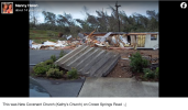
Yup. Same home on Cherokee Valley Road.
FFC was where violent tornados went to die for so long. Not shocked they may have botched Ringgold.

I think another mind blowing fact to me is you have a single supercell that you could plausibly argue dropped 3 continuous EF5 tornados on 4/27/11. Cordova, Rainsville, and then Ringgold. Not sure if you would include Philadelphia since the original
Parent cell of that EF5 underwent a pretty significant merger before it dropped Cordova.

Just an aside, is anyone getting pop ups on talkweather today on mobile? Like spam pop ups?
Yes!! Was wondering what was happening, too
 
Last edited by a moderator:
Sorry, I think there’s a little confusion here. The photo I said was a garage was the one labeled “A swept away home in Izard County” from the VLT Arkansas EF4. The photos you posted are from Barnesville, which are correctly labeled as showing a house.
Oops yeah my bad. got mixed up. You're referring to this house, right? Tornado Talk had it labeled as a home, but they're also human and could've made a mistake.

1754956185635.png

Sunny Side EF3: I admittedly can’t be 100% sure, but from the aerial it honestly looks like a poorly constructed home that just collapsed with debris sliding downhill. EF3 looks appropriate.
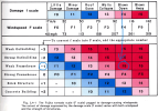
Your analysis is fair, but a big difference between the F scale and EF scale is when homes are completely blown down the F scale classifies the tornado as violent. Even weak homes. This can be explained by the logarithmic nature of the F scale. F4-F5 is a huge range of wind speeds (54 mph). The range covers all construction types, while also maintaining consistency by classifying violent damage with a violent rating. Like I've said, my goal with this exercise is consistency, not perfection.

1754956413219.png

But regarding Pine Log, the F scale graphs you posted literally prove it would not be rated F5. Poorly anchored homes = weak framehouse = F4. Pretty straightforward. Though that does mean it probably would have been rated F4 back in the day. And a case for a low end EF4 can be made.
This is a completely valid take. It honestly could go either way. What swayed me to F5 was the impressive debarking and uprooted shrubs. I've been doing landscaping and have had to remove some shrubs from people's gardens. It's insane how much work it is. They're insanely flexible and the tap roots go extremely deep. They're impossible to pull out without digging deep around the roots. The idea of wind ripping multiple out of the ground (with such small surface area to work with) is mind blowing to me.

1754956909189.png

Here's another picture that swayed me. A large concrete staircase that was moved.

1754957201786.png

Ultimately I'm fine classifying Pine Log as an F4. The important part is giving it a violent classification. I think the underrating of "violent" tornadoes as "strong" might arguably be more consequential than underrating F5s to F4s. It's definitely a much more prevalent issue in terms of quantity. I'd really like to be able to update this graph with corrected ratings and see what it looks like. I'm dying to know what the recent trend of violent tornadoes actually is.

1754957518473.jpeg
 
The Cullman article on tornado talk is in 4 parts.... Not sure how I'm going to tackle this one >~<. I know I need to, though, because searching for pics on this site brought up hardly anything. Gotta get something substantial in this databases at some point lol.
 
Pine Log, GA EF3 - 04/27/2011
Path length: 23.05 miles
fatalities: 0
Injuries: 25

Multiple two story homes were ripped from their foundations. The New Covenant Church was swept off its foundation. Two concrete steps were all that remained. At its peak intensity, the tornado swept away 7 homes. One even had its flooring and carpet removed from its slab.

The NWS rated the area in the photo below 150 mph. The lower bound for slab swept clean is 165, so the rating is egregiously bad. Nothing suggests these homes were poorly constructed. Substantially debarked trees, windrowing, and the removal of carpeting and fixtures is supportive of a violent tornado. Contextuals also supported a violent rating given the fact shrubs were ripped up and significant debarking occurred around the houses.

View attachment 45798
View attachment 45799
View attachment 45800
View attachment 45801
View attachment 45802


New rating: (E)F5

Reasons: Strong framed houses tossed off foundation, tree debarking.

The damage is certainly of at least mid to high-end EF4 intensity.
 
Van Buren, Arkansas EF4 - 02/05/2008 (Super Tuesday outbreak)
Path length: 121.8 miles
Fatalities: 13
Injuries: 139

In the Happy Bend community, a man left his mobile home and took shelter in a large, metal, intermodal shipping container. The container was blown hundreds of yards into the woods and the man was killed.

On the SE side of Mountain view a car dealership was destroyed and cars from the sales lot were thrown across the highway. One was lifted over a building and tossed into a ravine. A utility pole was pulled out of the ground and then a large part of the pole was "jammed back into the ground with all the wires still attached". A church was destroyed, as well as a boat plant.

The Stone County Medical Center had extensive damage, several doctors' offices were destroyed, major damage occurred to a fire station, body shop, paint shop, and car parts store.

View attachment 45774
View attachment 45775
^^ This is the boat plant that was destroyed

View attachment 45776
^^ A new home was ripped from the foundation and thrown into a field

View attachment 45777
^^There was nothing left of a dentist's office
View attachment 45778
^^ A slabbed home in Izard County
View attachment 45779
^^ License plate driven into tree

Here's an article about the survey. Some noteworthy excerpts:


View attachment 45781View attachment 45782
In the picture: A car from the destroyed dealership in Mountain View (Stone County) was thrown over some professional buildings across the street and ended up in a ravine.

New rating: (E)F5

Reasons: Automobile sized missiles fly through the air in excess of 100 meters. Incredible Phenomena. Houses swept clean. Concrete buildings heavily damaged or destroyed.


EF5 looks plausible.
 
Barnesville, GA EF3 - April 28, 2011
Path length: 30.82
Fatalities: 2
Injuries: 22

The tornado produced EF2-EF3 damage for most of its path but as it crossed Old Milner Road it became tremendously powerful. A forest was razed to the ground, and trunks were mashed together in a convergent pattern. A small core of suction vortices tore much of the bark from trees and left cycloidal markings in the grass. The article explicitly prohibits sharing images from certain contributors so I had to find Truman Boyle's aerial imagery myself. All images from the video were screenshotted myself. Here's the link:


View attachment 45784View attachment 45783
View attachment 45794

Damage around the Grove street area was especially intense. A family sheltered in a bathroom as the tornado hit. They laid flat in the tub, and the home was ripped away around them. The sizable frame house was shredded away until only a tattered bathroom was left. There a more images I can't share, but multiple homes in this area were flattened entirely other than just a few small interior rooms.


View attachment 45793

Patty and Marty Gunter experienced the tornado in their home. They ran downstairs, but couldn't make it to their safe place in time. They were in the kitchen and Pattie recalls the pressure being so strong it felt like her feet were nailed to the floor. Patti crouched down on the floor covering her head and the next thing she remembers is sitting on the ground in the foundation of the house. "There was no floor. Just dirt." Marty had a similar experience . In the blink of an eye the couple's home was ripped out from under them and they both survived, standing on bare dirt where the house had been. The only thing remaining was a few foundation blocks. One of their cars was found upside down 50 feet away, and the other was upside down in the woods 100 feet away.

Here's their house:

View attachment 45796

The home had a CMU foundation with grout and rebar. The house was secured to the foundation with "big bolts and washers every so often", which Tornado Talk has confirmed with photographic evidence. No substantial remains were deposited anywhere, only small pieces scattered in the forest hundreds of yards away. Damage patterns indicated a suction vortex completed a trochoidal loop over this spot. A stone tree ring planter filled with mulch and a medium sized tree inside took a direct hit, and disappeared with only some disturbed dirt and a few splinters left.

About 110 yards SE the most impressive structural damage occurred (pictured below). The house was less than two years old, and it was built to hurricane specifications. The foundation was built of firmly reinforced and fully filled/sealed concrete masonry, encased on the outside by brick veneer. It rose a little less than a foot above the ground. Some additional reinforced masonry columns were located in the open space inside the foundation. The house disappeared, with only a few remaining pieces of plumbing and brick inside the foundation. The rest of the house was granulated with tiny fragments scattered into the forest.

View attachment 45797View attachment 45792

Before and After imagery of the area from Google maps

View attachment 45788
View attachment 45787


Another home further in the path was completely swept clean aside from a small corner of the house


View attachment 45795


There are many many more images in the article that I can't share and they're all mind-blowing. Including a screwdriver, old photo, and paper stuck into fully debarked trees.


New rating: (E)F5

Reasons: Strong framed homes swept clean, trees completely debarked, incredible phenomena.

This damage is certainly well into the EF4 category and EF5 looks plausible.
 
Oops yeah my bad. got mixed up. You're referring to this house, right? Tornado Talk had it labeled as a home, but they're also human and could've made a mistake.

View attachment 45904


Your analysis is fair, but a big difference between the F scale and EF scale is when homes are completely blown down the F scale classifies the tornado as violent. Even weak homes. This can be explained by the logarithmic nature of the F scale. F4-F5 is a huge range of wind speeds (54 mph). The range covers all construction types, while also maintaining consistency by classifying violent damage with a violent rating. Like I've said, my goal with this exercise is consistency, not perfection.

View attachment 45906


This is a completely valid take. It honestly could go either way. What swayed me to F5 was the impressive debarking and uprooted shrubs. I've been doing landscaping and have had to remove some shrubs from people's gardens. It's insane how much work it is. They're insanely flexible and the tap roots go extremely deep. They're impossible to pull out without digging deep around the roots. The idea of wind ripping multiple out of the ground (with such small surface area to work with) is mind blowing to me.

View attachment 45907

Here's another picture that swayed me. A large concrete staircase that was moved.

View attachment 45909

Ultimately I'm fine classifying Pine Log as an F4. The important part is giving it a violent classification. I think the underrating of "violent" tornadoes as "strong" might arguably be more consequential than underrating F5s to F4s. It's definitely a much more prevalent issue in terms of quantity. I'd really like to be able to update this graph with corrected ratings and see what it looks like. I'm dying to know what the recent trend of violent tornadoes actually is.

View attachment 45910
Van Buren: Regardless of what TornadoTalk wrote, it's definitely a garage. Here's the full resolution pic (and FWIW, the home on this property was leveled but not slabbed):
img_20220106_132627-jpg.11520


Regarding your take on Sunny Side and the F scale itself... you say you're going for consistency, and that's fair. Still, I might mention that even during the F scale era, inconsistent ratings very much existed. For example, some tornadoes during the F scale era that leveled homes (Norton KS 1911, Moingona IA 1912, Hebron NE 1953, Mechanicville NY 1998, and Stoughton WI 2005 among others) were given F3 ratings anyway.

And yeah, I do think Pine Log would have gotten an F4 rating if it happened before 2002. And I do think that even under the current constraints of the EF scale, the survey team would have been well within their rights to go EF4. The concrete staircase being shifted is especially impressive. Still, I just don't think there's quite enough for EF5 there.
 
Back
Top