• Welcome to TalkWeather!
    We see you lurking around TalkWeather! Take the extra step and join us today to view attachments, see less ads and maybe even join the discussion.
    CLICK TO JOIN TALKWEATHER

Enhanced Fujita Ratings Debate Thread

2. Who's saying (Flat Rock-)Trenton was one of the strongest of the outbreak? It's borderline EF5, yes, but all of the official EF5s minus Philadelphia, and even some of the EF4s and New Wren, stomp it into the ground.
I’ve been under the impression that Flat Rock was a more hotly debated EF5 rating than even Tuscaloosa was, at least amongst the surveyors themselves. I heard it did some absolutely extraordinary tree damage, though admittedly I don’t think I’ve seen that many images of the damage, so I can’t really say that with confidence.

I tend to be more of the opinion that many intense tornadoes from that day likely reached similar intensities. Since Flat Rock was riding along the boundary, I think it makes sense that it was one of the top ones. But again, I can’t say that with confidence myself.
Yes, Flat Rock was incredibly violent when it comes to tree and structure damage (allegedly), although there aren’t any easily-findable images. Some surveyor on TornadoTalk directly gave the tornado an EF5 rating, although idk who that was or the circumstances of it
 
Last edited:
IMG_8673.jpeg
SPC specifically described a home being “exploded” by the Flat Rock tornado, although I can’t find a direct link for that quote. Was also deemed an “EF5 candidate” in the Lyza study, although Cullman is also listed so it’s not too impressive that the tornado is on there.
 
Last edited:
The flat rock article on Tornado Talk is extremely long with tons of exclusive pictures. It basically eviscerated everything in its path, including trees and soil. Super impressive stuff. I'll post more tornadoes tomorrow. The restrictions on sharing photos from Tornado Talk are annoying and a real ethical dilemna. Plus I used my talk weather username for my name on there. Not the brightest move lol.
 
The flat rock article on Tornado Talk is extremely long with tons of exclusive pictures. It basically eviscerated everything in its path, including trees and soil. Super impressive stuff. I'll post more tornadoes tomorrow. The restrictions on sharing photos from Tornado Talk are annoying and a real ethical dilemna. Plus I used my talk weather username for my name on there. Not the brightest move lol.
You can link them or put them in a Google site via a screenshot or something; this forum regularly shows copyrighted images in discussions (unless the wording says they are explicitly not allowed anywhere, then ofc dont do that)
 
  • Like
Reactions: AJS
Have quite a few posts to catch up on here... so let me take em one by one.

On another note, @TH2002, do you have any thoughts on the aforementioned Flat Rock-Trenton home that NWS gave a 4 to?
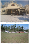
Regarding Flat Rock... this is the alleged "EF5" home in question. Absolutely nothing sets this above EF4. Walls nailed into the top of the subfloor, which remained bolted to its block foundation. Honestly, some WFO's would have given this damage an EF3 rating, and I honestly think this is another case of a surveyor mistaking a subfloor for a poured slab. EF4 is fine.

PHOTO: Chris Darden/NWS Huntsville
Fig-69-Chris-Darden-what-was-left-of-perry-home.jpg


@Grand Poo Bah... Good to know r/EF5 is a satire subreddit lol. Still, we live in a society where the line between satire and what people actually believe has been blurred, so it had me for just a sec.
Also, photo #5 in your Van Buren post is actually a garage. Photo #3 was indeed a well anchored home though.
Regarding the Pine Log, GA EF3... I think you could credibly argue for low-end EF4 but again, there is absolutely nothing to suggest EF5. The home in photo #2 was poorly anchored with cut nails, and the home in the Dana Way video was detached from its subfloor.
 
Have quite a few posts to catch up on here... so let me take em one by one.


Regarding Flat Rock... this is the alleged "EF5" home in question. Absolutely nothing sets this above EF4. Walls nailed into the top of the subfloor, which remained bolted to its block foundation. Honestly, some WFO's would have given this damage an EF3 rating, and I honestly think this is another case of a surveyor mistaking a subfloor for a poured slab. EF4 is fine.

PHOTO: Chris Darden/NWS Huntsville
Fig-69-Chris-Darden-what-was-left-of-perry-home.jpg


@Grand Poo Bah... Good to know r/EF5 is a satire subreddit lol. Still, we live in a society where the line between satire and what people actually believe has been blurred, so it had me for just a sec.
Also, photo #5 in your Van Buren post is actually a garage. Photo #3 was indeed a well anchored home though.
Regarding the Pine Log, GA EF3... I think you could credibly argue for low-end EF4 but again, there is absolutely nothing to suggest EF5. The home in photo #2 was poorly anchored with cut nails, and the home in the Dana Way video was detached from its subfloor.

Nope, photo #5 is for sure the house I described. Here's more pics.

1754842883692.png1754843046134.png

Also here's an especially intriguing photo from the home built to hurricane specs. Hurricane clips.

1754843126222.png

In regards to Pine Log, I'm using F scale criteria to redo the ratings to keep them consistent with the last 50 years, so in that context it was for sure an F5. The severe debarking and clean foundations place it firmly in that category. The F scale uses the words foundation, instead of slab, so there's less confusion about whether it has to be concrete or subfloor. Using the strict EF scale standards kind of defeats the purpose of what I'm doing, right? I'm basically trying to figure out how many violent tornadoes we've actually had if we stay true to the rating trends of the last 100 years, not the last 10 or 20.
 
Last edited:
These first two of three in this post will be controversial, but I think the new ratings are consistent with F scale era ratings (pre 2002). They could go either way, honestly.

Vaughn-Sunny Side, Georgia EF3 - April 27-28, 2011
Path length 21.6 miles
Fatalities: 2
Injuries: 0

1754843758521.jpeg
Colonial Home All walls collapsed and partially swept clean


New Rating: (E)F4

Reason: Well constructed house leveled


Beauregard-Smiths Station, Alabama - Talbotton, Georgia EF4
Path Length: 68 miles
Fatalities: 23
Injuries: 97

NWS Birmingham Survey highlights:
-Complete destruction of a house with all debris tossed a short distance from the foundation.
-The frame of a car was bent around the remnant of a large tree
-well anchored home removed from the foundation and anchored bolt screws remained in tact

1754844939056.jpeg
1754844955319.jpeg1754845037298.png
1754845014656.jpeg1754845028297.jpeg

New Rating: (E)F5

Reasons: Strong frame house blown away, automobile sized missiles, trees debarked.


Americus, Georgia EF3 - 03/01/2007
Path Length: 43 miles
Fatalities: 2
Injuries: 11

A path of significant damage was noted across southeast Webster County. A concrete block house and two machine shops were completely destroyed. Twenty-five feet of asphalt was also ripped up in front of the home. In Sumter County, the most significant damage occurred in the Americus area. A significant portion of the Sumter Regional Hospital was destroyed, and 1235 structures sustained damage, with 75 (42 businesses, 31 residences, 1 hospital, 1 church) being completely destroyed.

Here's the best image of the concrete block home and ripped up asphalt:
1754846364211.jpeg
Here's two of many business (made of concrete) that were destroyed
1754846414371.jpeg1754846434961.jpeg

New Rating: (E)F4

Reasons: I've edited my starting comment to include the actual F scale because it applies here. The concrete block home (brick structure) that was blown away would actually be classified as F5 in the previous era. Especially with the significant debarking and incredible phenomena of 25 feet of asphalt being ripped up. This is where the tornado was strongest. It widened and weakened in Americus, but there were plenty of blown over concrete structures that it would've been a slam dunk F4 in previous eras. EF3 is 100% underrated.

1754847794737.png
 
Last edited:
There are a ton of Georgia tornadoes on this list, which I think is extremely telling that NWS Peach Tree lowballs the hell out of tornado ratings. All past GA tornadoes deserve increased scrutiny if the NWS ever goes back and reclassifies tornadoes in a more consistent manner.

Adairsville, Georgia EF3 01/30/2013
Path Length: 21.7 miles
Fatalities: 1
Injuries: 17

The worst damage was along highway 140, where a large portion of a manufacturing plant was destroyed (it was an anchored concrete construction), and over 100 cars were overturned. 268 structures were hit, including 33 homes that were completely demolished

1754847367285.png
1754847437128.png
1754847455374.png
1754847474299.png


New Rating: (E)F4

Reasons: Concrete building blown down, weak frame houses blown away

1754848024570.png
 
Last edited:
Ringgold, Georgia EF4 - 04/27/2011
Path Length: 54.75 miles
Deaths: 20
Injuries: 335

The tornado became extremely violent near the intersection of Friendship and Cherokee Valley. 20 homes were destroyed in this neighborhood, with over half either mostly or entirely vanishing. It was absolute and complete devastation.
1754850302469.jpeg
1754849462189.png

One anchored home (surrounded by debarked hardwood trees and grass scouring) had the concrete slab picked clean of all debris, with only one large sill plate remaining. All fixtures and plumbing were shredded from the foundation, along with ceramic tiling, and the debris was windrowed away from the base of the slab. Unanchored homes were tossed whole well away from their foundations. 10 yards from the anchored home was the concrete slab of a shed, which rose several inches above the ground, and the southern and eastern sides were smashed, gouged, and flayed off.

(The home and shed slab are centered in this pictures)
1754849462251.png
1754850032704.png

There was intense grass scouring, and hundreds of impact craters pockmarked the landscape from high velocity projectiles. Trees and low-lying shrubbery were also entirely stripped of their bark and branches. Despite the 60 mph forward motion a large pickup truck was thrown roughly 40 yards in the opposite direction towards the southwest. This indicates extreme winds, especially considering the the most powerful winds would only have lasted a few seconds.

1754849864777.png
1754850283676.png
1754849922535.png
1754849969684.png

Cars were also tossed from every residence with some traveling at least 110 yards. And granulated debris was slammed into the ground with such force it was buried upright. A large section of wooden subflooring from one house was sliced vertically deep into the earth.

1754850117316.png
1754850245446.png


New Rating: (E)F5
Reasons: This is absolute textbook F5 and EF5 damage from any era. It requires no explanation, but regardless, strong framed houses tossed, automobile sized missiles, trees and shrubs entirely debarked, incredible phenomena.
 
Counterpoint: Americus is a tornado that proves that non-violent tornadoes can produce asphalt scouring, too.
Counter-counterpoint: The tornado was actually incredibly violent in this area, but broadened and weakened to F4 strength (still violent) before entering Americus. Regardless, it was certainly not a non-violent tornado as far as consistent 50 year precedent is concerned. I rated F4 because there's definitely not enough confidence for F5 in my mind. Non-violent tornadoes can scour some asphalt, maybe, but 25 feet of it? I highly doubt it. IMO EF3 is a nonsense rating.

Edit: Forgot to mention in the original post that the tornado slimmed down to about 800 yards where the scouring occurred, and then widened back out to a mile wide in Americus.
 
Last edited:
Counter-counterpoint: The tornado was actually incredibly violent in this area, but broadened and weakened to F4 strength (still violent) before entering Americus. Regardless, it was certainly not a non-violent tornado as far as consistent 50 year precedent is concerned. I rated F4 because there's definitely not enough confidence for F5 in my mind. Non-violent tornadoes can scour some asphalt, maybe, but 25 feet of it? I highly doubt it. IMO EF3 is a nonsense rating.

Edit: Forgot to mention in the original post that the tornado slimmed down to about 800 yards where the scouring occurred, and then widened back out to a mile wide in Americus.
This is an interesting topic and we discussed it a few months ago IIRC. One thing that must be kept in mind when it comes to pavement/road/asphalt stripping is that all you really need to damage it, especially a lot of it (20+ feet in this case) is a debris impact that allows the wind to undercut the substrate. It generates a “rolled up” appearance in some cases, like Smithville. It doesn’t take a violent tornado to do that in a lot of cases. In Smithville’s case, the “rolled up” asphalt was outside the extreme EF5 core. Joplin did something like this too, to a parking lot, but the damage surrounding this extreme instance of asphalt scouring wasn’t much more than an EF3 in that case. Road stripping/asphalt scouring is a weird DI because of this.

However, the supporting evidence in conjunction with this damage is pretty telling, I’d say. Cant say I disagree with an EF4 rating, but I don’t know about an EF5. Seems like a bit of a stretch to me, but it’s all pretty subjective.
 
Flat Rock, Alabama - Trenton, Georgia EF4 04/27/2011
Path length: 45 miles
Fatalities: 17 (3 were indirect)
Injuries: 125

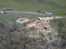
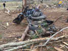
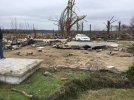
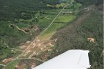
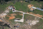
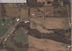
The tornado began by rapidly intensifying in uninhabited forest and flattened wide swaths of trees. It drug one 30 foot chunk leaving an etch in the ground over 100 yards long. Less than five minutes after formation it was extremely formidable. It annihilated a small brick house leaving barely a trace. The remnants were accelerated to such high speeds that it broke and shattered asphalt on a road 60 yards away.

1754853566509.png

Across the street it hit Camp ToKnowHim and two very large RVs, leaving virtually no identifiable traces. It also tossed a shipping container full of equipment. Violent impact marks were left across the area, along with debarking of trees and severe low-lying shrub damage. Acres of forest were demolished and ground scoured.

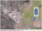
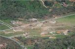
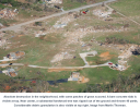
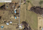
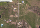
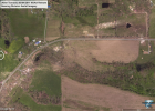
Further along the path an F350 truck was rolled 20 yards, and RV was thrown 90 yards, and a single wide trailer was thrown 50 yards before touching the ground. A frame house was also swept clean and a 45 foot tall hardwood tree was ripped out of the ground and dragged 30 yards. Here's the before and after of the property.
1754854310294.png1754854317332.png

A mile later the tornado was even stronger and it bounced a pickup truck 300 yards, and lofted two cars through the air for 100 yards, transported substantial trees significant distances, and obliterated every structure it touched.

1754854646906.png

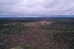
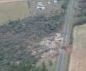
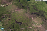
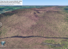
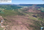
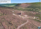
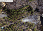
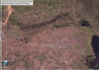
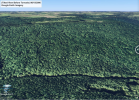
The tornado continued to strengthen in uninhabited land for 6 and a half miles, destroying a huge swath of forest and spraying dirt across rocky outcroppings and broken trunks. It hit a large downslope with an 800 foot elevation drop and became its most extreme. A vast chunk of old, thick forest was completely mulched. Despite having no structural debris loading there was extreme debarking, and all signs of greenery were almost entirely erased. Many felled trunks were split further into two or three chunks. Years later, aerial imagery revealed there wasn't a single tree that survived in the direct path.

1754855154436.png 1754855171642.png

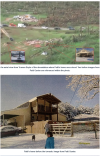
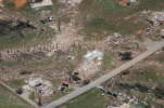
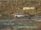
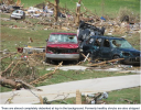
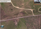
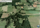
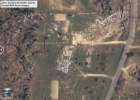
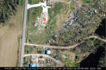
It finally hit a populated area again and two homes were smeared across the ground from their foundations. One of the NWS surveyors for this tornado, Chris Darden, said all day they had seen "nothing but carnage". He described the second home below as "pretty well built" that was swept away down to the flooring. nearby trees were denuded and debarked. Even most of the carpeting had been stripped. The washer, dryer, and fridge all had disappeared and still weren't located three days later when Chris revisited the site.

1754855905841.png1754856063019.png

Chris Darden, engineer Tim Marshall, and others reviewed the destruction to
the house and ultimately designated it as high-end EF4 damage. Per our
interview with Chris, "It was pretty well swept ... it didn't quite qualify for a 5.
There was some small debris that was still around. The home was built
pretty well, but there was some anchoring that was a little bit suspect with it.
There was a little bit of the cow fencing that was still there, that had not
been completely destroyed ... In my mind, to this day, that tornado probably
was a five. I kind of equate it to the Tuscaloosa tornado because I know how
Birmingham struggled with that one. I struggled the same way when I was in
Huntsville with this one. I think they were of similar magnitude."

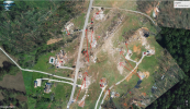
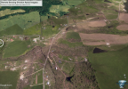
With a forward speed of 50 mph, the .85 mile wide tornado crossed from this region into a field where it continued to flatten and debark large swaths of forest. Unfortunately, on the other side of that field were dozens of residences. Many were obliterated along with everything else in the tornado's path.

1754856957427.png1754856980914.png

Some seriously incredible contextual damage occurred here with exclusive pictures that Tornado Talk explicitly forbids from being shared. This includes a concrete porch slab of a double wide that was knocked 10 yards from its original location, A huge hardwood ripped out of the ground (leaving a deep crater) and carried 50 yards, the foundation of a double wide that was ripped out of the ground concrete and all.

I've summarized barely over half the article, and posted maybe 5% of the pictures. It goes seriously in depth showing the nonstop carnage this tornado caused. I now agree with other user's claims that this was close to Smithville in strength. Highly recommend subscribing and checking it out.


New rating: (E)F5

Reasons: Dozens of instances of incredible phenomena, strong framed houses obliterated, unbelievable vegetation damage, and countless huge projectiles and vehicles carried over 100 yards.
 
Last edited:
You can link them or put them in a Google site via a screenshot or something

Flat Rock, Alabama - Trenton, Georgia EF4 04/27/2011
Path length: 45 miles
Fatalities: 17 (3 were indirect)
Injuries: 125

The tornado began by rapidly intensifying in uninhabited forest and flattened wide swaths of trees. It drug one 30 foot chunk leaving an etch in the ground over 100 yards long. Less than five minutes after formation it was extremely formidable. It annihilated a small brick house leaving barely a trace. The remnants were accelerated to such high speeds that it broke and shattered asphalt on a road 60 yards away.

View attachment 45855

Across the street it hit Camp ToKnowHim and two very large RVs, leaving virtually no identifiable traces. It also tossed a shipping container full of equipment. Violent impact marks were left across the area, along with debarking of trees and severe low-lying shrub damage. Acres of forest were demolished and ground scoured.

Further along the path an F350 truck was rolled 20 yards, and RV was thrown 90 yards, and a single wide trailer was thrown 50 yards before touching the ground. A frame house was also swept clean and a 45 foot tall hardwood tree was ripped out of the ground and dragged 30 yards. Here's the before and after of the property.
View attachment 45856View attachment 45857

A mile later the tornado was even stronger and it bounced a pickup truck 300 yards, and lofted two cars through the air for 100 yards, transported substantial trees significant distances, and obliterated every structure it touched.

View attachment 45858

The tornado continued to strengthen in uninhabited land for 6 and a half miles, destroying a huge swath of forest and spraying dirt across rocky outcroppings and broken trunks. It hit a large downslope with an 800 foot elevation drop and became its most extreme. A vast chunk of old, thick forest was completely mulched. Despite having no structural debris loading there was extreme debarking, and all signs of greenery were almost entirely erased. Many felled trunks were split further into two or three chunks. Years later, aerial imagery revealed there wasn't a single tree that survived in the direct path.

View attachment 45859 View attachment 45860

It finally hit a populated area again and two homes were smeared across the ground from their foundations. One of the NWS surveyors for this tornado, Chris Darden, said all day they had seen "nothing but carnage". He described the second home below as "pretty well built" that was swept away down to the flooring. nearby trees were denuded and debarked. Even most of the carpeting had been stripped. The washer, dryer, and fridge all had disappeared and still weren't located three days later when Chris revisited the site.

View attachment 45861View attachment 45862


With a forward speed of 50 mph, the .85 mile wide tornado crossed from this region into a field where it continued to flatten and debark large swaths of forest. Unfortunately, on the other side of that field were dozens of residences. Many were obliterated along with everything else in the tornado's path.

View attachment 45863View attachment 45864

Some seriously incredible contextual damage occurred here with exclusive pictures that Tornado Talk explicitly forbids from being shared. This includes a concrete porch slab of a double wide that was knocked 10 yards from its original location, A huge hardwood ripped out of the ground (leaving a deep crater) and carried 50 yards, the foundation of a double wide that was ripped out of the ground concrete and all.

I've summarized barely over half the article, and posted maybe 5% of the pictures. It goes seriously in depth showing the nonstop carnage this tornado caused. I now agree with other user's claims that this was close to Smithville in strength. Highly recommend subscribing and checking it out.


New rating: (E)F5

Reasons: Dozens of instances of incredible phenomena, strong framed houses obliterated, unbelievable vegetation damage, and countless huge projectiles and vehicles carried over 100 yards.
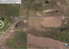
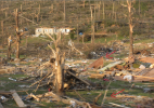
I wrote this tornado’s Wikipedia article a few days ago, and I can say that in my research I found some extremely impressive damage. A few points you may want to check out;
* Home at the end of County Road 652, visible in the response imagery
* County Road 369 scattered debris
* Damage at the intersection of Highway 115 and County Road 823 near the GA border (below)
IMG_8683.jpeg
 
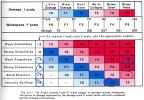
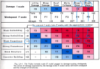
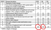
With the original F scale framed houses being blown over and/or blown off their foundation was an F4 rating no matter the quality of construction. This is a HUGE discrepancy with the EF scale, where it is now common to rate slabbed homes without anchoring EF3.

If all those EF3s were converted to F4s I think we'd be shocked to see the trends with violent tornadoes. My hypothesis is we'd see a sharp curve upward from around 2018 onward, and 2011 would have at least triple the amount of violent tornadoes of any other year since we started keeping records.
1754927480665.png

It's also interesting that brick structures being blown away was considered F5. I wonder if this includes CMU structures. Ultimately, it's possible the wind speeds with the F Scale were too high, but there was clearly an established precedent with damage classification with the F scale that the EF scale has completely failed to maintain.
 
This has been covered in here before, but In the recent Anthony Lyza interview that @ColdFront shared, he chalks the classification issue up to being a rounding error. Essentially, the EF scale only deals in 5 mph increments, but the threshold for ratings is specific to 1 mph.

The threshold for EF4 is 166 mph, but the nearest 5mph integer is 165 mph (EF3). The threshold for EF5 is 201 mph, but the closest integer is 200 mph (EF4). This rounding error leads to the classification of tornadoes usually being a rating too low.

1754928866644.png

The obvious fix would be raising the lower bound of a slabbed home to 170 mph, and the expected value to 205 mph. However, as laughably simplistic and obvious as this solution is, it wouldn't fix anything because surveyors regularly go far below the lower bound for slabbed homes, and the expected value hasn't been used once in 10 years (Rochelle-Fairdale was the last). The upper bound has been used less than 5 times in the EF scale era. In conclusion, Lyza's rounding error theory is pretty naive.

Ultimately the inconsistency is a conscious choice by the stewards of the EF scale who have been trusted for 20 years to know better. The only real mystery is the motive. Why would someone want to hide the fact thunderstorms are becoming increasingly violent and destructive, and instead, lead people to believe they're getting weaker?
 
Nope, photo #5 is for sure the house I described. Here's more pics.

View attachment 45815View attachment 45816

Also here's an especially intriguing photo from the home built to hurricane specs. Hurricane clips.

View attachment 45817

In regards to Pine Log, I'm using F scale criteria to redo the ratings to keep them consistent with the last 50 years, so in that context it was for sure an F5. The severe debarking and clean foundations place it firmly in that category. The F scale uses the words foundation, instead of slab, so there's less confusion about whether it has to be concrete or subfloor. Using the strict EF scale standards kind of defeats the purpose of what I'm doing, right? I'm basically trying to figure out how many violent tornadoes we've actually had if we stay true to the rating trends of the last 100 years, not the last 10 or 20.
Sorry, I think there’s a little confusion here. The photo I said was a garage was the one labeled “A swept away home in Izard County” from the VLT Arkansas EF4. The photos you posted are from Barnesville, which are correctly labeled as showing a house.

Sunny Side EF3: I admittedly can’t be 100% sure, but from the aerial it honestly looks like a poorly constructed home that just collapsed with debris sliding downhill. EF3 looks appropriate.

Flat Rock: posted above why I think EF4 is fine, but you’ve definitely made a case that it could be contextually considered an EF5.

Regarding Ringgold, thanks for digging up proof the concrete slab home was indeed anchored. My stance has changed from “Ringgold should have been rated EF5” to “Ringgold WAS an EF5”.

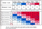
But regarding Pine Log, the F scale graphs you posted literally prove it would not be rated F5. Poorly anchored homes = weak framehouse = F4. Pretty straightforward. Though that does mean it probably would have been rated F4 back in the day. And a case for a low end EF4 can be made.
 
Back
Top