Kds86z
Member
lol no . Oh wellBetter now? I tried to fix it.
Follow along with the video below to see how to install our site as a web app on your home screen.
Note: This feature may not be available in some browsers.
lol no . Oh wellBetter now? I tried to fix it.
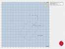
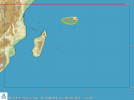
From Meteo-France on the areas of interest that the JTWC call 90S and 91S;And just like that we have what is most likely a junkie invest far off to the west of 90S. The new invest is Invest 91S. Most likely won’t form but it’s still there:
View attachment 45643
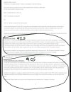
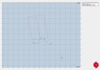
Well for once what seemed like a junkie actually might form after all.And just like that we have what is most likely a junkie invest far off to the west of 90S. The new invest is Invest 91S. Most likely won’t form but it’s still there:
View attachment 45643
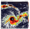
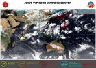
This became Tropical Depression 15W overnight, and it is not expected to intensify at all really, similarly to the former 14W that it absorbed while developing.Invest 97W has been upgraded to a High chance of formation by the JTWC and they have issued a TCFA on it.
View attachment 45673
WTPN21 PGTW 051500
MSGID/GENADMIN/JOINT TYPHOON WRNCEN PEARL HARBOR HI//
SUBJ/TROPICAL CYCLONE FORMATION ALERT (INVEST 97W)//
RMKS/
1. FORMATION OF A SIGNIFICANT TROPICAL CYCLONE IS POSSIBLE WITHIN
160 NM EITHER SIDE OF A LINE FROM 26.2N 158.4E TO 35.0N 156.6E
WITHIN THE NEXT 12 TO 24 HOURS. AVAILABLE DATA DOES NOT JUSTIFY
ISSUANCE OF NUMBERED TROPICAL CYCLONE WARNINGS AT THIS TIME.
WINDS IN THE AREA ARE ESTIMATED TO BE 18 TO 23 KNOTS. METSAT
IMAGERY AT 051200Z INDICATES THAT A CIRCULATION CENTER IS LOCATED
NEAR 26.7N 158.7E. THE SYSTEM IS MOVING WEST-NORTHWESTWARD AT 11
KNOTS.
2. REMARKS: THE AREA OF CONVECTION (INVEST 97W) PREVIOUSLY LOCATED
NEAR 26.2N 159.8E IS NOW LOCATED NEAR 26.7N 158.7E, APPROXIMATELY 625
NM NORTHWEST OF WAKE. ENHANCED INFRARED SATELLITE (EIR) IMAGERY
DEPICTS A DISORGANIZED LOW-LEVEL CIRCULATION CENTER BEING SHEERED
LIGHTLY FROM THE PRIMARY CONVECTION TO THE NORTHEAST. A 051051Z ASCAT-
C PASS INDICATES A SYMMETRIC, DEFINED CIRCULATION WITH 20-25 KNOT
WINDS ON THE SOUTHERN MOST PERIPHERY OF THE LOW-LEVEL CIRCULATION
CENTER (LLCC). ENVIRONMENTAL ANALYSIS REVEALS FAVORABLE CONDITIONS
THAT IS CHARACTERIZED BY MODERATE VERTICAL WIND SHEAR (15-20 KNOTS),
GOOD EQUATORWARD OUTFLOW ALOFT, AND WARM SEA SURFACE TEMPERATURE (28-
29C). GLOBAL MODELS ARE AGREEING THAT INVEST 97W WILL CONTINUE TO
DEVELOP OVER THE NEXT 24 HOURS, BUT ARE NOT IN AGREEMENT WITH THE
OVERALL TRACK, WITH THE GFS AND ECENS ENSEMBLE MODELS AGREEING WITH A
NORTHWESTWARD TRACK. MAXIMUM SUSTAINED SURFACE WINDS ARE ESTIMATED AT
18 TO 23 KNOTS. MINIMUM SEA LEVEL PRESSURE IS ESTIMATED TO BE NEAR
1005 MB. THE POTENTIAL FOR THE DEVELOPMENT OF A SIGNIFICANT TROPICAL
CYCLONE WITHIN THE NEXT 24 HOURS IS
HIGH
.
3. THIS ALERT WILL BE REISSUED, UPGRADED TO WARNING OR CANCELLED BY
061500Z.//
NNNN
