• Welcome to TalkWeather!
    We see you lurking around TalkWeather! Take the extra step and join us today to view attachments, see less ads and maybe even join the discussion.
    CLICK TO JOIN TALKWEATHER

2025 Global Tropical Cyclone Season Discussion

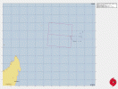
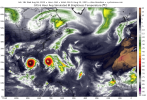
And 98W is now High chance according to the JTWC, so we all know what that means: a TCFA.
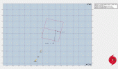
IMG_3424.gif

WTPN21 PGTW 062230
MSGID/GENADMIN/JOINT TYPHOON WRNCEN PEARL HARBOR HI//
SUBJ/TROPICAL CYCLONE FORMATION ALERT (INVEST 98W)//
RMKS/
1. FORMATION OF A SIGNIFICANT TROPICAL CYCLONE IS POSSIBLE WITHIN
100 NM EITHER SIDE OF A LINE FROM 18.2N 149.0E TO 18.9N 146.2E
WITHIN THE NEXT 12 TO 24 HOURS. AVAILABLE DATA DOES NOT JUSTIFY
ISSUANCE OF NUMBERED TROPICAL CYCLONE WARNINGS AT THIS TIME.
WINDS IN THE AREA ARE ESTIMATED TO BE 18 TO 23 KNOTS. METSAT
IMAGERY AT 061800Z INDICATES THAT A CIRCULATION CENTER IS LOCATED
NEAR 18.4N 148.1E. THE SYSTEM IS MOVING WEST-NORTHWESTWARD AT 03
KNOTS.
2. REMARKS: THE AREA OF CONVECTION (INVEST 98W) PREVIOUSLY LOCATED NEAR
18.3N 148.4E, IS NOW LOCATED NEAR 18.4N 148.1E, APPROXIMATELY 236 NM
NORTHEAST OF SAIPAN. ANIMATED MULTISPECTRAL SATELLITE IMAGERY (MSI)
DEPICTS PERSISTENT CENTRALIZED CONVECTION OVER A COMPACT LOW-LEVEL
CIRCULATION CENTER (LLCC). ENVIRONMENTAL ANALYSIS REVEALS FAVORABLE
CONDITIONS WITH LOW VERTICAL WIND SHEAR (5-10 KNOTS), GOOD OUTFLOW
ALOFT, AND WARM SEA SURFACE TEMPERATURES (29-30 C). DETERMINISTIC AND
ENSEMBLE MODELS SHOW 98W CONTINUING TO TRACK GENERALLY WESTWARD AND
DEVELOPING OVER THE NEXT 24 HOURS. MAXIMUM SUSTAINED SURFACE WINDS ARE
ESTIMATED AT 18 TO 23 KNOTS. MINIMUM SEA LEVEL PRESSURE IS ESTIMATED TO
BE NEAR 1006 MB. THE POTENTIAL FOR THE DEVELOPMENT OF A SIGNIFICANT
TROPICAL CYCLONE WITHIN THE NEXT 24 HOURS IS HIGH.
3. THIS ALERT WILL BE REISSUED, UPGRADED TO WARNING OR CANCELLED BY
072230Z.
//
NNNN
 
“Another One”

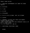
JTWC has upgraded 91S to a High chance Invest.

IMG_3436.gif


WTXS21 PGTW 062200
MSGID/GENADMIN/JOINT TYPHOON WRNCEN PEARL HARBOR HI//
SUBJ/TROPICAL CYCLONE FORMATION ALERT (INVEST 91S)//
RMKS/
1. FORMATION OF A SIGNIFICANT TROPICAL CYCLONE IS POSSIBLE WITHIN
170 NM EITHER SIDE OF A LINE FROM 7.3S 62.9E TO 6.8S 57.2E WITHIN
THE NEXT 12 TO 24 HOURS. AVAILABLE DATA DOES NOT JUSTIFY ISSUANCE
OF NUMBERED TROPICAL CYCLONE WARNINGS AT THIS TIME. WINDS IN THE
AREA ARE ESTIMATED TO BE 28 TO 33 KNOTS. METSAT IMAGERY AT
062200Z INDICATES THAT A CIRCULATION CENTER IS LOCATED NEAR 7.3S
62.5E. THE SYSTEM IS MOVING WESTWARD AT 05 KNOTS.
2. REMARKS: THE AREA OF CONVECTION (INVEST 91S) PREVIOUSLY LOCATED NEAR
6.2S 62.1E IS NOW LOCATED NEAR 7.3S 62.5E, APPROXIMATELY 595 NM WEST OF
DIEGO GARCIA. ANIMATED MULTISPECTRAL SATELLITE IMAGERY (MSI) DEPICTS
PERSISTENT DEEP CONVECTION OVER AN OBSCURED LOW-LEVEL CIRCULATION
CENTER (LLCC). A 061709Z METOP-C ASCAT IMAGE SHOWS AN ASYMMETRIC WIND
FIELD WITH STRONGER (30-35 KTS) WINDS WITHIN THE SOUTHERN SEMICIRCLE.
ENVIRONMENTAL ANALYSIS REVEALS FAVORABLE CONDITIONS WITH LOW TO
MODERATE EASTERLY VERTICAL WIND SHEAR (15-20 KNOTS), STRONG POLEWARD
OUTFLOW ALOFT, AND WARM SEA SURFACE TEMPERATURES (28-29 C). GLOBAL
MODELS ARE IN GOOD AGREEMENT THAT INVEST 91S WILL CONTINUE TO TRACK
GENERALLY WESTWARD OVER THE NEXT 24 HOURS AND CONTINUE TO DEVELOP.
MAXIMUM SUSTAINED SURFACE WINDS ARE ESTIMATED AT 28 TO 33 KNOTS.
MINIMUM SEA LEVEL PRESSURE IS ESTIMATED TO BE NEAR 1004 MB. THE
POTENTIAL FOR THE DEVELOPMENT OF A SIGNIFICANT TROPICAL CYCLONE
WITHIN THE NEXT 24 HOURS IS HIGH.
3. THIS ALERT WILL BE REISSUED, UPGRADED TO WARNING OR CANCELLED BY
072200Z.
//
NNNN
Dvorak is already T#2.5 so this is likely already a TC.
IMG_3437.jpeg
 
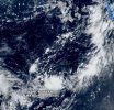
Zoom Earth must be having some sort of problem with 98W because it doesn’t seem to show the Invest and its track right now:
IMG_3439.jpeg
98W is bottom center
 
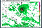
This is a legendary run of the GFS (poster’s note: likely won’t happen this exact way if it happens at all)
IMG_3443.png
 
And here is the simulation of the appearance of these hypothetical systems:
View attachment 45719
While it definitely isn’t going to pan out this way (knock on wood), the fact that the GFS is doing this at all is a little worrying to me. However, it is just the operational run - let’s see how long this will stick around for. It may end up not even being there by the next run.
 
“Another One”

JTWC has upgraded 91S to a High chance Invest.

View attachment 45716


WTXS21 PGTW 062200
MSGID/GENADMIN/JOINT TYPHOON WRNCEN PEARL HARBOR HI//
SUBJ/TROPICAL CYCLONE FORMATION ALERT (INVEST 91S)//
RMKS/
1. FORMATION OF A SIGNIFICANT TROPICAL CYCLONE IS POSSIBLE WITHIN
170 NM EITHER SIDE OF A LINE FROM 7.3S 62.9E TO 6.8S 57.2E WITHIN
THE NEXT 12 TO 24 HOURS. AVAILABLE DATA DOES NOT JUSTIFY ISSUANCE
OF NUMBERED TROPICAL CYCLONE WARNINGS AT THIS TIME. WINDS IN THE
AREA ARE ESTIMATED TO BE 28 TO 33 KNOTS. METSAT IMAGERY AT
062200Z INDICATES THAT A CIRCULATION CENTER IS LOCATED NEAR 7.3S
62.5E. THE SYSTEM IS MOVING WESTWARD AT 05 KNOTS.
2. REMARKS: THE AREA OF CONVECTION (INVEST 91S) PREVIOUSLY LOCATED NEAR
6.2S 62.1E IS NOW LOCATED NEAR 7.3S 62.5E, APPROXIMATELY 595 NM WEST OF
DIEGO GARCIA. ANIMATED MULTISPECTRAL SATELLITE IMAGERY (MSI) DEPICTS
PERSISTENT DEEP CONVECTION OVER AN OBSCURED LOW-LEVEL CIRCULATION
CENTER (LLCC). A 061709Z METOP-C ASCAT IMAGE SHOWS AN ASYMMETRIC WIND
FIELD WITH STRONGER (30-35 KTS) WINDS WITHIN THE SOUTHERN SEMICIRCLE.
ENVIRONMENTAL ANALYSIS REVEALS FAVORABLE CONDITIONS WITH LOW TO
MODERATE EASTERLY VERTICAL WIND SHEAR (15-20 KNOTS), STRONG POLEWARD
OUTFLOW ALOFT, AND WARM SEA SURFACE TEMPERATURES (28-29 C). GLOBAL
MODELS ARE IN GOOD AGREEMENT THAT INVEST 91S WILL CONTINUE TO TRACK
GENERALLY WESTWARD OVER THE NEXT 24 HOURS AND CONTINUE TO DEVELOP.
MAXIMUM SUSTAINED SURFACE WINDS ARE ESTIMATED AT 28 TO 33 KNOTS.
MINIMUM SEA LEVEL PRESSURE IS ESTIMATED TO BE NEAR 1004 MB. THE
POTENTIAL FOR THE DEVELOPMENT OF A SIGNIFICANT TROPICAL CYCLONE
WITHIN THE NEXT 24 HOURS IS HIGH.
3. THIS ALERT WILL BE REISSUED, UPGRADED TO WARNING OR CANCELLED BY
072200Z.
//
NNNN
Dvorak is already T#2.5 so this is likely already a TC.
View attachment 45715
Zoom Earth has updated the track and intensity of 91S and it is now 35 kts (40 mph), so expect 02S here soon.
 
To be honest, I would somewhat trust the GFS than the AI ensemble models. The AI Ensembles wants everything to be a storm. The AI operational isn't that bad though, but, like every model, it has it's faults. For me, I look at everything and figure out, okay which solution/output makes the most sense given the pattern.
 
Zoom Earth has updated the track and intensity of 91S and it is now 35 kts (40 mph), so expect 02S here soon.
The last time the SHEM produced a storm in July (equivalent to January down there) and in August (equivalent to February down there) of the same season was the infamous 1996-97 season (which went on to be the most active SHEM season on record)

The last July Storm in the SHEM before the recent 01S 2025-26 (which formed in the AR and crossed 90E and moved into the SWIO) was another 01S (formed and dissipated in the AR) in July 2022.

The last August Storm in the SHEM was an 01S in the 2000-01 season that formed in the SWIO (Phoebe 2003-04 could count too as the most recent one as it was a tropical low on August 31st)
 
To be honest, I would somewhat trust the GFS than the AI ensemble models. The AI Ensembles wants everything to be a storm. The AI operational isn't that bad though, but, like every model, it has it's faults. For me, I look at everything and figure out, okay which solution/output makes the most sense given the pattern.
Another fellow person who doesn’t trust the AI stuff. I feel you.
 
And 98W is now High chance according to the JTWC, so we all know what that means: a TCFA.
View attachment 45709

WTPN21 PGTW 062230
MSGID/GENADMIN/JOINT TYPHOON WRNCEN PEARL HARBOR HI//
SUBJ/TROPICAL CYCLONE FORMATION ALERT (INVEST 98W)//
RMKS/
1. FORMATION OF A SIGNIFICANT TROPICAL CYCLONE IS POSSIBLE WITHIN
100 NM EITHER SIDE OF A LINE FROM 18.2N 149.0E TO 18.9N 146.2E
WITHIN THE NEXT 12 TO 24 HOURS. AVAILABLE DATA DOES NOT JUSTIFY
ISSUANCE OF NUMBERED TROPICAL CYCLONE WARNINGS AT THIS TIME.
WINDS IN THE AREA ARE ESTIMATED TO BE 18 TO 23 KNOTS. METSAT
IMAGERY AT 061800Z INDICATES THAT A CIRCULATION CENTER IS LOCATED
NEAR 18.4N 148.1E. THE SYSTEM IS MOVING WEST-NORTHWESTWARD AT 03
KNOTS.
2. REMARKS: THE AREA OF CONVECTION (INVEST 98W) PREVIOUSLY LOCATED NEAR
18.3N 148.4E, IS NOW LOCATED NEAR 18.4N 148.1E, APPROXIMATELY 236 NM
NORTHEAST OF SAIPAN. ANIMATED MULTISPECTRAL SATELLITE IMAGERY (MSI)
DEPICTS PERSISTENT CENTRALIZED CONVECTION OVER A COMPACT LOW-LEVEL
CIRCULATION CENTER (LLCC). ENVIRONMENTAL ANALYSIS REVEALS FAVORABLE
CONDITIONS WITH LOW VERTICAL WIND SHEAR (5-10 KNOTS), GOOD OUTFLOW
ALOFT, AND WARM SEA SURFACE TEMPERATURES (29-30 C). DETERMINISTIC AND
ENSEMBLE MODELS SHOW 98W CONTINUING TO TRACK GENERALLY WESTWARD AND
DEVELOPING OVER THE NEXT 24 HOURS. MAXIMUM SUSTAINED SURFACE WINDS ARE
ESTIMATED AT 18 TO 23 KNOTS. MINIMUM SEA LEVEL PRESSURE IS ESTIMATED TO
BE NEAR 1006 MB. THE POTENTIAL FOR THE DEVELOPMENT OF A SIGNIFICANT
TROPICAL CYCLONE WITHIN THE NEXT 24 HOURS IS HIGH.
3. THIS ALERT WILL BE REISSUED, UPGRADED TO WARNING OR CANCELLED BY
072230Z.
//
NNNN
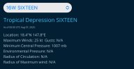
Well this has escalated super quickly!

This has become Tropical Depression 16W now;
IMG_3492.jpeg
The JTWC site hasn’t updated yet for the warning and forecast.
 
On the Atlantic’s storm mode right now:

 
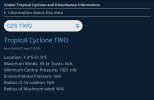
It’s official! We now have Tropical Cyclone 02S in the SHEM in the SWIO;
IMG_3497.jpeg
 
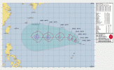
16W’s first warning cone calling for a 90 kt (105 mph) peak

IMG_3518.gif
 
This one model wants 16W to become a Super Typhoon


EXCEPT FOR THE COAMPS-TC (GFS) WHICH INSISTS THIS IS GOING TO BE A SUPER-TYPHOON ONE DAY
 
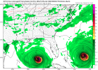
18Z GFS hates me apparently. It sends a strong hurricane across the Atlantic, and it makes landfall with a pressure of 958 mb after a 930 something peak near the Bahamas. It moves in the county I live in and just west of me with a pressure of 990 mbs. Mind you I live in Central Virginia and we don’t have storms moving overhead of us due to the mountains the west.

IMG_3698.jpeg
 
18Z GFS hates me apparently. It sends a strong hurricane across the Atlantic, and it makes landfall with a pressure of 958 mb after a 930 something peak near the Bahamas. It moves in the county I live in and just west of me with a pressure of 990 mbs. Mind you I live in Central Virginia and we don’t have storms moving overhead of us due to the mountains the west.

View attachment 45746
Here is that same hypothetical system near its peak intensity:
IMG_3699.jpeg
 
I sent this to a well known Meteorologist and friend of mine a few days ago.

I chose 2018 because it seems to be popping up a lot as far as analog goes particularly with the ENSO Neutral. The East and West PAC differences are astonishing.

I had this thought last night about comparing the total ACE and number of systems before August 15th to this year vs. 2018.

Note: TS Ivo formed the day I was putting it together so it's not included in the East Pacific total

Atlantic: (Prior to August 15th)
2018: (4 total systems)
TS Alberto thru TS Debby (Total ACE: 15.5)
2025: (4 total systems)
TS Andrea thru TS Dexter (Total ACE: 3.2)

East PAC: (Prior to August 15th)
2018: (13 total systems)
Hurricane Aletta thru TS Kristy: ACE Total: 102.1
2025: (11 total systems)
TS Alvin thru TS Henriette: ACE Total: 40

West PAC: (Prior to August 15th)
2018: (25 total systems)
TS Bolaven thru TS Rumbia: ACE Total: 107.3
2025: (20 total systems)
Typhoon Wutip thru TS Bailu: ACE Total: 38
 
Back
Top