To clear up some of this whole "theoretical scale" hogwash; let me post some of my discoveries surrounding the Somerset-London KY EF4 from 5/16/25.
(Which just from me, lets actually be scientific)
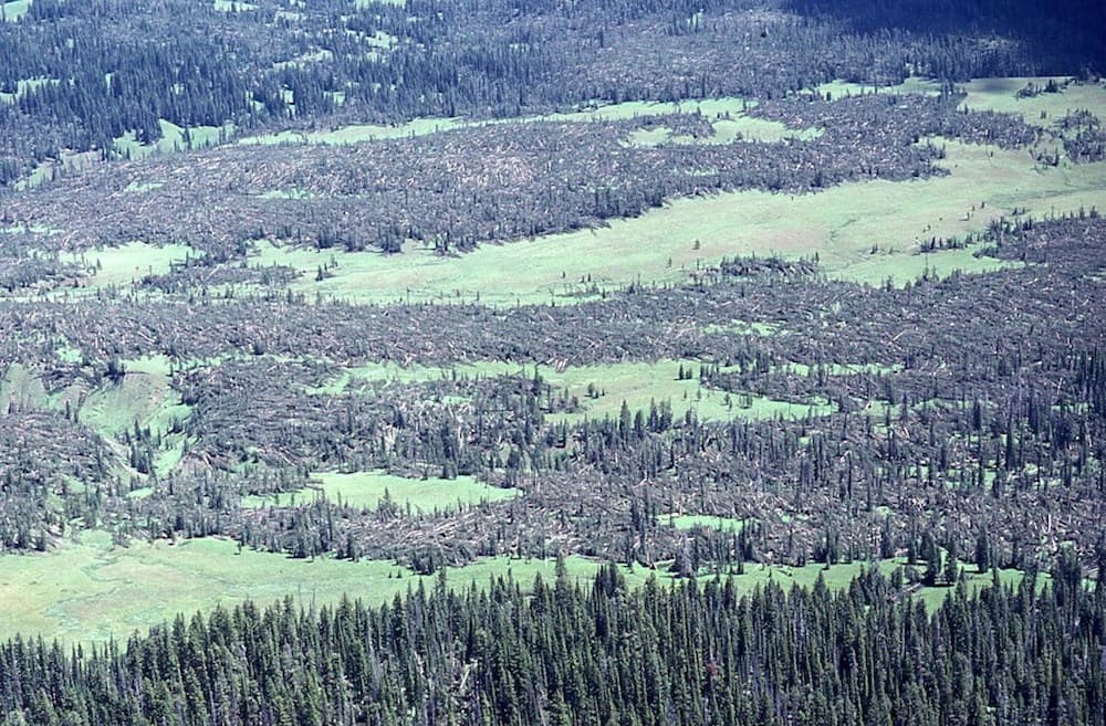
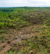
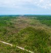
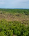
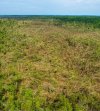
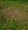
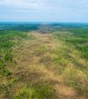
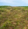
I was doing a little sleuthing for clear imagery from the Daniel Boone national forest, sat between Somerset and London; and boy was I delighted. In a series of photographs by Ben Childers; you can visibly see the incredible damage the forest took, with the tornado actually unveiling caves, grottoes, even cliffs, down to tree species affected. Trees, particularly the healthy population seen in the National Forest, act as a erosion preventer; even with this, you can still see scouring among the fallen, and cyclically rotated vegetation. Note the valleys within the natural terrain; you can see how debris were pulled and shoved into these low points.
I cannot get over the extent of the damage here; I (if I get the motive and the TIME particularly!) might try to ID a few of the trees seen here, but shortleaf pines are absolutely present.
Another interesting thing is the destruction of low lying plants, such as bushes (probably Carolina Buckthorn, mountain laurel, etc); trees can often shelter these bushes/shrubs with tornadoes (again trees evolved to not fall in wind); but with London, they're simply completely gone in a few locations. It's not like this was an unhealthy forest, rather the opposite; this was a well managed, diverse, and old forest with active work on ensuring that. Pines are very flexible, yet this still wasnt adequate to "protect" these low lying plants. I personally feel this is a hallmark of a very intense tornado.
This tornado is one that I plan to study extensively in the future.