Navigation
Install the app
How to install the app on iOS
Follow along with the video below to see how to install our site as a web app on your home screen.
Note: This feature may not be available in some browsers.
More options
-
Welcome to TalkWeather! We see you lurking around TalkWeather! Take the extra step and join us today to view attachments, see less ads and maybe even join the discussion. CLICK TO JOIN TALKWEATHER
You are using an out of date browser. It may not display this or other websites correctly.
You should upgrade or use an alternative browser.
You should upgrade or use an alternative browser.
Significant Tornado Events
- Thread starter locomusic01
- Start date
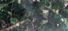
Looks to me like two tornadoes. The end of the top path looks to be displaced from the beginning of the bottom path to me. Also, the path widths are very different. By itself that isn’t really a good indicator of whether it was actually one path or not, but combined with the former interpretation I think it’s reasonable.After reading a couple of posts on the least successfully re-branded popular social media site, I'd like an opinion: is this a continuous track, or two tornadoes?
View attachment 45410
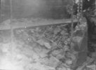
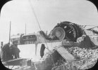
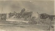
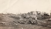
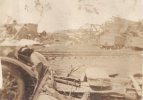
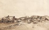
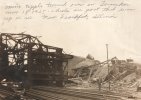
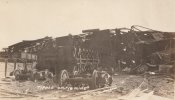
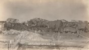
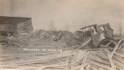
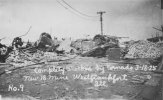
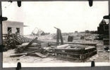
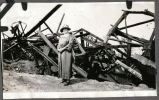
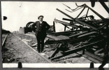
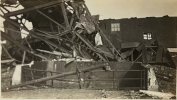
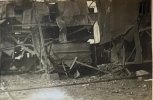
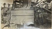
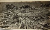
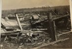
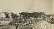
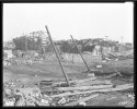
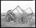
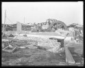
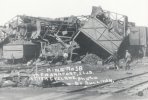
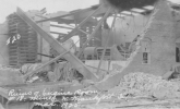
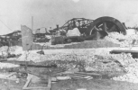
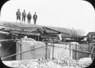
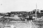
Oh thought I might share some of the ones I collected of Peabody Mine 18 and put in the article along with about 1,500 other photos haha. These come from JCHS and Frankfort Area Genealogical Soceity + Silkwood Inn Museum and Illinois State Archives. Part 1. I will say the damage to this mine is nothing short of extreme, steel reinforced fireproof brick and concrete buildings razed, the multi-hundred ton tipple tower torn down and pulled from the ground by its concrete anchoring piers, and general carnage. Five at the mine site were killed and even the air currents in the mine shaft were reversed by the suction and blew off the reinforced steel door to the office at the bottom of the 518 foot deep mine. ( had to downscale these, full size ones are on the article).I think there might be one or two in my unsorted photos I need to go through eventually, but here's what I've got of Peabody #18:


This obviously isn't the mine itself, but it's a home that was demolished just to the northeast:

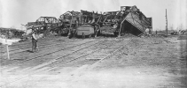
This photo has a lot of cleanup.
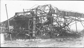
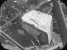
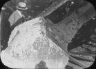
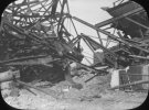
Aaron Rider
Member
Notable how many Tri State photos included people posing. They were very aware of the incredible display of natureOh thought I might share some of the ones I collected of Peabody Mine 18 and put in the article along with about 1,500 other photos haha. These come from JCHS and Frankfort Area Genealogical Soceity + Silkwood Inn Museum and Illinois State Archives. Part 1. I will say the damage to this mine is nothing short of extreme, steel reinforced fireproof brick and concrete buildings razed, the multi-hundred ton tipple tower torn down and pulled from the ground by its concrete anchoring piers, and general carnage. Five at the mine site were killed and even the air currents in the mine shaft were reversed by the suction and blew off the reinforced steel door to the office at the bottom of the 518 foot deep mine. ( had to downscale these, full size ones are on the article).
View attachment 45411
This photo has a lot of cleanup.
View attachment 45412
View attachment 45413
View attachment 45414
View attachment 45415
View attachment 45416
View attachment 45417
View attachment 45418
View attachment 45419
View attachment 45420
Lake Martin EF4
Member
Which tornado is this?After reading a couple of posts on the least successfully re-branded popular social media site, I'd like an opinion: is this a continuous track, or two tornadoes?
View attachment 45410
To me it certainly LOOKS like 2 separate tracks, though.
Smithville, at about 17 miles by Tornado Talk's path, the grey line on the right is the Mississippi state boundary.Which tornado is this?
Last edited:
Western_KS_Wx
Member
TornadoTalk has Smithville as a continuous track, so I’m assuming there was enough evidence to come to that conclusion. I agree with it being continuous, looks like a very rapid and potent failed occlusion resulting in a much narrower and weaker vortex being what happened here. That’s fascinating how fast the vortex broke-down though, pretty much like the failed occlusion Moore ‘13 underwent just a more dramatic example.Which tornado is this?
To me it certainly LOOKS like 2 separate tracks, though.
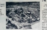
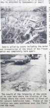
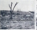
Was doing some reading on 4/3/74 and came across some damage photos from a newspaper on the Pickett TN/Wayne KY F4 that I had not seen. This thing looks to have been a monster. Some pretty violent contextual damage it seems. On any other day, a tornado like this would have been the storm of the day.


N0mz
Member
I don’t think Grinnell was even close to an EF5 candidate, but I think it probably should have been looked at closer for EF4. Marion was a slam dunk viotor, but maybe the wind estimate should have been 180 or so. Agree on the other three. I’d like to raise Morganfield, Lake City and Selmer as other potential viotors.Regarding the other 2025 EF5 candidates:
EDIT: I rechecked Grinnell. Still an EF5 candidate, but no longer a definitive EF5. In fact, none of the tornadoes this year so far have gotten my definitive EF5 rating. If the second season doesn't send out a monster, 2025 may go down as the first year since 2022 with no definitive EF5s IMO.
- Diaz: rated appropriately. This is my poster child for top end EF4.
- Marion: at minimum, the official wind estimate is too high. I'd honestly argue that an EF3 rating would've also been appropriate. The most contentious violent rating since Newnan, IMO.
- Grinnell:
strongest EF5 candidate of the year, mostly for the contextual damage.I take this back, still a decent candidate but I'm moving it into the EF4-EF5 range.- Plevna: haven't seen any damage pointing to an intensity above EF4
- Jamestown: nasty looking vehicle damage but the field was already plowed. Very big question mark.
- Enderlin:
secondstrongest EF5 candidate of the year, mainly for the train car.
I was actually hoping Tornado Talk would do some studies on the “lesser known” violent tornados of the 1974 super outbreak. Similar to what they did with the Frankfort F4. Considering it would be a mammoth undertaking, I can see why they limited their scope some to just Xenia, Guin, and Frankfort.
Just seeing those pictures above from the Pickett/Wayne tornado really makes me wonder how many very violent tornados that day were just reduced to footnotes in history because of the bigger names like Guin, Xenia, Brandenburg etc that occurred the same day.
Just seeing those pictures above from the Pickett/Wayne tornado really makes me wonder how many very violent tornados that day were just reduced to footnotes in history because of the bigger names like Guin, Xenia, Brandenburg etc that occurred the same day.
Juliett Bravo Kilo
Member
I was actually hoping Tornado Talk would do some studies on the “lesser known” violent tornados of the 1974 super outbreak. Similar to what they did with the Frankfort F4. Considering it would be a mammoth undertaking, I can see why they limited their scope some to just Xenia, Guin, and Frankfort.
Just seeing those pictures above from the Pickett/Wayne tornado really makes me wonder how many very violent tornados that day were just reduced to footnotes in history because of the bigger names like Guin, Xenia, Brandenburg etc that occurred the same day.
Truth be told, Guin was a mystery for a long time due to how difficult photographs were to come by from it until recently. Guin would likely be more famous if not part of a large outbreak.
I think TornadoTalk has said that they're not gonna write as many in depth premium articles anymore as they simply don't have the manpower for it. Maybe they'll take the paywall down then. Well, I can hope.
Juliett Bravo Kilo
Member
TornadoTalk has Smithville as a continuous track, so I’m assuming there was enough evidence to come to that conclusion. I agree with it being continuous, looks like a very rapid and potent failed occlusion resulting in a much narrower and weaker vortex being what happened here. That’s fascinating how fast the vortex broke-down though, pretty much like the failed occlusion Moore ‘13 underwent just a more dramatic example.
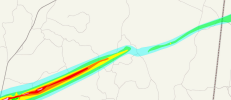
The area in blue is where I wonder if a hand off occurred; yeah it could've been a failed occlusion but the sharp change in direction makes me wonder. I remember a poster in this thread a couple hundred or so pages back suggested that a cycling occurred here and was quickly shot down but now I have to wonder....
joshoctober16
Member
The area in blue is where I wonder if a hand off occurred; yeah it could've been a failed occlusion but the sharp change in direction makes me wonder. I remember a poster in this thread a couple hundred or so pages back suggested that a cycling occurred here and was quickly shot down but now I have to wonder....View attachment 45544
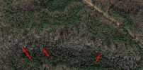
in this spot there is some trees down.
interesting to note this seems to have been a fast moving loop , you can try it out with blender by making 2 spheres attach together and make one move foward while spining , making the other one seem to orbit the other one.
then just make this pair move forward and you get this.

2 examples shown here , top one is a fast moving example (smithville)
and bottom one is a slow moving example (moore) , they are both (blue sphere) spinning the same speed around the white sphere (that is moving forward)
Union
Member
A bit off topic from the stuff being talked about before this post lol but:
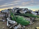
Does anyone here have any more imagery of this white SUV fused/rammed into this farming equipment from Mayfield? There is a collection of 4 photos (2 attached) that were uploaded on Twitter shortly after the tornado, and I can't seem to find any more media at all, maybe it's in some drone videos but it's very far away, the 4 photos do supply good enough angles I was just hoping maybe there was some video or just more photos as the damage itself is pretty incredible.
From my knowledge this didn't happen on the Candle Factory property but another property in SW Mayfield as it was tearing through that industrial park area, there's also considerably more images and videos from the factory and the parking lot and none I have seen show this.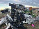


Juliett Bravo Kilo
Member
A bit off topic from the stuff being talked about before this post lol but:
Does anyone here have any more imagery of this white SUV fused/rammed into this farming equipment from Mayfield? There is a collection of 4 photos (2 attached) that were uploaded on Twitter shortly after the tornado, and I can't seem to find any more media at all, maybe it's in some drone videos but it's very far away, the 4 photos do supply good enough angles I was just hoping maybe there was some video or just more photos as the damage itself is pretty incredible.
From my knowledge this didn't happen on the Candle Factory property but another property in SW Mayfield as it was tearing through that industrial park area, there's also considerably more images and videos from the factory and the parking lot and none I have seen show this.View attachment 45579View attachment 45578
Holy crap, this also happened with Chapman 2016!
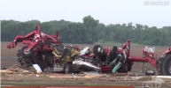
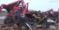
I'm fully convinced Mayfield should've been rated EF5 based off this and the Bremen damage.
AJS
Member
100% agreed. Based on the damage seen in Bremen, Mayfield was a classic example of what true EF5 contextual damage looks like, but not being rated such due to the construction present in the area.Holy crap, this also happened with Chapman 2016!
View attachment 45593
View attachment 45594
I'm fully convinced Mayfield should've been rated EF5 based off this and the Bremen damage.

