• Welcome to TalkWeather!
    We see you lurking around TalkWeather! Take the extra step and join us today to view attachments, see less ads and maybe even join the discussion.
    CLICK TO JOIN TALKWEATHER

Severe WX April 1-2 (overnight) Severe Weather Event

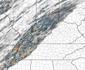
Scratching my head as is everyone else. the CAMs certainly don't support a HIGH at this time.

but the confidence and alignment at both the SPC and local offices is quite concerning. the pros seem to be seeing something we're not.
 
Contrary to what most others here are saying, I think a HIGH risk today is absolutely warranted. If my model and some of the other guidance is correct, a significant and life-threatening event will unfold today. I'm currently running a 1 km ultra high res model centered on Memphis that started last night before I went to bed, so I think that was a great call. It should be able to resolve some very fine details about the event. Hopefully I'll be able to post some details on that in the next few hours.


But yeah, I absolutely believe in this HIGH. It's going to over perform as a HIGH as well, I believe. I would not be surprised at all today to see multiple EF4's.
Thanks @wx_guy
 
Contrary to what most others here are saying, I think a HIGH risk today is absolutely warranted. If my model and some of the other guidance is correct, a significant and life-threatening event will unfold today. I'm currently running a 1 km ultra high res model centered on Memphis that started last night before I went to bed, so I think that was a great call. It should be able to resolve some very fine details about the event. Hopefully I'll be able to post some details on that in the next few hours.


But yeah, I absolutely believe in this HIGH. It's going to over perform as a HIGH as well, I believe. I would not be surprised at all today to see multiple EF4's.
Yeah hrrr runs been sick … doubt SPC will. But would not shock me see them add a 45 percent t area along Ms river into Paducah region
 
parameter space at the sfc will be more than supportive of all
modes of severe weather. Latest short-term high resolution guidance
soundings forecast an environment by early Wednesday afternoon that
is progged to be in place with model agreement of SBCAPE between
1,800 J/kg and 3,000+ J/kg (in various locations statewide) and ESRH
(Effective Storm Relative Helicity) between the values of 200
m^2/s^2 and 400+ m^2/s^2 (in various locations statewide). In
addition, hodographs show large sickle-shaped between 0 and 3km
which is evident of super-cellular storm mode which is associated
with all hazards from large hail, damaging wind gusts, and
tornadoes.

3000+?! . Yeah…..
 
Updraft helicity tracks through about 9pm tonight from latest HRRR...

Even if the tracks aren't particularly robust, they are incredibly dense in the risk in the risk area. Just look at that coverage in East TN!

I'm not a met or expert at analyzing model output at this level, but could this be due to some kind of refinement issue in HRRR where the intensity tracks or supercells are so intense they're being split into smaller discrete storms by the model?
 

Attachments

  • Image 4-2-25 at 6.29 AM.jpeg
    Image 4-2-25 at 6.29 AM.jpeg
    365.8 KB · Views: 0
parameter space at the sfc will be more than supportive of all
modes of severe weather. Latest short-term high resolution guidance
soundings forecast an environment by early Wednesday afternoon that
is progged to be in place with model agreement of SBCAPE between
1,800 J/kg and 3,000+ J/kg (in various locations statewide) and ESRH
(Effective Storm Relative Helicity) between the values of 200
m^2/s^2 and 400+ m^2/s^2 (in various locations statewide). In
addition, hodographs show large sickle-shaped between 0 and 3km
which is evident of super-cellular storm mode which is associated
with all hazards from large hail, damaging wind gusts, and
tornadoes.

3000+?! . Yeah…..
Think Nws Memphis would launch a weather balloon. Lunch time or after .i bet find some pockets of cape pushing 4000j/kg
 
Yeah hrrr runs been sick … doubt SPC will. But would not shock me see them add a 45 percent t area along Ms river into Paducah region
Yes, some evidence to back up your point.

This is a random (not cherry-picked) sounding at 20z, near the start of the event, ahead of the very first discrete cell of the day it shows. This is a VTP of 12.9, well in the range for EF3+.

1743593563077.png
 
I hope this stays away from AL! I love hot & humid weather! EDIT: What I do find confusing is how the SPC issues 45-59% Winds on MOD Risk, or even Enhanced days but only 30-44 on High Risk. This confuses me. Especially since the SPC expects this later today.
 
Back
Top