Navigation
Install the app
How to install the app on iOS
Follow along with the video below to see how to install our site as a web app on your home screen.
Note: This feature may not be available in some browsers.
More options
-
Welcome to TalkWeather! We see you lurking around TalkWeather! Take the extra step and join us today to view attachments, see less ads and maybe even join the discussion. CLICK TO JOIN TALKWEATHER
You are using an out of date browser. It may not display this or other websites correctly.
You should upgrade or use an alternative browser.
You should upgrade or use an alternative browser.
Parker Copeland
Member
the shear with this event is wild, like qlcs stuff overnight will be wild
Ledian
Member
*sigh* Typical...
I'll be interested to see what the close-range models say once we get in-range, aside from the NAM forgetting what instability is.
Scott81
Member
I would expect a lot of power outages!
Don't be so harsh on the NAM, atleast it's trying hahaI'll be interested to see what the close-range models say once we get in-range, aside from the NAM forgetting what instability is.
ashtonlemleywx
Member
So is the current thinking that the GFS, Euro, and NAM are having early season moisture bias? The big debate in my storm chasing circles at the moment is the Northern extent of the instability and warm sector.
I'm not confident that instability doesn't struggle, but with strong wind fields, I don't think AL gets through this without a number of QLCS tornadoes.So is the current thinking that the GFS, Euro, and NAM are having early season moisture bias? The big debate in my storm chasing circles at the moment is the Northern extent of the instability and warm sector.
tennessee storm chaser
Member
- Messages
- 1,623
- Reaction score
- 3,058
- Location
- jackson tennessee
- Special Affiliations
- SKYWARN® Volunteer
Instability always this range seems underdone … that will become more certain closer we get .I'm not confident that instability doesn't struggle, but with strong wind fields, I don't think AL gets through this without a number of QLCS tornadoes.
ashtonlemleywx
Member
This is what I've been telling everyone. We've just seen this happen so many times in the past. They underestimate moisture return/daytime heating and then BAM cape values explode once in cam range.Instability always this range seems underdone … that will become more certain closer we get .
The trend I've seen several times is:This is what I've been telling everyone. We've just seen this happen so many times in the past. They underestimate moisture return/daytime heating and then BAM cape values explode once in cam range.
1) Instability goes up, especially for the daytime areas, as we approach close-range
2) By the morning of, realized instability is higher than modelled
3) As the afternoon comes, SBCAPE values are progged to decrease in the evening on modelling
4) We get a brief decrease in diurnal heating after dark
5) Strengthening LLJ bolsters moisture return as storms get into AL
ashtonlemleywx
Member
Plus that shorter distance to the Gulf coastline in Eastern MS going into Alabama helps moisture and usually isn't factored into the modeling.The trend I've seen several times is:
1) Instability goes up, especially for the daytime areas, as we approach close-range
2) By the morning of, realized instability is higher than modelled
3) As the afternoon comes, SBCAPE values are progged to decrease in the evening on modelling
4) We get a brief decrease in diurnal heating after dark
5) Strengthening LLJ bolsters moisture return as storms get into AL
The specific values of low-level moisture and instability within where the warm sector ends up being located are likely getting underdone, but the idea of the warm sector getting increasingly pinched as the system heads east is a real one, and it is a synoptic level problem that is not only not trying to change, but is getting more prominent as we get closer. The upper wave is coming out a bit too amplified and meridional, and this effect on the downstream wavelengths is causing the low-level winds east of the Mississippi River to have too much of an easterly component to get good moisture advection. This isn't Oklahoma. The deeper low-level moisture comes from the western and central portion of the Gulf, which is not located to our southeast. Synoptic level southeast flow is not favorable for robust low-level moisture advection east of the Plains. That's why the vast majority of our larger tornado events here in Dixie have a due south surface wind on the synoptic scale and most Plains chasers ahead of time think low-level shear isn't optimal, only to be proven wrong. The warm sector will get increasingly pinched as you head east of I-55. But yes, within the warm sector itself, dewpoints and CAPE values like to trend upward some as we get closer.
tennessee storm chaser
Member
- Messages
- 1,623
- Reaction score
- 3,058
- Location
- jackson tennessee
- Special Affiliations
- SKYWARN® Volunteer
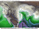
NAM underdoing moisture return at 11 AM the morning of an event.
View attachment 34267
Quick question Fred , Are some our bigger tornado events occurred with a surface wind out of the southeast ? Vs southThe specific values of low-level moisture and instability within where the warm sector ends up being located are likely getting underdone, but the idea of the warm sector getting increasingly pinched as the system heads east is a real one, and it is a synoptic level problem that is not only not trying to change, but is getting more prominent as we get closer. The upper wave is coming out a bit too amplified and meridional, and this effect on the downstream wavelengths is causing the low-level winds east of the Mississippi River to have too much of an easterly component to get good moisture advection. This isn't Oklahoma. The deeper low-level moisture comes from the western and central portion of the Gulf, which is not located to our southeast. Synoptic level southeast flow is not favorable for robust low-level moisture advection east of the Plains. That's why the vast majority of our larger tornado events here in Dixie have a due south surface wind on the synoptic scale and most Plains chasers ahead of time think low-level shear isn't optimal, only to be proven wrong. The warm sector will get increasingly pinched as you head east of I-55. But yes, within the warm sector itself, dewpoints and CAPE values like to trend upward some as we get closer.
It was already answered in the post you're responding to. The statement that answers the question for you is what prompted you to ask the question that's already answered.Quick question Fred , Are some our bigger tornado events occurred with a surface wind out of the southeast ? Vs south
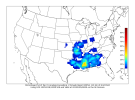
12Z CIPS analog guidance really favors southern MS for severe, especially tornadic, activity. Generally coincides with what the 12Z GFS advertised, with southern MS and northern LA during the late afternoon and evening having the best overlap of diurnally-based instability and kinematics, which will probably be rapidly intensifying around then.


KevinH
Member
He anctually answered your question. Read what he said starting with “This isn’t Oklahoma”Quick question Fred , Are some our bigger tornado events occurred with a surface wind out of the southeast ? Vs south
tennessee storm chaser
Member
- Messages
- 1,623
- Reaction score
- 3,058
- Location
- jackson tennessee
- Special Affiliations
- SKYWARN® Volunteer
Quick question Fred , Are some our bigger tornado events occurred with a surface wind out of the southeast ? Vs south
Feel stupid. LolHe anctually answered your question. Read what he said starting with “This isn’t Oklahoma”


