
Navigation
Install the app
How to install the app on iOS
Follow along with the video below to see how to install our site as a web app on your home screen.
Note: This feature may not be available in some browsers.
More options
-
Welcome to TalkWeather! We see you lurking around TalkWeather! Take the extra step and join us today to view attachments, see less ads and maybe even join the discussion. CLICK TO JOIN TALKWEATHER
You are using an out of date browser. It may not display this or other websites correctly.
You should upgrade or use an alternative browser.
You should upgrade or use an alternative browser.
MMWX
Member
- Messages
- 751
- Reaction score
- 2,465
- Location
- Mississippi State University
- Special Affiliations
- SKYWARN® Volunteer
Have we ever created a thread for an event 8+ days out?
Obviously I think it's warranted considering it's been hinted at for probably over ten days at this point, just crazy how far out this has been forecasted.
Obviously I think it's warranted considering it's been hinted at for probably over ten days at this point, just crazy how far out this has been forecasted.
I think(?) it has happened a few times, but can't recall any specific examples. I'd say this is a bit unique in being a consistent feature on models, moreso than most events I recently recall. Of course, I have seen things that look potentially problematic completely melt away by the day of.Have we ever created a thread for an event 8+ days out?
Obviously I think it's warranted considering it's been hinted at for probably over ten days at this point, just crazy how far out this has been forecasted.
KevinH
Member
This was a thing a while back, BUT I thought we had to wait until the SPC highlighted an area first. I guess not lolHave we ever created a thread for an event 8+ days out?
Obviously I think it's warranted considering it's been hinted at for probably over ten days at this point, just crazy how far out this has been forecasted.
In any case.. email notifications ON!
")
Oh yeah, I forgot that there were discussions about that! I remember we also had to take some time, on at least a few occasions, to figure out how chronographically spacious threads should be, I think most recently during the stuff going on in the Plains in 2024?This was a thing a while back, BUT I thought we had to wait until the SPC highlighted an area first. I guess not lol
In any case.. email notifications ON!
tennessee storm chaser
Member
- Messages
- 1,877
- Reaction score
- 4,288
- Location
- jackson tennessee
- Special Affiliations
- SKYWARN® Volunteer
What’s even crazier is the consistency of models showing this . All blendsHave we ever created a thread for an event 8+ days out?
Obviously I think it's warranted considering it's been hinted at for probably over ten days at this point, just crazy how far out this has been forecasted.
- Moderator
- #7
Considering the talk, not only on here, but on multiple social media platforms by mets and the general weather community about how bad this spring tornado season could be, I green lit this thread, even though it's over a week out. It's been consistently showing up and this very well could be our first big problem of the season.
KevinH
Member
Yeah… That sounds very familiar lolOh yeah, I forgot that there were discussions about that! I remember we also had to take some time, on at least a few occasions, to figure out how chronographically spacious threads should be, I think most recently during the stuff going on in the Plains in 2024?
Anti Marine Layer
Member
It will be the first severe weather event of the meteorological spring.
Cyclonic Paracosm
Member
the few soundings I have seen look really good for its range, I also bet that we get some D4-8 outlooks soon
KevinH
Member
What do you mean soon?the few soundings I have seen look really good for its range, I also bet that we get some D4-8 outlooks soon
tennessee storm chaser
Member
- Messages
- 1,877
- Reaction score
- 4,288
- Location
- jackson tennessee
- Special Affiliations
- SKYWARN® Volunteer
Within next 3 days, SPC start to highlight certain areas .sayingWhat do you mean soon?
00z euro is a wild look for next Tuesday
Sawmaster
Member
Remembering that 2011 was seen developing many days out, I think this deserves our attention because modeling has improved considerably since then..Considering the talk, not only on here, but on multiple social media platforms by mets and the general weather community about how bad this spring tornado season could be, I green lit this thread, even though it's over a week out. It's been consistently showing up and this very well could be our first big problem of the season.
KevinH
Member
Post pictures man!! Lol00z euro is a wild look for next Tuesday
CheeselandSkies
Member
06Z GFS significantly reduces the threat for next Tuesday by spinning up a lead system that tracks right along the coast the day before and interdicts the moisture.
tennessee storm chaser
Member
- Messages
- 1,877
- Reaction score
- 4,288
- Location
- jackson tennessee
- Special Affiliations
- SKYWARN® Volunteer
We see that hold s. Or trend. This far out 6z suits usually off runs. More interested in today12 z06Z GFS significantly reduces the threat for next Tuesday by spinning up a lead system that tracks right along the coast the day before and interdicts the moisture.
tennessee storm chaser
Member
- Messages
- 1,877
- Reaction score
- 4,288
- Location
- jackson tennessee
- Special Affiliations
- SKYWARN® Volunteer
If 0z euro comes even close to verifying, we got big problem
- Moderator
- #19
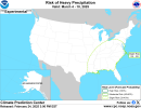
Day 4-8 Convective Outlook
NWS Storm Prediction Center Norman OK
0355 AM CST Tue Feb 25 2025
Valid 281200Z - 051200Z
...DISCUSSION...
A dry, continental airmass across the eastern CONUS and northern
Gulf will keep severe weather potential low on D4/Fri and D5/Sat. By
D6/Sun, as the mid-level low starts to translate into the southern
Plains, robust low-level moisture advection is expected to occur
ahead of a developing surface cyclone. After this time, severe
weather may be possible any day through early next week. In general,
the overall pattern suggests moisture returning to the southern
Plains and parts of the Southeast with a broad trough in the western
CONUS with a series of shortwave troughs advecting into the Plains
and eventually across the eastern CONUS. This pattern will likely
support one or more severe weather episodes, but pinpointing the
exact day and location will require less variance in the timing and
amplitude of the mid-level pattern within the extended range
ensemble suite. Therefore, no severe weather probabilities are
warranted at this time.
KevinH
Member
Should be interesting to watch.Day 4-8 Convective Outlook
NWS Storm Prediction Center Norman OK
0355 AM CST Tue Feb 25 2025
Valid 281200Z - 051200Z
...DISCUSSION...
A dry, continental airmass across the eastern CONUS and northern
Gulf will keep severe weather potential low on D4/Fri and D5/Sat. By
D6/Sun, as the mid-level low starts to translate into the southern
Plains, robust low-level moisture advection is expected to occur
ahead of a developing surface cyclone. After this time, severe
weather may be possible any day through early next week. In general,
the overall pattern suggests moisture returning to the southern
Plains and parts of the Southeast with a broad trough in the western
CONUS with a series of shortwave troughs advecting into the Plains
and eventually across the eastern CONUS. This pattern will likely
support one or more severe weather episodes, but pinpointing the
exact day and location will require less variance in the timing and
amplitude of the mid-level pattern within the extended range
ensemble suite. Therefore, no severe weather probabilities are
warranted at this time.
This is just me, but I think we are going to start seeing the earth do things we have never seen before. Whatever rules that people have for the weather are gone.