• Welcome to TalkWeather!
    We see you lurking around TalkWeather! Take the extra step and join us today to view attachments, see less ads and maybe even join the discussion.
    CLICK TO JOIN TALKWEATHER

Hurricane Hurricane Beryl

Definitely shortcutting Yucatan and hugging the northern guidance still
 
Could definitely see her giving it another go at intensifying before reaching Texas/NE Mexico. Plenty of warm water out there.
G16_sector_gm_GEOCOLOR_12fr_20240705-1322.gif
 
To me, it looks the center is getting ready to move offshore on the north side of the Yucatan.
 

Attachments

  • Hurricane Beryl (Cat.1) July 5th 126.gif
    Hurricane Beryl (Cat.1) July 5th 126.gif
    9.7 MB · Views: 0
  • Hurricane Beryl (Cat.1) July 5th 126.gif (Updated).gif
    Hurricane Beryl (Cat.1) July 5th 126.gif (Updated).gif
    552.7 KB · Views: 0
SHIPS starting to pick up on chances of rapid intensification. But still lower chances, although as well all know, the Gulf is not to be played around with. I think everyone is expecting rapid intensification probably.
1720205041097.png
 
Symmetry-wise, she's emerging after her trip across the Yucatan very well structured. It's not going to take much time for her to get going.
 
The Official Track is near the south end of the newest guidance coming in. I am almost 100% sure the official track will have a shift north at 4 PM CDT. Because the Official Track is further south, the Confidence Bubbles and TS avoidance bubbles are on the bottom edge of most of the newest model paths as well. This should change at 4 PM CDT later today.

1720205309458.png
 
Mid level dry air may be a significant limiting factor. A very dry ULL spinning above the far southwestern Gulf.

1720206001921.png
 
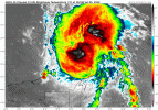
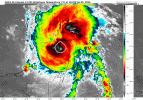
At this point, I think we can all say that dry air/wind shear mean nothing to Beryl. LOL!
True, but this is a fight at a level she's not fought yet. Possible though - she brought a lot of moisture with her.
 
Good bit of shear, too. So definitely some things working against Beryl in the Gulf. But - it's the Gulf. It will be fun to follow, regardless.
1720207134861.png
 
Beryl getting ready to move offshore to the north of Yucatan. Robust lightning starting near the center.
 

Attachments

  • TS Beryl July 5th 128.png
    TS Beryl July 5th 128.png
    379.7 KB · Views: 0
SHIPS at 0z gives decent chances for Rapid Intensification in the next 48-72 hours. These are the biggest indicators yet of RI in the Gulf. 20% chance of 65kt increase in 72 hours is actually pretty high. A cat 3 could be on the table.

1720227757148.png
 
I haven't yet made adjustments to the Mini-Ensemble graphic to account for the "late" models (they end in "I", like HFAI instead of HFSA), but I'll try to add that in at some point. The Confidence Bubble is almost entirely in Texas now, and the 72-hour Confidence Bubble goes up to the Galveston/Houston area now. Again, the idea here is to show uncertainty in a way the Cone is not quite able to do -- the Cone's width is NOT based on the storm itself but rather is static for the entire year (2024, in this case), based on the 2019-2013 average error. These Confidence Bubbles are dynamic and based on the storm's modeling. So most of the Texas coast is in play now, according to these Confidence bubbles.

Looking at the winds, I see the Navy model has a Cat 2 coming inland -- it'll be interesting to see how the other models adapt intensity-wise.

1720228906146.png
 
While Beryl has certainly had a rough evening, convection is firing again near the center. 11 PM NHC forecast has it coming ashore as a high-end Cat. 1 in TX. Considering her propensity for exceeding expectations, wouldn't be surprised if her appearance improves significantly through tomorrow.
G16_sector_gm_GEOCOLOR_24fr_20240705-2320.gif
 
Back
Top