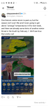
If we are going to have another legitimate shot at a wintry weather system in these parts, I wouldn't give a lot of attention to things until after Feb 5th-7th or so, but it could potentially be just after that. NAO/AO looks to be heading back into negative territory around and after that time on the GFS ensembles and Euro ensembles, and the Euro weeklies like the idea of us heading back toward maybe some eastern troughing if not Gulf-type disturbances again after the 7th-8th of Feb. That general type of timing also makes sense with the cycle length of 6-weeks or a couple/few days short with the LRC cycle this 2024-2025 season. (No, I'm not fully sold on pulling excruciatingly exact specific details from that thing, but it does seem to be a reliable way of figuring out the timing of specific patterns/waves in the flow and how those cycle through the season... and the general geometry of those patterns. I think a lot of that reliability may be tied to being a way of tracking MJO propagation cycling into the longer term, but that's only an observation from the outside looking in. I'm not privy on all the details of how that system works specifically.)


")