• Welcome to TalkWeather!
    We see you lurking around TalkWeather! Take the extra step and join us today to view attachments, see less ads and maybe even join the discussion.
    CLICK TO JOIN TALKWEATHER

Severe WX Tuesday-Thursday May 7-9th Severe Threat

warneagle

Member
Messages
3,729
Reaction score
3,208
Location
Arlington, VA
Special Affiliations
  1. SKYWARN® Volunteer
The Wichita area might have some flooding issues this evening. Slow-moving storms producing a lot of heavy rain. I think the WPC had a moderate risk up that way.
 

warneagle

Member
Messages
3,729
Reaction score
3,208
Location
Arlington, VA
Special Affiliations
  1. SKYWARN® Volunteer
That's a really tight couplet moving toward Erick, OK. Could be a strong tornado in progress with that one. Confirmed TOG.
 

Lori

Administrator
Staff member
Administrator
Moderator
Messages
1,035
Reaction score
653
Location
Vandiver, AL
Special Affiliations
  1. SKYWARN® Volunteer
Who is streaming?
 

FEARLESS

Member
Messages
37
Reaction score
3
Location
Signal Mountain, TN
Special Affiliations
  1. SKYWARN® Volunteer
Continuing to streaming data coming up thru mississippi river valley and the wind dynamics over michigan and wisconsin
 

Bama Ravens

Member
Messages
1,207
Reaction score
648
Location
Morris, AL (Northern Jefferson County)
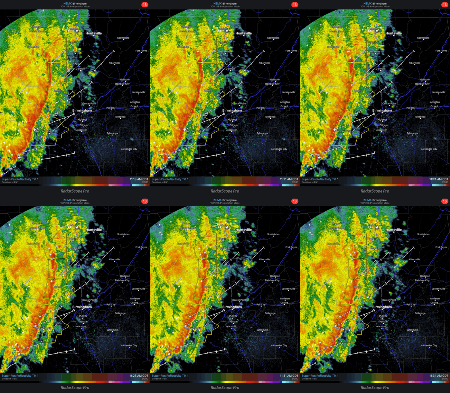
Wasn’t expecting a line like this today:

CF42-E95-C-AFFA-458-A-B550-F11-EFAB9-CFFD.gif
 

Equus

Member
Messages
3,290
Reaction score
3,368
Location
Jasper, AL
Special Affiliations
  1. SKYWARN® Volunteer
Minor roof damage SW of Haleyville corresponds with area of higher velocities or perhaps even a mesovortex.
Screenshot_20190509-114145_RadarScope.jpg


Pretty windy here with soaking rain. More than I expected. Surprised we are only in a SPC Marginal.

Edit... actually a bit more than minor roof damage, several trees down and three apartments with slight damage associated with that signature. Also reports of several trees down near Brilliant which corresponds with another kink/mesovortex. Not especially likely to be tornado touchdowns but wind damage has been associated rather precisely with enhanced velocity presentations. Neat to see I guess.
 
Last edited:
Messages
452
Reaction score
380
Location
Canton, GA
TOR for the rotation North of Hazel Green now. Circulation has crossed into Tennessee. Definitely tightened up on the last scan.

Wall cloud reported North of Alabama A&M, associated with the Central Madison cell.
 
Back
Top