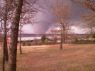
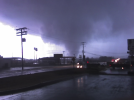
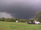
I found some tornado damage photos at a collectibles show last weekend. No labels, but the house in them looked Great Lakes-y to me given its design. At first, I expected the mystery to stay a mystery, but then I remembered that the army did a partial aerial survey of the damage from the 6/28/1924 Sandusky–Lorain tornado. Just for fun, I pulled up the
gallery on Wikimedia, and
there was the house in my pictures!!! I couldn't believe it.
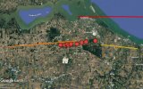
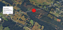
This sent me down a rabbit hole, and I discovered that the rural shots in the series don't show Lorain tornado damage at all. They show damage from a lesser-known tornadic storm that moved across Sandusky and Erie counties on the same day. I managed to locate most of the sites in the pictures, and I made a
Google map to keep track of things (still missing some of the Lorain shots). Grazulis attributes the damage to two tornadoes: an F3 that started near Vickery and supposedly dissipated near Castalia, and an F2 that hit near Huron. But most of the damage photos were taken well east of Castalia (and close to where Grazulis says the Huron F2 started), so I think there may have been just one long-tracked tornado.
The house in the picture was owned by the Waldock family (who still own the land) and stood on the east side of Route 4, just north of Miller Road. It was repaired after the tornado, then abandoned, but the foundation is
still sitting there next to the road. I've literally spent my entire life driving past it, wondering about it.
The whole set of damage photos is incredible and worth perusing. Particularly cool is
this area of
impressive-looking convergent tree damage.