Eoline
Member
They obtained the photos directly from Kathy Delp; they were never directly posted online prior.What's the original source though of those photos? It isn't disclosed in that description.
Follow along with the video below to see how to install our site as a web app on your home screen.
Note: This feature may not be available in some browsers.
They obtained the photos directly from Kathy Delp; they were never directly posted online prior.What's the original source though of those photos? It isn't disclosed in that description.

Good finds anyways. Very rarily are you able to obtain from someone photos of a 4/27 tornado. I found a interesting tweet of someone saying they found a new Smithville photo from some guy before getting in his shelter. May dig it back up again if its of any interest.They obtained the photos directly from Kathy Delp; they were never directly posted online prior.
A bunch of the 74 tornadoes were deep in the Cumberland Mountains of Tennessee and Kentucky. Also, many of the Southern tornadoes were after dark. The combination of darkness and very remote country explains a lot.74 still kinda fascinates me, feels like the weather community has kinda overlooked it despite its legacy. Probably due to the fact that so much info on it is clearly missing or wasn't well documented.
I would argue some of the more violent tornados on that day were actually in that northeastern TN/southeastern KY corridor.A bunch of the 74 tornadoes were deep in the Cumberland Mountains of Tennessee and Kentucky. Also, many of the Southern tornadoes were after dark. The combination of darkness and very remote country explains a lot.
Looking at the damage paths, between the well known N Alabama and Ohio valley corridors is practically a wall of f4 tornadoes. I imagine that looking from east to west, you’d be hard pressed to spot a gap between violent tornado tracks.I would argue some of the more violent tornados on that day were actually in that northeastern TN/southeastern KY corridor.
More rural than the other areas that day so they aren’t as famous as the headliners, but you still had multiple F4s jammed in that corridor in the evening. Some on the ground at the same time.
There was actually one rated F2 that went through the Daniel Boone forest that left such a severe scar that it was still somewhat evident a few years ago. I’ll have to check my sources but I want to say a TN reanalysis of the 74 outbreak stated that F2 was likely much stronger.
Edit: I posted pictures earlier in this thread, but the Pickett, TN F4 arguably deserved to be rated F5. Especially relative to some of the other 5s on that day.
I don’t think it’s any coincidence both super outbreaks took place in conjunction with historic La Ninas. 1973-74 was particularly intense, and by some metrics the most intense on record. Even compared to 2011, 74 really just stands out in the sheer size of its aerial expanse. That kind of warm sector is mind blowing.Looking at the damage paths, between the well known N Alabama and Ohio valley corridors is practically a wall of f4 tornadoes. I imagine that looking from east to west, you’d be hard pressed to spot a gap between violent tornado tracks.
Just adds to how insane the 74 outbreak was
I recall a tornado was downgraded to F4 like Russiaville for 1965. Dunno if it was Pickett but I've always had a feeling that it could've likely actually been f5, cause the only reason it was downgraded is they couldn't find an example of the f5 damage that caused the upgrade.I would argue some of the more violent tornados on that day were actually in that northeastern TN/southeastern KY corridor.
More rural than the other areas that day so they aren’t as famous as the headliners, but you still had multiple F4s jammed in that corridor in the evening. Some on the ground at the same time.
There was actually one rated F2 that went through the Daniel Boone forest that left such a severe scar that it was still somewhat evident a few years ago. I’ll have to check my sources but I want to say a TN reanalysis of the 74 outbreak stated that F2 was likely much stronger.
Edit: I posted pictures earlier in this thread, but the Pickett, TN F4 arguably deserved to be rated F5. Especially relative to some of the other 5s on that day.
I believe that was the one in southern Tennessee in Coffee CountyI recall a tornado was downgraded to F4 like Russiaville for 1965. Dunno if it was Pickett but I've always had a feeling that it could've likely actually been f5, cause the only reason it was downgraded is they couldn't find an example of the f5 damage that caused the upgrade.
per wikipeida it was a tornado that hit both Lincoln and Coffee countiesI believe that was the one in southern Tennessee in Coffee County
Edit: I now think it was in Hardin County
Edit #2: actually, probably Lincoln County?

Plenty of candidates! Sunnyside and Pittsfield both appear as obvious choices. If you look through pictures of Coldwater Lake, midway, Sunnyside, Pittsfield, Sheridan, and more, you'll see debris granulation with most. Russiaville apparently debarked trees and scoured grassAlso Russiaville shouldn't have been downgraded TBH. 65 should have had multiple f5s.
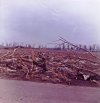
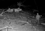
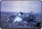

 stormstalker.wordpress.com

Plenty of candidates! Sunnyside and Pittsfield both appear as obvious choices. If you look through pictures of Coldwater Lake, midway, Sunnyside, Pittsfield, Sheridan, and more, you'll see debris granulation with most. Russiaville apparently debarked trees and scoured grass
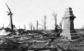
Just look at this vicious damage near Sheridan:
View attachment 54545
Coldwater Lake #1:
View attachment 54546
Sunnyside:
View attachment 54547
Pittsfield:
View attachment 54548
April 11, 1965 — Palm Sunday Outbreak
[Note: Click photos for larger versions.] Across the upper Midwestern United States, March of 1965 was cold, snowy and miserable. The month began with blizzard conditions across the region on March…
Pittsfield-Strongsville, Lebanon-Sheridan, Kokomo-Greentown and Coldwater Lake-Manitou Beach all have compelling cases as well, to varying degrees. Tbh we should probably just give Coldwater Lake an F5 purely on its monstrous appearance:Good lord, how is this not F5 worthy?

I mean, come on now. If you tear a John Deere in half, you gain automatic entry into the F5 club. Those are just the rules.

Another tractor having a very bad day, this one thrown more than half a mile:

A bus, or at least what little is left of one:

Pretty good case to be made that Sunnyside was the most violent tornado of the outbreak, which is saying something.

...
There are several others that would definitely have warranted consideration, but Sunnyside is just egregious.

Can you expand more on this or have a link to where this has been discussed before? I’d love to learn more about the Wisconsin part of Palm Sunday 1965I also don't understand why it's even rated the way it is. The tornadoes of 65 are a lot more intense in general in comparison to some of the more questionable tornadoes of that era of analysis (I. E. Sunfield, Charles City). Even with that, we aren't even getting into whatever the hell happened with the surveys on the Wisconsin side of the outbreak.
I know I'm flooding the thread with Palm Sunday (sorry), but here's some more stuff from the "F1" in Monroe, WI:


And from the Watertown, WI "F2" as well:


Again, I'm far from an expert, but I feel fairly confident in saying the official ratings for Palm Sunday are.. not great.
Apparently lots of the ratings were handed out by summer interns at NWS offices years later (when the Fujita scale was in effect) so yeah, college interns with zero experience were shown past damage photos in poor quality black and white photographs and asked to rate these past tornadoes based off those aforementioned photos.He has more on this region of the outbreak, including that part of the thread, but in general the surveys were not particularly good in that region.