- Thread starter
- #12,361
locomusic01
Member
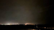
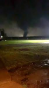
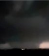
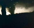
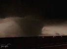
Didn't get around to posting yesterday, but here's some stuff from the Southern Michigan F4s (mostly Coldwater Lake and Manitou Beach):


Follow along with the video below to see how to install our site as a web app on your home screen.
Note: This feature may not be available in some browsers.


Afaik, the bottom picture is from the 1965 Comstock Park tornado
How in the hell is there not an official F5 from that...
Literally absurd.
Whoops, yeah they were both supposed to be in the Comstock Park post before I got distracted:Afaik, the bottom picture is from the 1965 Comstock Park tornado


Apparently some said that Hudsonville was stronger than Flint, is that true?On a related note, I can't recall where now, but I've also seen this series of photos labeled as being from Comstock Park '65. In reality, they're from the 1956 Hudsonville-Standale F5.
By the way, do you still have the files on June 5th, 1917 tornadoes and the May 14th, 1923 F5 tornado @locomusic01 (sorry for the mention)?@locomusic01 do you have anything on the June 5th, 1917 Kiro/Elmont F4 and May 14th, 1923 Big Springs F5?
I hadn't examined the Yazoo City path detail before I made that post, that it was a family was obvious upon examination. On Landsat there's also an apparent gap between where it meets the Natchez Trace Parkway and just outside French Camp where it took a more northerly heading and strengthened to EF3. The image quality isn't good there but it surprises me visible tree damage ceases, even with the data limitations, given the rating and how well it shows elsewhere.Y'know what, screw it, I'll take my swing at that list, and your response to it.
And, as a bonus...
Larkin, AR EF4 (Mar 14, 2025, 118.9 miles) - this one is already under fire, but I trust that LZK wouldn't have combined the tracks if they weren't 100% certain it was a single tornado. I'm fairly certain this was just varying intensity at multiple points.
Well thinking about our environment on 3/14; wind damage being frequent doesn't remotely surprise me. It was supposed to be a wind-based risk area with the additional risk for intense tornadic activity; but that solution isnt fully what we saw, which there is reason for why. Mainly in the evolution of the jet streak, it ejected absurdly favorably and right on time; allowing for much much much more discrete development; but still remember the thermodynamic parameters existed for powerful winds above 80mph. Being a stout EML above the surface, which allowed for evaporative cooling, which leads to strong downdrafts; we still had those strong downdrafts with our cells, discrete or not!I hadn't examined the Yazoo City path detail before I made that post, that it was a family was obvious upon examination. On Landsat there's also an apparent gap between where it meets the Natchez Trace Parkway and just outside French Camp where it took a more northerly heading and strengthened to EF3. The image quality isn't good there but it surprises me visible tree damage ceases, even with the data limitations, given the rating and how well it shows elsewhere.
For the Monette tornado, on Sentinel I can trace it further east than the official track by perhaps a mile and a half. But I can't see anything in the Fremont-Crystal area to connect it to the Mayfield tornado. Though I can't really see where it crossed the Francis River either. Tree damage isn't always obvious especially where they've no leaves (something to bear in mind when I opine on the March 14 tornado). When it comes to the radar, I must admit I can't 'read' velocity signatures very well for things like handoffs like some here can. But it does appear to weaken and on the balance of evidence I'd be fine calling it two tornadoes.
My scepticism with the March 14 tornado is because it doesn't present like past confirmed very long track tornadoes. They tend to have long, continuous portions of the track at a fair intensity. The atmospheric processes that encourage very long tracks overlap with those producing high intensities. For the March 14 tornado, only the portion from west of Fifty Six to near Ash Flat shows such continuity and intensity. This was also the only part to produce a big, persistent TDS, but the rest was where the radar coverage is suboptimal. The sharp deviations later in the track are also atypical. It could be because a weaker, shallower circulation steers differently, but it's reminiscent of events where shorter tracks have been joined up.
Some of the DIs are snapped or damaged trees that were seen on satellite, in some cases making the path over a mile wide but weak, atypically. They'll have higher resolution imagery than Sentinel, but the 'broad, multi-swath' pattern mentioned in one DI might fit with wind damage, and they did put some thunderstorm wind damage points in the area. Could more of it be just wind? On DAT for the 10/12/21 outbreak, there's a narrow band of supposed thunderstorm damage and an EF1 tornado between the Dresden and Chandlers Chapel tornadoes, albeit with a clear velocity cycle. The radar coverage later in the March 14 tornado is not great and I freely admit I can't give more than a guess as to what it shows.
There's like a 95% chance I'm wrong here (though the NWS isn't infallible) and chances are an obvious enough path will be visible on the satellite in a couple of weeks and I'll eat crow. But it seems remarkably different to other very long tracked tornadoes. If it actually is one tornado there might be cause to be less dubious about previous possible events.
Is the first one not the Poplar Bluff tornado? I'm probably completely wrong, but that and the Poplar Bluff EF3 (first attachment) look nearly the same. From one other photo I've seen of the tornado on the Arkansas side (second picture attached) the tornado had an Andover 2022-reminiscent shape while strengthening, although EF4 intensity was reached further down in the path and it was noticeably wider, seen in the survey.Well thinking about our environment on 3/14; wind damage being frequent doesn't remotely surprise me. It was supposed to be a wind-based risk area with the additional risk for intense tornadic activity; but that solution isnt fully what we saw, which there is reason for why. Mainly in the evolution of the jet streak, it ejected absurdly favorably and right on time; allowing for much much much more discrete development; but still remember the thermodynamic parameters existed for powerful winds above 80mph. Being a stout EML above the surface, which allowed for evaporative cooling, which leads to strong downdrafts; we still had those strong downdrafts with our cells, discrete or not!
So Franklin-Fifty Six's path might be "wobbly" or even somewhat diffuse for this reason; as strong RFD widened the tornado, reducing it's winds with conservation of angular momentum in mind, but still allowing for strong multi-vortex activity. We saw this last year on 5/26/24, with the Dawson Springs KY EF3; very wide, fast moving, long tracked, but did not produce any variety of particularly violent level damage. Based on what photos I have seen of Franklin-Fifty Six, it looks very similar in appearance to Dawson Springs 2024; very dark, wide, and almost a little diffuse looking. RFD/Strom interactions can deeply alter a tornadoes behavior and path, along with environmental parameters outside of just the storm-scale interactions.
Edit: Something I just thought of; look at the difference in appearance between Franklin-Fifty Six, and the Diaz EF4 from literally the same time! Notice how thin the Diaz tornado looks? Well the damage can be correlated to just that; being the angular momentum of a thin, vertically intense tornado; keeping in mind the Diaz tornado existed in the southern area of the outbreak, it's parent supercell had a less intense RFD, as the wind probs increased with northward extent.
First photo is Franklin-Fifty Six, the second is the Diaz tornado. You'll notice the difference instantly