Smithville at number 1? Why is bridge creek below Joplin? Sherman was violent for sure but number 3 I think is just too much speculation.
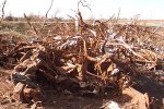
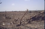
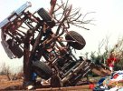
1. Piedmont - Worst tree/vegetation damage I have ever seen as well as some of the worst ever granulation and vehicle damage. Plus other feats of damage like Cactus make this a no brainer. Cyclodials were also insane.
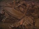
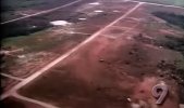
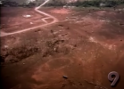
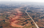
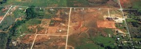
2. Bridge Creek, if we discount Cactus it would probably be a tie, but nothing I can say can describe the damage as well as what Iocomusic showed. It by far has the worst scouring out of any tornado on record.
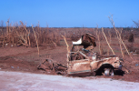
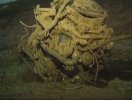
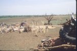
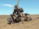
3. Smithville - Basically extreme damage all round with a fast forward speed, the worst granulation bar Jarrell and it probably has some of the worst structural damage to family residences. It's vehicle damage is slightly below the previous 2 but at this level its just cherry picking. Tree damage was extreme and probably similar to BC though still not quite as insane as Piedmont.
4. Moore 2013 EF-5. - Besides Smithville and Piedmont easily the most violent EF-5 tornado we have seen. The level of damage at Orr family farm is similar to Bridge creek in its severity.
These top 4 are the only ones I can rank in order with certainty if we include pre 21st century tornadoes. If it is just EF-5s then I would say
5. - Hackleburg
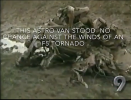
6. Joplin
7. Greensburg
8. Parkersburg
9. Rainsville
10. Philadelphia (the trenching of 2 feet is semi-impressive but it is not true scouring, rather just ripping out clumps of saturated soil).
Other F5s to include would be New Richmond, Tri-state which is possibly a top 5 contender after reading some books, the complete destruction of Peabody Mine #18 which was primarily constructed out of reinforced concrete buildings is particularly impressive. As our numerous other feats. Andover, Brandenburg and Guin should be mentioned as having extremely violent contextuals. As for Jarrell, damage- wise it definitely takes the number 1 spot but it's slow movement speed makes it impossible to determine it's true intensity, though it was evidently violent. (Imagine if Bridge Creek was moving that slow).