
Navigation
Install the app
How to install the app on iOS
Follow along with the video below to see how to install our site as a web app on your home screen.
Note: This feature may not be available in some browsers.
More options
-
Welcome to TalkWeather! We see you lurking around TalkWeather! Take the extra step and join us today to view attachments, see less ads and maybe even join the discussion. CLICK TO JOIN TALKWEATHER
You are using an out of date browser. It may not display this or other websites correctly.
You should upgrade or use an alternative browser.
You should upgrade or use an alternative browser.
Severe WX Severe Wx Outbreak March 1st- 3rd, 2023 - Southern States, MS/OH/TN Valley
- Thread starter KevinH
- Start date
- Moderator
- #703
The Fort Smith, AR radar is also down.
This happens so often it feels like weather radars have performance anxiety.
I agree, and I didn't even have to put on my tin foil hat.This happens so often it feels like weather radars have performance anxiety.

cincywx
Member
DAY 1 CONVECTIVE OUTLOOK
NWS STORM PREDICTION CENTER NORMAN OK
1030 AM CST WED MAR 01 2023
VALID 011630Z - 021200Z
...THERE IS AN ENHANCED RISK OF SEVERE THUNDERSTORMS FROM PARTS OF
THE ARKLATEX INTO THE MID-SOUTH...
..SUMMARY
A FOCUSED CORRIDOR OF SEVERE POTENTIAL IS EVIDENT THIS AFTERNOON
THROUGH TONIGHT FROM NORTHEAST TEXAS INTO THE MID-SOUTH AND
TENNESSEE VALLEY. SCATTERED LARGE TO VERY LARGE HAIL, DAMAGING
WINDS, AND TORNADOES ALL APPEAR POSSIBLE. A STRONG TORNADO MAY ALSO
OCCUR.
..SOUTHERN PLAINS INTO THE MID-SOUTH AND TENNESSEE VALLEY
A BROAD AREA OF ENHANCED SOUTHWESTERLY MID-LEVEL FLOW WILL PERSIST
TODAY THROUGH TONIGHT ACROSS THE SOUTHERN PLAINS INTO THE MS VALLEY
AND OH VALLEY. AT THE SURFACE, A FRONT EXTENDS FROM NORTH TX INTO MO
AND THE MIDWEST. LOW-LEVEL MOISTURE IS FORECAST TO GRADUALLY
INCREASE THIS AFTERNOON AND EVENING ALONG/SOUTH OF THIS BOUNDARY. A
STRONG CAP NOTED ON THE 12Z SHV SOUNDING SHOULD INHIBIT ROBUST
CONVECTIVE DEVELOPMENT FOR AT LEAST A FEW MORE HOURS. EVENTUALLY,
SUBTLE LARGE-SCALE FORCING ASSOCIATED WITH A LOW-AMPLITUDE MID-LEVEL
PERTURBATION OVER TX, ALONG WITH MODEST LOW-LEVEL CONVERGENCE ALONG
THE FRONT, SHOULD SUPPORT CONVECTIVE INITIATION OVER NORTHEAST
TX/THE ARKLATEX REGION BY LATE THIS AFTERNOON.
STEEP MID-LEVEL LAPSE RATES, INCREASING LOW-LEVEL MOISTURE, AND
FILTERED DAYTIME HEATING SHOULD SUPPORT MODERATE INSTABILITY IN A
NARROW CORRIDOR FROM NORTHEAST TX INTO THE MID-SOUTH. DEEP-LAYER
SHEAR IN EXCESS OF 50 KT WILL EASILY SUPPORT ORGANIZED
THUNDERSTORMS, INCLUDING SUPERCELLS. SCATTERED LARGE TO VERY LARGE
HAIL WILL BE THREAT WITH ANY INITIALLY DISCRETE CONVECTION THAT
DEVELOPS. WITH TIME, THUNDERSTORMS SHOULD CONGEAL INTO ONE OR MORE
BOWING LINE SEGMENTS AS THEY SPREAD EASTWARD ACROSS THE MID-SOUTH
AND TN VALLEY THIS EVENING AND TONIGHT. THE DAMAGING WIND THREAT
SHOULD INCREASE ACROSS THESE AREAS AS THIS MODE TRANSITION OCCURS.
WHILE THERE IS STILL SOME UNCERTAINTY, MOST GUIDANCE ALSO SUGGESTS
THAT A SOUTHERLY LOW-LEVEL JET WILL MODESTLY STRENGTHEN THIS EVENING
TO AROUND 30-35 KT. A NARROW ZONE OF MORE FAVORABLE TORNADO
POTENTIAL MAY EXIST ACROSS PARTS OF SOUTHERN/CENTRAL AR INTO
NORTHERN MS AND SOUTHWESTERN TN, PARTICULARLY IF SUPERCELLS CAN
REMAIN AT LEAST SEMI-DISCRETE. A STRONG TORNADO APPEARS POSSIBLE IN
THIS CORRIDOR. BASED ON CONSENSUS OF 12Z GUIDANCE, CONFIDENCE HAS
INCREASED IN A MORE CONCENTRATED CORRIDOR OF SEVERE POTENTIAL ACROSS
THIS REGION, WARRANTING THE ADDITION OF AN ENHANCED RISK.
I knew it!!! Called it lol. Or semi called it I guess hahah. Focal point of major tornado threat will be along that frontal boundary. All eyes glued tonight for me. A long night of radar scope watchingD1 ENH. Sigtor and hail risk.
View attachment 18397

By 2 o'clock Arkansas looks to be in the crosshairs of severe/tornadic storms.
After looking through CAMS its clear the environment in E TX, OK and AR and LA will be very favourable for strong-intense tornadoes during Thursday evening. yet the main uncertainty to whether we see a significant outbreak is going to be whether we see discrete open warm sector storms. As far as I have seen, HRRR, WRF and NAM 3k all do not show any sustained discrete development. But any small shortwave or prefrontal confluence could trigger this - so I think thats what needs keeping an eye one in the next 24 hours.
OHWX97
Member
Sheesh. Seems like this kind of stuff happens way too often
FYI, it’s been down for the last two days or so. I actually thought that tweet was good news, given that they’re optimistic they’ll have it repaired by this afternoon.This happens so often it feels like weather radars have performance anxiety.
tornado examiner
Member
No major changes in the recent day 2 outlook. Just some polygon adjustments….
TornadoFan
Member
Update:
Thunderstorms will likely be ongoing in the vicinity of the warm
front from southwest TX through the Mid-South. A few stronger storms
are possible within this corridor during the morning, but the
primary severe threat is expected to begin over the warm sector
Thursday afternoon. Wind profiles throughout the warm sector will
support supercells, but warm mid-level temperatures and weak ascent
introduce uncertainty regarding the location and coverage of any
warm sector storms. Mesoscale ascent associated with the weak wave
low mentioned in the synopsis may provide enough ascent to initiate
a few discrete cells across northeast TX, which could then move
downstream into southeast OK, southwest AR, and northwest LA.
- Admin
- #714
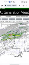
Interesting Helicity Updrafts models for tonight are for Southern Arkansas between 5PM and 7 PM and then Western Alabama at 1 AM. Keep your eyes open tonight. It is going to get bumpy.
Equus
Member
Pretty decent simulated soundings for large hail from NE TX into Arkansas especially early in the event; steep lapse rates especially in the mid-levels, large CAPE in the hail growth zone, and a mostly straight hodograph above 1km suggesting mostly speed shear are all effective large hail indicators

Last edited by a moderator:
Can't get over the strength of the updrafts swaths later this afternoon. Yes I know updrafts swaths are not correlated to tornadoes. But Potential exists this afternoon and on for a strong tornado threat. You'll have a few lone supercells which will really take full advantage of the environment today.
Attachments
I have a feeling it's going to be a rough afternoon before the main event tommorow. Hopefully not, but these supercells will have all the room to work in.
One this is for sure... we are likely to see a LOT of hail reports, potentially big hail as well.Can't get over the strength of the updrafts swaths later this afternoon. Yes I know updrafts swaths are not correlated to tornadoes. But Potential exists this afternoon and on for a strong tornado threat. You'll have a few lone supercells which will really take full advantage of the environment today.
12z Euro soundings are high end for Friday across the northern half of GA into SC, especially around 21z.
CheeselandSkies
Member
12z Euro soundings are high end for Friday across the northern half of GA into SC, especially around 21z.
Andy, do you have any thoughts on tomorrow you'd care to share here?