- Moderator
- #401
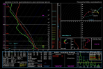
Last night’s EURO base reflectivity product showed the development of discrete activity in the open warm sector across eastern TX, northern LA in the afternoon/eve.
Follow along with the video below to see how to install our site as a web app on your home screen.
Note: This feature may not be available in some browsers.
Don't know how accurate Ryan hall is but his video popped up on my featured YouTube feed lol
What do the highlighted words mean in other words? LolInteresting tidbit from the overnight AFD from FFC:
The next significant weather system begins to come together on
Thursday night/Friday morning as a deep, stout shortwave digs
into the Southern Plains. This shortwave will rapidly organize a
strong surface low pressure system, with organized frontal
boundaries that is progged to be centered somewhere around
the mid/lower Mississippi River Valley on Friday morning.
Compared to yesterday, the low pressures progression has risen
significantly towards the North and is beginning to show signals
of occlusion by the time the front reaches the NW corner of the
forecast area on Friday morning, which may undercut the potential
severity of the system with more limited upper-level support,
surface convergence, and instability than previously forecast.
(This change is similar to the frontal passage and severe threat
that this coming system on Monday has undergone) However,
significant values of severe parameters in regards to low- and
deep-level shear and moisture continue to be prevalent. Despite
some model uncertainty on timing and positioning, a 15% Convective
Outlook had been issued by SPC, based on the potential severity
of this system, and will need to be monitored closely through the
week.
Occludes?The 00z euro is having a hard time saying this system even occludes lol.
Don't know how accurate Ryan hall is but his video popped up on my featured YouTube feed lol
Closes off. Pinched off the warm front keeping it from being a wide open warm sector … interesting see if it happensOccludes?
I was about to watch this video, but just changed my mind. If this is what Ryan did in this video then he deserves every thumbs down vote he gets. Don’t do that to people.It seems like this is getting worse through different topics. Like people are posting click bait titles and then not even talking about the subject in the title at all in the video. Not sure how YouTube can fix this though.
Convective chronicles and trey is about the only reliable YouTuber for in depth analysis that I've foundIt seems like this is getting worse through different topics. Like people are posting click bait titles and then not even talking about the subject in the title at all in the video. Not sure how YouTube can fix this though.
A lot of in line supercells that's pretty dangerous
I was about to watch this video, but just changed my mind. If this is what Ryan did in this video then he deserves every thumbs down vote he gets. Don’t do that to people.
James Spann does one every day, morning and afternoon. Just not the weekends, unless we are getting severe weather that day.By all means watch whatever you please, I was just giving my personal opinion. Ryan Hall did a good job with his 12/10/21 coverage which if I recall correctly was how he gained a lot of followers in the first place, but since then in my opinion he's made some questionable decisions which have influenced my choice to watch other creators instead (as an aside,James Spann/ABC 33/40 don't seem to be posting the daily Weather Xtreme videos anymore, which is a big loss).
Edit: James is still posting videos, he's just calling them the "morning briefing" now and some if not most of them are live-streamed so they don't show up under the normal "videos" tab on his channel page.
Now back on board your regularly scheduled hype train for this upcoming weather event...
James Spann does one every day, morning and afternoon. Just not the weekends, unless we are getting severe weather that day.