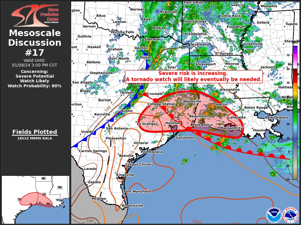
Regardless of discrete OWS development, my biggest concern is that we get multiple embedded supercells that are capable of producing intense tornadoes - take the Easter Outbreak: multiple intense and even a violent tornado were spawned by the line.
Given the strength of the wind fields any robust mesocyclone would be able to do dangerous things.
Given the strength of the wind fields any robust mesocyclone would be able to do dangerous things.