
Maxed out CC and clear debris ball on simulated radar is insaneThis is very significant
View attachment 16770
Navigation
Install the app
How to install the app on iOS
Follow along with the video below to see how to install our site as a web app on your home screen.
Note: This feature may not be available in some browsers.
More options
-
Welcome to TalkWeather! We see you lurking around TalkWeather! Take the extra step and join us today to view attachments, see less ads and maybe even join the discussion. CLICK TO JOIN TALKWEATHER
You are using an out of date browser. It may not display this or other websites correctly.
You should upgrade or use an alternative browser.
You should upgrade or use an alternative browser.
Severe WX Severe Weather Threat Jan 12th, 2023
- Thread starter KevinH
- Start date
cincywx
Member
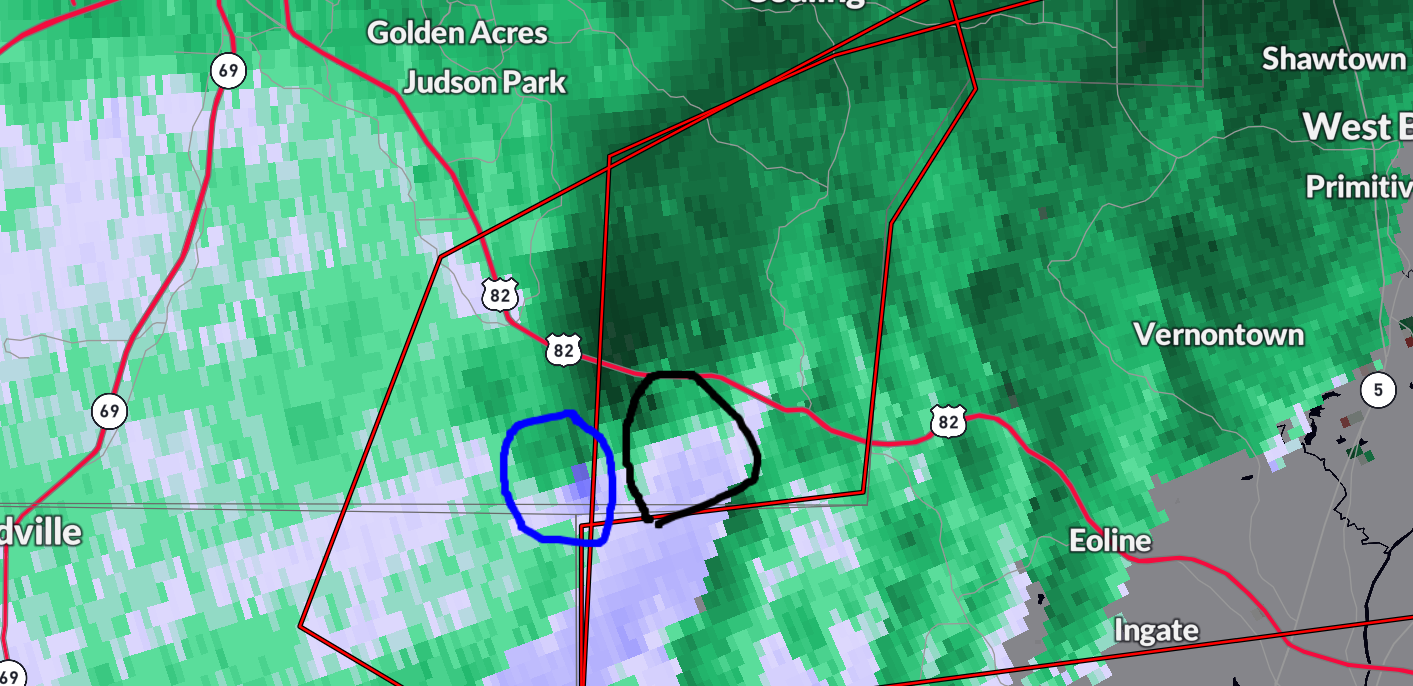
very evident debris ball on reflectivity east of moundville.
edit: it increased in size, wow.
edit: it increased in size, wow.
MattPetrulli
Member
May be a failed attempt. Looking ahead, those showers in the inflow of the cell may limit it somewhatMoundville cell is attempting to occlude but old tornado remains on the ground. New meso is evident though
kcyalater
Member
what is my guy spann doing???
Significant large tornado must be ongoing is a PDS issued yet???
Not watching but is he misinterpreting CC radar imagery? I’ve seen him do that before.i don’t think james is looking at the right information.
Argus
Member
We're more in the enhanced risk than west Alabama, should this event worsen the further eastward?
OHWX97
Member
The supercell near Needham, AL could use a tornado warning.
TornadoFan
Member
The debris ball is clearly evident on reflectivity and is growing on CC.

Storms are expected to become linear but intensify as they track eastward.We're more in the enhanced risk than west Alabama, should this event worsen the further eastward?
kcyalater
Member
taylor acknowledged the tds being inconsistent with velocity analysis
ashtonlemleywx
Member
There's just something about that land around Brent and Calera. It's astounding how often tornadoes touchdown in that area.
I'm telling yall its cursed.
I'm telling yall its cursed.
SmokeEater
Member
What's going on with them today? As soon as the couplet dies down, TDS or not they act like it's off the ground. And like you guys have said, it seems to have been down since almost the MS/AL line.
Sent from my SM-S901U using Tapatalk
Sent from my SM-S901U using Tapatalk
kcyalater
Member
i’m confused by the west blocton storm. tds is massive but velocity shows nothing
The strong rotation may be very close to the ground, some tornsdoes look week on velocity but produce strong tornadoes because of how low it is. I may be wrong but I've seen a few like iti’m confused by the west blocton storm. tds is massive but velocity shows nothing
MattPetrulli
Member
Shallow signature, similar to Cookeville 2020 and Bowling Green 2021i’m confused by the west blocton storm. tds is massive but velocity shows nothing
Thank you!Shallow signature, similar to Cookeville 2020 and Bowling Green 2021
Jpgood97
Member
Likely tornado forming on the southern storm headed for Greensboro. Really ramping up over last scans
Sent from my iPhone using Tapatalk
Sent from my iPhone using Tapatalk
kcyalater
Member
tds does look to be dissipating now.