GXSC
Member

My fear of strong tornadoes has apparently pushed me out of the hatched risk for Friday in the latest SPC update.
Follow along with the video below to see how to install our site as a web app on your home screen.
Note: This feature may not be available in some browsers.
Well, they mention long lived supercells with fast moving strong tornadoes so I'd say it would be hatched with the previous systemI can't help but feel like the significance of hatched areas is being lost a little bit. Like would tomorrow's threat area be hatched in the previous system? Is it that kind of hatched, or the kind of hatched that every system this year has been labelled with? Not being argumentative or rhetorical either. This risk area is right over my neck of the woods and I don't know how to interpret it.
Yes. I would bet my entire house over it, especially with it mentioning strong tornadoes and long-tracked supercells.Like would tomorrow's threat area be hatched in the previous system?
Hopefully it's a blessing in disguise and you end up having the chase of a lifetime. Best of luck.Welp.
Couldn't abide literally flying out of an Enhanced Risk area with significant tornadoes possible to start a "chase trip," so cancelled my flight booking and won't be going on the tour. It's a lot of money to waste, but there's also a lot of stuff going on at work and at home that makes me feel like it's the right decision.
I'll still be chasing tomorrow and Friday, tomorrow with the same partner who joined me for March 10th.
Gotta make this one pay off, man. Big risk, big decisions to be made tomorrow chasing. Just go with your gut tmrw and hopefully you get your reward!Welp.
Couldn't abide literally flying out of an Enhanced Risk area with significant tornadoes possible to start a "chase trip," so cancelled my flight booking and won't be going on the tour. It's a lot of money to waste, but there's also a lot of stuff going on at work and at home that makes me feel like it's the right decision.
I'll still be chasing tomorrow and Friday, tomorrow with the same partner who joined me for March 10th.


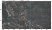
Bit ominousView attachment 52426
The severe weather threat for Tornado Watch 86 continues.
SUMMARY...The tornado risk will increase over the next couple hours
in southwestern Oklahoma -- within Tornado Watch #86.
DISCUSSION...A cluster of thunderstorms is evolving/strengthening
near the triple point around Childress TX -- where several severe
gusts have recently been measured. Over the next couple hours, these
storms, and additional developing storms along its northern/eastern
flank, should continue to intensify as they move into a warm/moist
boundary layer and steep deep-layer lapse rates (around 2000 J/kg
MLCAPE). Clockwise-curved hodographs will increase in size (250+
m2/s2 effective SRH) as the nocturnal low-level jet strengthens over
the next couple hours, favoring intensifying low-level
mesocyclones/right-movers. As a result, the tornado risk (some
strong) will increase into southwestern OK over the next couple
hours, along with the potential for very large hail and severe wind
gusts.
Copic and crew are already debating going up to Davenport lolPretty boring in term of anything significant. Radar doesn’t make it seem like that’s going to change in the short term.
Yeah, from a chasing perspective this looks like a non event.Copic and crew are already debating going up to Davenport lol