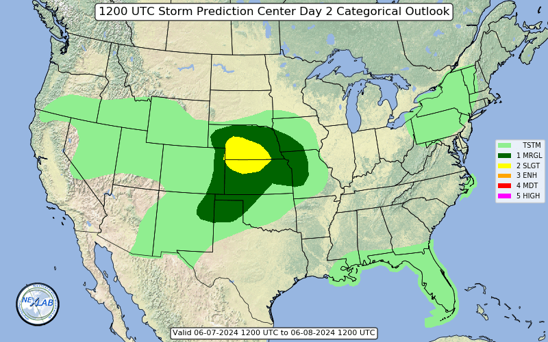
I am curious, does anyone else see somewhat of a disconnect between the best instability and shear for tomorrow? For example, on the 12Z 3KM NAM valid for 21Z tomorrow, you have SBCAPES of 3-4K over much of central and southern Alabama. Yet 0-1KM SRH is mostly <200m2/s2 in that area. The higher values are displaced to the east over GA where there is no CAPE progged.
I can't get any soundings to pull up on Pivotal Weather, but on earlier runs I saw a lot of the critical angles in the hodographs were around 40-50 degrees, rather than the 90-ish degrees you look for for classic significant tornado setups.
I'm thinking the reasoning for this is the progged location of the surface low, to the NNW, thus the cold front is oriented NE-SW with veered low level winds along it. Normally you would expect with a deepening surface low to the NW you would have strong and backing low-level winds out ahead of the triple point, into the warm sector, and correspondingly high SRH.
Any thoughts as to whether the parameters may end up lining up better than shown verbatim, or if this is accurate could this be a caveat putting a ceiling on long-track strong-violent tornado potential? Could be one of those scenarios where tornado potential is limited except perhaps where a boundary left by the morning storms locally enhances SRH?
Not saying this will null the event's potential...just another uncertainty/ceiling factor to watch for?