
Navigation
Install the app
How to install the app on iOS
Follow along with the video below to see how to install our site as a web app on your home screen.
Note: This feature may not be available in some browsers.
More options
-
Welcome to TalkWeather! We see you lurking around TalkWeather! Take the extra step and join us today to view attachments, see less ads and maybe even join the discussion. CLICK TO JOIN TALKWEATHER
You are using an out of date browser. It may not display this or other websites correctly.
You should upgrade or use an alternative browser.
You should upgrade or use an alternative browser.
Severe Weather Threat 4/27-4/28, 2024 - (Saturday, Sunday)
- Thread starter andyhb
- Start date
lake.effect
Member
jiharris0220
Member
It’s not a conservative forecast, but I’m saying it’s conservative considering the environment due to over clustering of convection.My apologies, I meant 15% but the fingers typed something else. My point still remains. This isn’t a conservative forecast, it is balanced against all factors. It’s actually an excellent forecast for 13z. There are still some initial unknowns, but multiple tornadic supercells appear probable, some producing significant tornado families, potentially modulated by storm mode toward evening.
The only thing keeping this from being a higher risk is the storm mode which the NWS is concerned about.
Which is what’s really worrying me because now it seems even the hrrr is trending more discrete.
I really hope this doesn’t make what happened yesterday seem tame.
warneagle
Member
winds are pretty unidirectional at the moment at TOP but you can see the same deep moisture, stout EML, steep mid-level lapse rates you see on the OUN sounding.

Haven't seen one since I first started using it, that I can remember.When was the last time a 90% occur on CWASP?
jiharris0220
Member
The EML being stronger than expected has basically nuked the possibility of morning convection limiting instability for today.
The only convection to be seen are weak scattered showers that aren’t even located in the warm sector.

The only convection to be seen are weak scattered showers that aren’t even located in the warm sector.
Tempestas Tonitrua
Member
Jeff Duda(stormtrack site owner also has a PhD) posted this nugget last night on today’s threat. However, I haven’t seen any of the SPC outlooks mention this so it may already be null and void this morning. But wave timing is a good thing to keep in mind:
If the TX overnight convection never materializes, that could imply the wave has not yet arrived, which could imply that it is late in ejecting. Thursday (the 25th) seemed to underperform a bit, and I suspect it is because the wave ejected too late. Perhaps that may have influenced the timing of this next one so that it might also arrive a bit late, and after the best destabilization has manifested.
If the TX overnight convection never materializes, that could imply the wave has not yet arrived, which could imply that it is late in ejecting. Thursday (the 25th) seemed to underperform a bit, and I suspect it is because the wave ejected too late. Perhaps that may have influenced the timing of this next one so that it might also arrive a bit late, and after the best destabilization has manifested.
TornadoFan
Member
Well, thats not good.The EML being stronger than expected has basically nuked the possibility of morning convection limiting instability for today.
The only convection to be seen are weak scattered showers that aren’t even located in the warm sector.
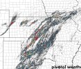
View attachment 25805
tornado examiner
Member
so outside of storm mode are there any fail modes still immediately present?
- Admin
- #150
- Messages
- 2,433
- Reaction score
- 2,273
- Location
- Meridianville, Al
- Special Affiliations
- SKYWARN® Volunteer
Wes has a strict process to verify met status in order to maintain the integrity of the met tag. I've alerted him and he'll see this as well in order to get that ball rolling. I look forward to seeing Andy with the tag.Trying to figure out how to do that. I don't think I have the ability. @WesL ??
TornadoFan
Member
Not a great sign seeing dewpoints already in the mid to upper sixties across the risk area.
SmokeEater
Member
TornadoFan
Member
Now the storms out in the Texas panhandle are doing something.
TornadoFan
Member
Tanner
Member
It's 11am EDT..for reference.
TornadoFan
Member
Not goodIt's 11am EDT..for reference.
Tanner
Member
Whenever storms start producing significant hazards (most notably tornadoes) this EARLY into the day, you almost know it's going to be a long day. Yesterday did the same thing with the early storms in Texas and Nebraska.
TornadoFan
Member
atrainguy
Member
Yeah, I was just thinking that. Yesterday went crazy early. Ominous sign.Whenever storms start producing significant hazards (most notably tornadoes) this EARLY into the day, you almost know it's going to be a long day. Yesterday did the same thing with the early storms in Texas and Nebraska.
cincywx
Member
the rotation on this one has slowly increased into the lower levels over the past thirty minutes.