
Kory
Member
VADs look impressive in SE TX and West LA. Watch the confluence band in East TX....I suspect something may be wonky with the LL wind profile. These storms are just not spinning much.
Follow along with the video below to see how to install our site as a web app on your home screen.
Note: This feature may not be available in some browsers.
VADs look impressive in SE TX and West LA. Watch the confluence band in East TX....I suspect something may be wonky with the LL wind profile. These storms are just not spinning much.
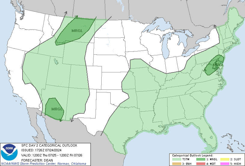
Yeah I think an enhanced or moderate risk would have been a better bet. Wednesday on the other hand is already looking like a potential moderate/possibly high risk day.I am not buying a high risk either. Tomorrow looks clustered and messy as well. Really eyeballing Wednesday tho!
I'm watching but they seem to be really struggling. Something is definitely missing here.VADs look impressive in SE TX and West LA. Watch the confluence band in East TX....
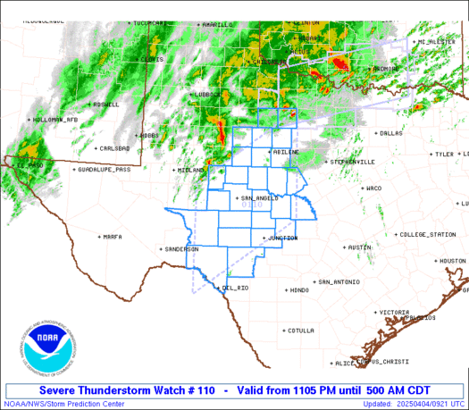
kind of irrelevant when kpoe is down anyways. oh joy...Storm along I-20 in NE LA looks like it might be interesting, but impossible to tell what's going on below 12,000 feet. I've always wondered why KPOE and KLCH are so close to each other, leaving great radar coverage in SW LA but horrible in the no-man's land between SHV, DGX and LZK.
*New tornado warning SW of Shreveport
classic TWC.High risk, tornadoes on the ground, and The Weather Channel has a show about supernatural events on right now.