Kds86z
Member
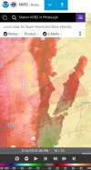
In my first tornado watch of 2025. Pennsylvania though so never expect much.
Follow along with the video below to see how to install our site as a web app on your home screen.
Note: This feature may not be available in some browsers.
Agreed. My other beef with the local media coverage is their insistence on using tilted perspective views for their maps. It skews the size, shape, and direction of the radar returns, as well as actually making me a bit dizzy with the disorientation as I look around the map or they move the map around. BBC discontinued tilted perspective several years ago for some of the same reasons, and I feel that our local television stations here should do the same. Thank you for attending my TED talk.I am saddened by the damage and loss of life we got yesterday, but thrilled that the worst case scenario we saw before the event depicted by the HRRR did not verify. I think moving away from the idea that meteorologists should be held to account when they relay what the best technology we have is depicting when that doesn't verify is best.
I will say though that I have one criticism of some coverage of this event - the use I saw of the base velocity product instead of the storm relative velocity product. There were examples yesterday where SRV was clearly showing couplets that were being missed and even downplayed as insignificant on air. When you can't find the rotation on base velocity and then it gets labeled as "just not that impressive" when there is a well defined couplet on SRV, that's a big problem that can lead to lower lead times for people in the path.

So far, all i’ve really seen are the few damage reports from the potentially violent tornadoes that have happened.Are there videos of the tornados starting to trickle in on YouTube from Friday & Saturday?
I still hold fast to my theory that CAPE is the most important ingredient for significant long track tornadoes. Yes, we've had a few powerful, long tracked, low CAPE tornadoes, but they're extremely rare. Everything else can be perfect, but without the jet fuel it won't get far. There didn't seem to be enough instability as the storm arrived, and the amount it was sucking up from the gulf, was being dampened by the rain shield.All in all, I think we can identify the 6 main ingredients for a super outbreak.
1. Longwave trough
2. Perpendicular orientation of the jet streak over PBL flow
3. Modest forcing
4. A decent amount of surface mixing (drying of low levels) to prevent crapvection
5. Moist mid levels
6. Extreme kinematics
Getting all 5 of these to occur at the same time is why these sorts of outbreaks only happen every 30+ years.
The cape was more than enough yesterday, it was ranging 2000 to 4000j/kg.I still hold fast to my theory that CAPE is the most important ingredient for significant long track tornadoes. Yes, we've had a few powerful, long tracked, low CAPE tornadoes, but they're extremely rare. Everything else can be perfect, but without the jet fuel it won't get far. There didn't seem to be enough instability as the storm arrived, and the amount it was sucking up from the gulf, was being dampened by the rain shield.
04/27 had 4000 Cape in Alabama the night before the storm. And even though the storms on 04/26 ate some of it up, they left behind other ingredients that amplified the rest of the environment (like the moist mid levels?). The self fueling process from the gulf of Mexico was extremely interesting to watch, but the storm was burning it faster than it was producing it.
I really meant to structure this comment in more of an open ended question form, but now that I've got it all typed out it's the opposite lol. I learn best from presenting my theories straight up and having them scrutinized I guess.

That one may have been so rural it didn’t hit much worth posting about anywhere.It’s pretty scary how there isn’t much being said about the tornadoes that happened down in the vicinity of Bassfield and surrounding areas.
I’m inclined to agree. but based on that debris ball…That one may have been so rural it didn’t hit much worth posting about anywhere.
Other than that one brick home, I’m not really seeing the violent damage with Bakersfield. Everyelse along its path so far looks more borderline.