• Welcome to TalkWeather!
    We see you lurking around TalkWeather! Take the extra step and join us today to view attachments, see less ads and maybe even join the discussion.
    CLICK TO JOIN TALKWEATHER

Severe WX Severe Weather Threat 3/14-3/16

Alright- now that this event has wrapped up- can we discuss forecast vs observed? I am in no way interested in shaming meteorologists or fellow posters so let’s get that out of the way.

I do believe- based on rough calculations- that the categorical probabilities verified. This is not an exact science without exact data, but I think this is close enough to move on from that.

But relative to the doomsday many of us were predicting on Saturday, what went wrong? Speaking in generalities here- it seemed like the HRRR grabbed everyone’s attention- rightfully so- and we discounted the NAM for perceived model biases. Then I believe on day 2, we started seeing the HRRR downtrend to closer match the underwhelming NAM and we began to discount the validity of both.

I do believe the HRRR ended up being pretty close with QLCS and contamination across the northern portions of the outlook and a somewhat messy storm mode throughout. A few strong tornadoes did form (seemingly over the same spots) and we had a number of mid-range storms, but it seemed the fuel to sustain was missing most of the day.

I’m interested to hear more specific and educated analysis on what we saw. We are lucky that the 4/27/2011 comparisons were way off and that the ceiling of this event truly was not realized.
 
I think statistically, the high risk verified. We had multiple tornadoes on the ground and caused fatalities and significant damage. And personally, I think Thursday night if a high risk was issued would have been verified too.

This was a significant severe weather outbreak regardless of what was forecasted and I pray the people affected have a safe and smooth recovery.
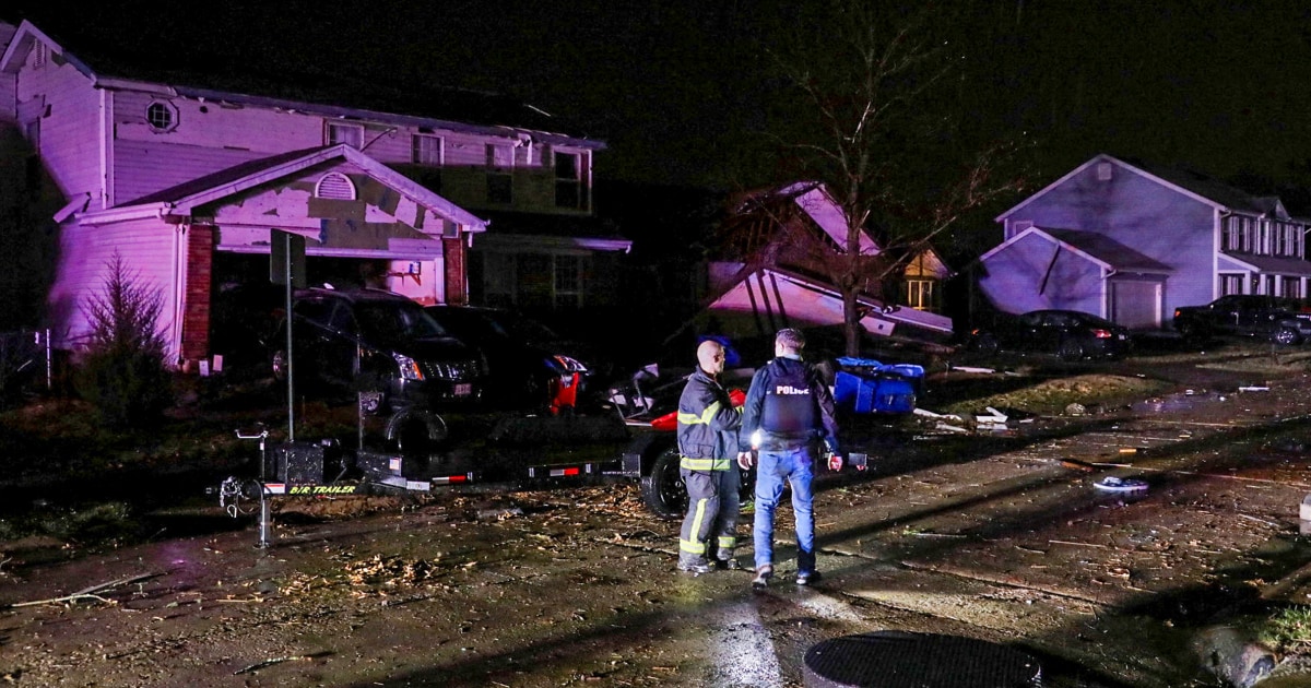
Agreed. The 4/27/11 analogs didn't pan out, and the quantity of tornadoes was less than what many expected. But the quality of the tornadoes that did form was significant. There remains a great loss of life and property across huge swaths of the country. This will still be a substantial outbreak that will probably have multiple EF3+ tornadoes to its infamy moving forward. As we make advancements in technology and AI, it'll be very interesting if the tech will ever get to identifying false positives like this generally was (although I do believe it statistically verified and will still be considered a major outbreak).
 
The HRRR model actually verified to an extent. When I looked at the last run, I thought "That doesn't look like supercells". Even early in the event, I was questioning the nature of what was occuring. The system had the look of jellyfish. It wasn't screaming supercells, but yet they were caught in junk convction and the like. This allowed Birmingham a lucky break since the supercells could never form in the proper place.

On that note, I will say this. Last year, you know we had the May 8th storm event here. In this part of Georgia, we are more vulnerable to storms that come in from the north and northwest. You can get supercells from Athens, but those are very rare. I've done this here for eighteen years here, and <5 tornado warnings for this location. Birmingham tends to have their storms follow a path from the southwest, not south-southwest. Nothing could form at the right place and time. Back in 2003, we had a high risk that pretty much was centered on Tulsa. Watched the Tulsa towercam, and the only storm was over Kansas. The high risk may have verified, but not in the right place.

The surprising thing was that the event overcame the junk convection in places. Not only did the junk convection spare Birmingham and Jefferson County, when this junk convection coma over Georgia, it may have diverted the instablity southward, sparing Atlanta (and me) from the severe weather.

Last night, once it was clear that Birmingham was spared, the thought was that north Georgia would see the bad weather. Again, it didn't happen. And yes, since 5/8/24, Brittany and I had a little more storm anxiety than usual.
 
One thing I’ve noticed: SPC upgraded to a hail-driven enhanced risk for the far north portion of today’s risk (Western PA) with a 5% tornado contour. Any storms that do form shouldn’t be very robust though, there’s pretty weak instability being forecast there.
 
Back
Top