tennessee storm chaser
Member
- Messages
- 1,613
- Reaction score
- 3,019
- Location
- jackson tennessee
- Special Affiliations
- SKYWARN® Volunteer
Well SPC not backing down on Friday or Saturday events already mentions strong strong tornadoes
Follow along with the video below to see how to install our site as a web app on your home screen.
Note: This feature may not be available in some browsers.

yeah, Birmingham mentions some discrete activity already ….Yeah, I'll pass on that. Day 5 SPC says "multiple rounds of convection, 'mix of supercells and QCLS' " what're we looking at an all day morning to night severe/tornado threat in Alabama?
Deep-layer shear vector orientation with respect to boundaries, vertical wind profile structure, and capping strength play the biggest role on storm mode. If your thinking was correct about higher CAPE, your local area would never see the late spring and summer MCS/derecho events. They would all be supercells because of high CAPE. Not how it works...Wouldn't higher CAPE, by its very nature, prevent the formation of a squall line? Can the atmosphere really form something linear in so much instability? Got a little curious, and did some digging. This study says the average Springtime QLCS forms in 500-2000 CAPE. 3500 J/kg would blow that out of the water (literally).
I also want to re-highlight A comment I posted in the Severe Weather Megathread, because it feels especially relevant now.
I think people (and models) could be underestimating the type of highly atypical and powerful ingredients we're sending from up here in the north to the Dixie Alley.


And Friday late and overnight starting to like no picnic either … lower level jet screaming with increased cape for Friday afternoon. Afraid the 6zgfs has started the up trend evenI’m gonna keep it a buck 50 with you guys.
Saturday looks like a greater substantial threat than Friday by an order of magnitude.
Firstly, far more agreement between global models, the CMC and AI Euro also have the same scenario.
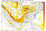
View attachment 34991View attachment 34992
The broad troughing to the southwest of the surface low creates enough height falls to generate a weak vort max in the PBL. This weak vort max causes a very strong LLJ by Saturday afternoon. Combine this with the enhanced moist air advection from the present surface low, then you have dew points in the high 60s to 70s. What you have is the very rare scenario of having a strong LLJ directly overlapping high cape by the afternoon hours.
View attachment 34994View attachment 34995
This sounding in central Mississippi is the result product of such a thing. You guys know what most of these parameters mean so nothing needs to said about these numbers other than they’re what create significant tornado outbreaks.
But look at the depth of that effective inflow layer along with the highly streamwise vertical wind profile in the PBL, this is the setup that causes supercells to become tornadic quickly.
The upper level jet can be marked out here, and it’s almost perpendicular to the PBL flow, which is prime for discrete storm mode development.
Also, look at the vertical temp/dew point profile, pretty much completely moist from top to bottom up to the EL.
Notice the inversion layer, it’s weak enough to allow any remotely powerful updrafts though and go to town while strong enough to deny crapvection.
And if you guys noticed earlier looking at the 500mb vorticity, you’ll realize this trough setup has forcing that’s weak enough to not generate a messy storm mode, but strong enough for plentiful convection to actually occur in the OWS.
View attachment 34993
This is honestly making me feel a little dreadful, hopefully things downtrend from here.
You jinxed us earlier in the thread when you mentioned we often get skipped over.Just getting caught up this morning, but my feelings have not changed from last night. In fact, I'm starting to get that dreadful feeling that @MichelleH often speaks of. All signs point to a volatile setup for the Southeast. I fear this could shape up to be one of the most dangerous events Georgia has seen in a number of years.
As a resident of north Forsyth county for the last 15 years, I don’t believe we’ve had any significant tornadoes in North Central GA in some time. I believe there was an f3/f4 that went through North Dawson county/Dahlonega back during the Palm Sunday outbreak in 1994. Have there been any strong/significant tornadoes since then?You jinxed us earlier in the thread when you mentioned we often get skipped over.
As a resident of north Forsyth county for the last 15 years, I don’t believe we’ve had any significant tornadoes in North Central GA in some time. I believe there was an f3/f4 that went through North Dawson county/Dahlonega back during the Palm Sunday outbreak in 1994. Have there been any strong/significant tornadoes since then?

Yep, highest for central/north Alabama since March 25, 2021 imo.Saturday looking increasingly custom tailored to be a bad day for a lot of people; could always throw a fail mode or two in the mix but that's about the highest ceiling we have seen in quite a while
Was thinking along the same lines.Yep, highest for central/north Alabama since March 25, 2021 imo.
